
 Yahoo News
 Cyclone Oma barrels towards Australian coast and is set to bring devastating winds and torrential rain
Residents in Australia are being urged to prepare for a tropical cyclone which is barrelling towards the east coast, bringing with it torrential rain and winds of up to 130km.
Forecasters say Cyclone Oma is set to approach southern Queensland this weekend, with authorities warning people to prepare for up to 500mm of rain to fall in just 24 hours.
The cyclone is currently a weak category two storm and is sitting around 950km northeast of Brisbane, moving at around 10km/h.
Although forecasters say there are many paths for the system and it may not make landfall, winds of up to 130km/h and heavy rain are expected to batter parts of the coast.
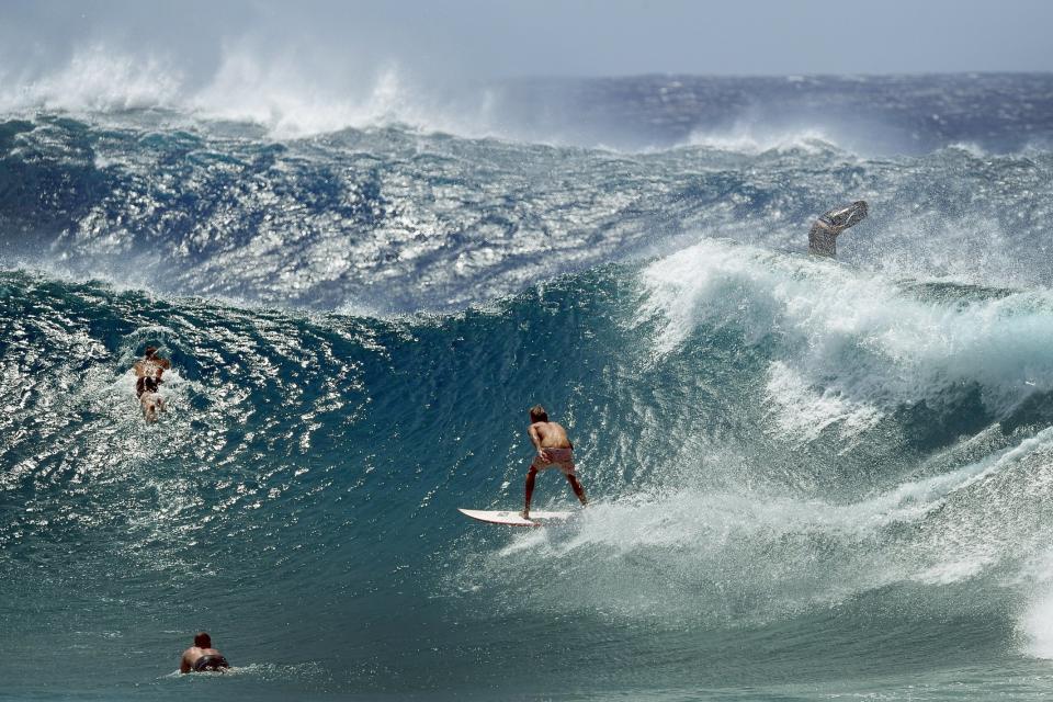
Queensland State Manager Bruce Gunn said the effects of the cyclone are already being felt, with warnings in place for higher tides and dangerous surfing conditions.

"Surf and swell conditions will be hazardous for coastal activities such as rock fishing, boating, and swimming and many beaches are already closed for public safety,” he said.
"Forecast certainty is shaping up to see the most likely scenario that Cyclone Oma will approach the coast this weekend, and a coastal crossing cannot be ruled out at this stage.
"Gale force winds are possible for exposed coastal beaches, combined with heavy rainfall. The Bureau has issued a Flood Watch from Gladstone to the New South Wales border.
“Forecast rainfall totals are largely dependent on the cyclone track, and there still are a wide range of scenarios at this point," Mr Gunn added on Thursday.
On Wednesday, high tides combined with the swell caused by Cyclone Oma brought sea water to streets in the Gold Coast and Brisbane.
Yesterday #kingtides combined with swell caused by #CycloneOma and brought sea water to #GoldCoast streets and even #Brisbane! To find out how tides, weather and ocean conditions cause coastal inundation, read our blog: https://t.co/WFbRT6TqGE pic.twitter.com/3Iu8asGnt0
— Bureau of Meteorology, Queensland (@BOM_Qld)
There are more than a dozen possible paths the cyclone could take, according to forecasters. However, forecasters said it’s less likely that Cyclone Oma will cross the Queensland coast.
But the forecaster added: “While it is unusual for a cyclone to track this far south, it is not unprecedented. Each tropical cyclone is unique and it is difficult to make historical comparisons.”

Cyclone Nancy was the last cyclone to directly impact Brisbane, although it did not make landfall but rather grazed the coast near Byron Bay before moving offshore.
The main impacts were coastal erosion and flooding for Gold Coast beaches and the Hinterland.
A severe weather warning is now in place for the east coast in Queensland, stretching from the town of Seventeen Seventy to the New South Wales border.
Queensland Police said: "Abnormally high tides, dangerous surf and damaging winds are developing about the southeast Queensland coast and islands."
Speaking to ABC radio, Bureau of Meteorology forecaster Jonty Hall said Cyclone Oma will continue to move at around 10km/h towards the coast until Friday, but after that it is less predictable.
He added: “We are starting to see the main swell packet from Oma starting to arrive on the south coast of Queensland now. That’s likely to increase in the next couple days.”

