
 Yahoo News
 Towns hit by torrential rain prepare for yet another deluge as 106 flood warnings put in place
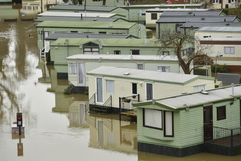
Towns across the country have erected flood defences as they prepare for a month’s worth of rain in the next 24 hours.
Beleaguered communities already battling floods have been told to expect even more rainfall, with pockets of north Wales, northern England and Scotland among those in line for further deluges.
The Environment Agency (EA) said there were 106 flood warnings in place for England on Thursday morning.
It added that there is a “heightened flood risk” across the Midlands, while there are six severe flood warnings – meaning a danger to life – in place around the Rivers Lugg, Severn and Wye.
The lower Avon also remains especially high.
Commuter misery
Flooding has caused rail misery for commuters at the start of Wednesday, after a major rail route connecting England and Scotland was blocked.
The West Coast Main Line is closed between Carlisle and Lancaster following recent downpours.
Services run by Avanti West Coast from London Euston to Glasgow and Edinburgh via Birmingham are affected, as well as trains operated by Northern and TransPennine Express.
Ticket restrictions have been lifted and rail replacement buses will be deployed between Preston and Carlisle.
Passengers were warned that some journeys could take up to two hours longer than normal.
Disruption is expected to last until at least the end of Thursday.
Delays and cancellations
A speed restriction was implemented for trains in Cumbria and north Lancashire between 5pm on Wednesday and 10am on Thursday due to the wet weather increasing the risk of landslips and flooding.
Several lines in Wales remain closed due to flooding, including Aberdare to Pontypridd; Ebbw Vale Town to Cardiff Central; Abergavenny to Hereford; and Blaenau Ffestiniog to Llandudno.
Network Rail said it is working hard to repair and reopen routes as soon as possible.
London Euston services are also affected by a points failure caused by an accident during overnight engineering work.

The issue caused delays and cancellations to Avanti West Coast and London Northwestern Railway trains on Thursday morning.
Points are mechanical systems that enable trains to switch from one track to another.
A Network Rail spokesman said: "A set of points was accidentally damaged during some engineering work on the approaches to Euston last night.
"This has reduced the number of tracks and platforms we are able to use at Euston this morning and some services have had to be altered or cancelled as a result.
"Passengers travelling to or from Euston today are advised to check before they travel, although we expect the disruption to be quite limited."
Overnight weather
Rain fell heavily across northern and western parts of Britain overnight, Met Office forecaster Mark Wilson said, adding it was likely to continue until about 3pm.
The village of Capel Curig in north Wales received 54 mm of rain in 24 hours, compared to an average of 97 mm of rain for the whole of February.
Cumbria's Shap, which recorded 120 mm across February 2019, saw 52 mm fall before day broke on Thursday.
But some relief reprieve was on the way later in the day, Wilson said.
"The rain will clear through the west in the afternoon then through the south east later," he said.
People can look forward to "sunshine and showers" later in the day, the forecaster added.
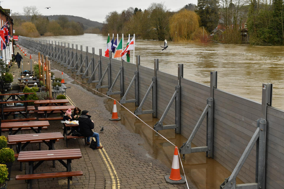
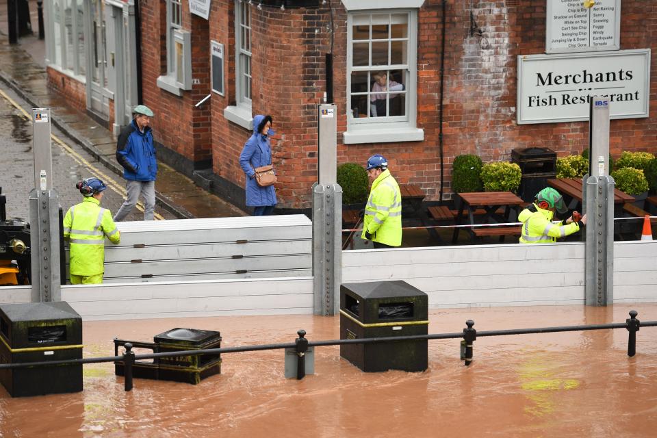
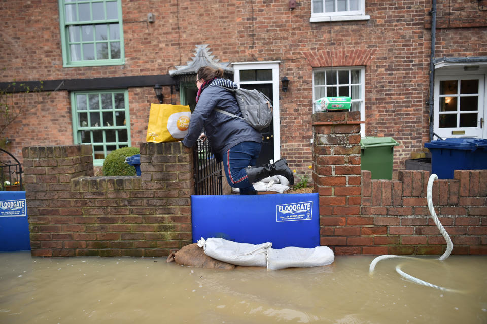
Temporary flood defences in Bewdley, Worcestershire

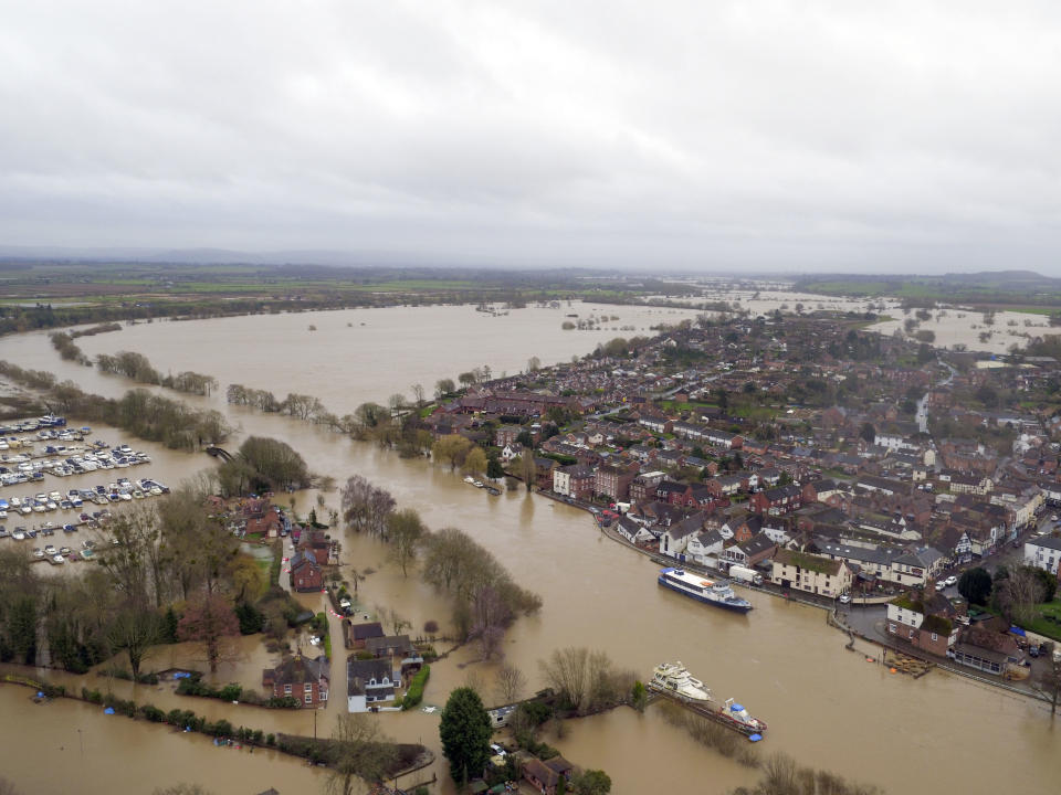
Read more: Tewkesbury nervously waiting for flooding
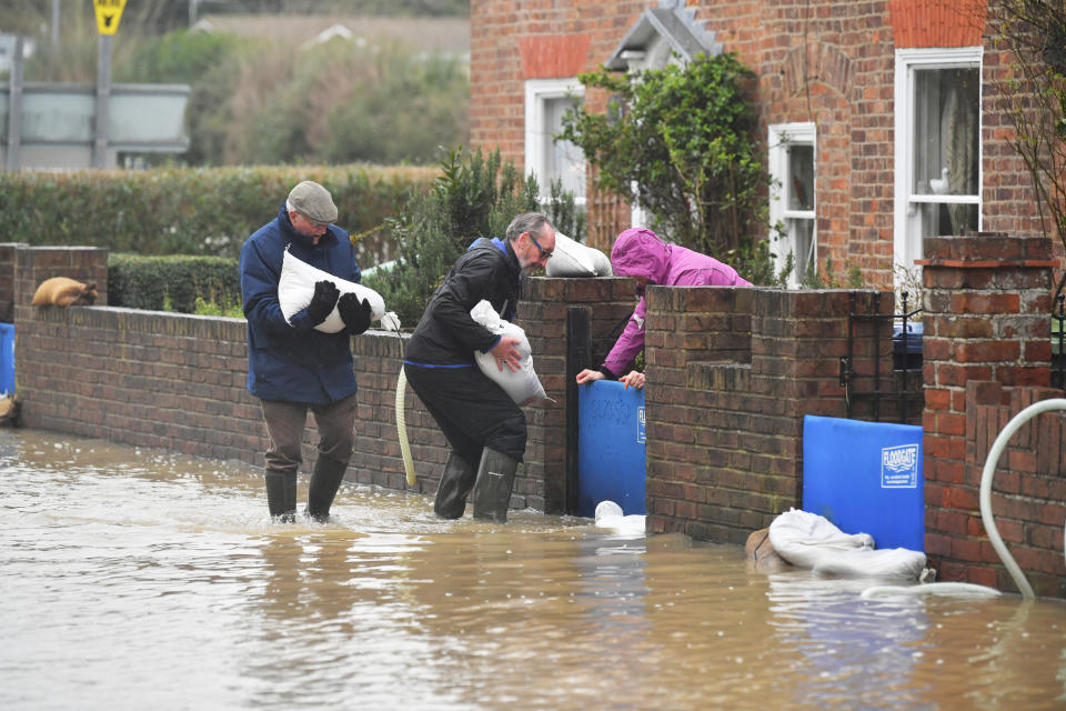
Temporary flood defences in Tewkesbury, Gloucestershire


Wilson urged people to be mindful of warnings as they go about their day.
"There could be some pretty tricky conditions on the roads, make sure you give yourself a bit more time with travel because there's some fairly heavy rain around," he said.
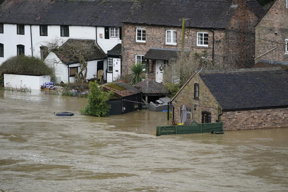
The EA reported England has already received 141% of its average February rainfall so far this month courtesy of Storm Dennis, adding that river levels in the Colne, Ribble, Calder, Aire, Trent, Severn, Wye, Lugg, and Derwent all set new records in recent days.
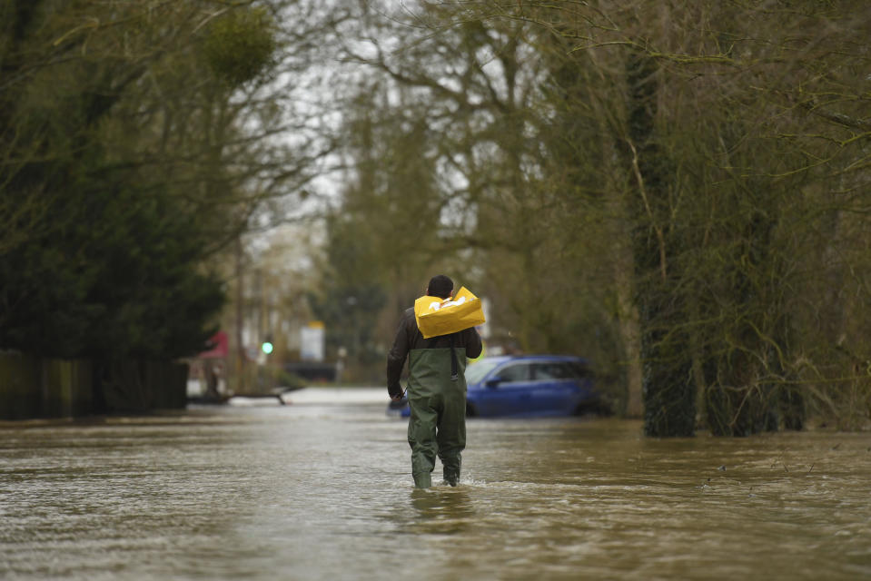
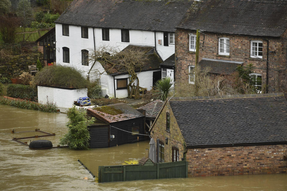
Trunk roads have been forced to close and hundreds of people have been evacuated from their homes in the worst-affected areas.
But forecasters have predicted further heavy rainfall is on its way, three days after Storm Dennis left the UK for Scandinavia.
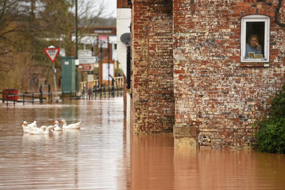
Read more: Heavy rain sees river in flood-ravaged town reach highest level in 200 years
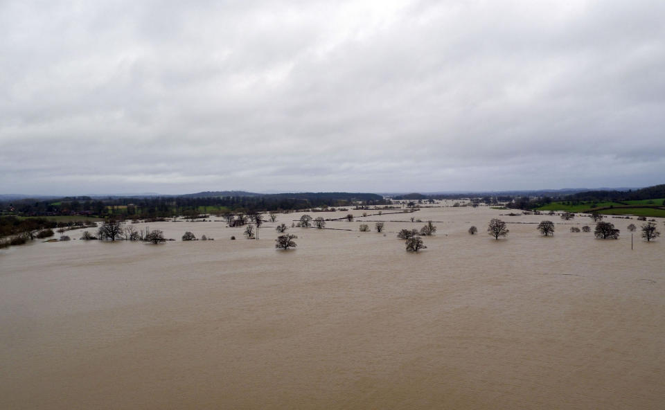
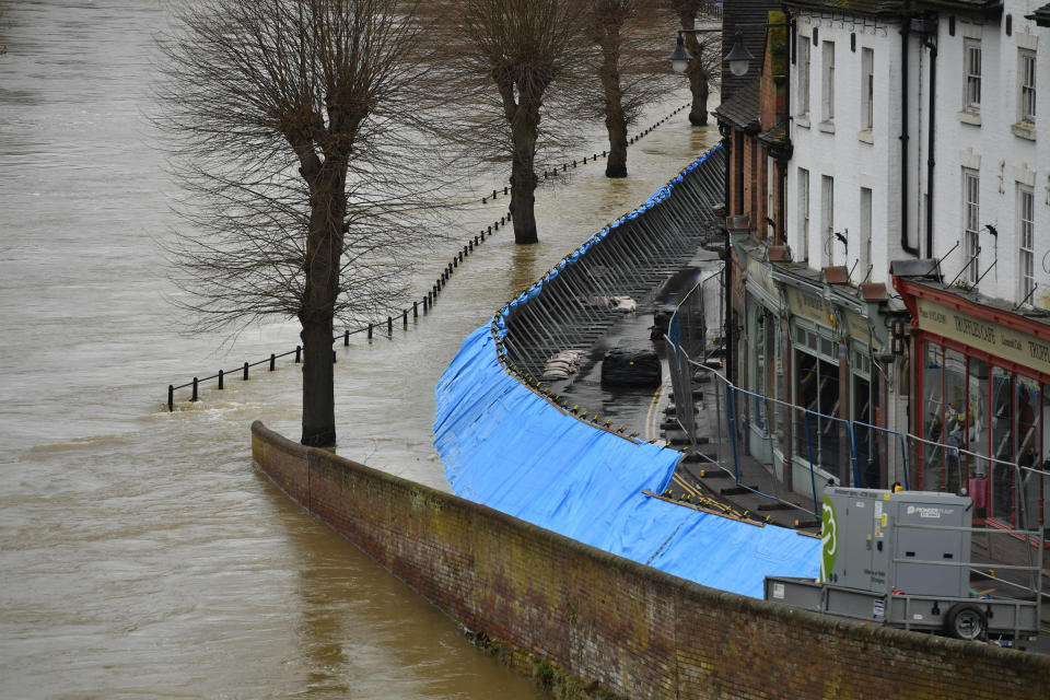
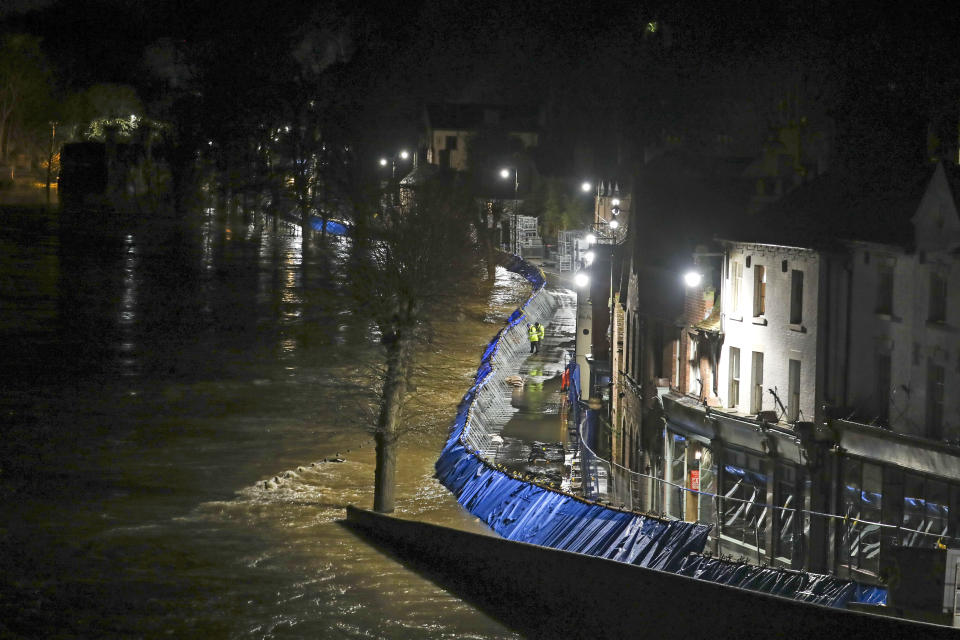
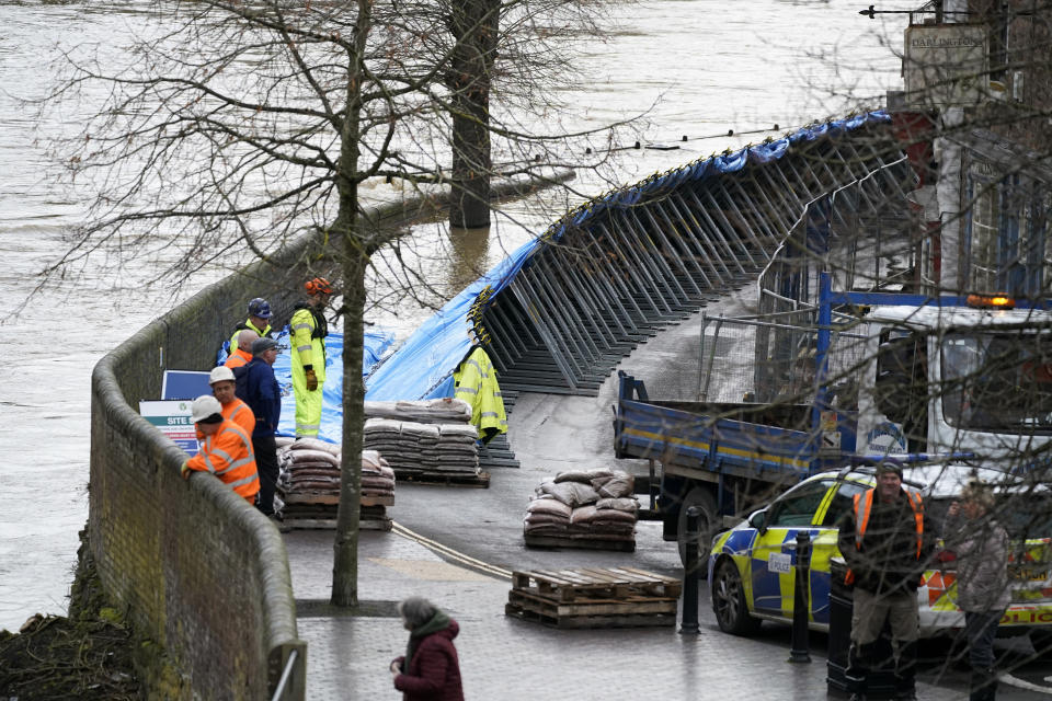
Temporary flood barriers hold back the Severn in Ironbridge, Shropshire

Craig Snell, from the Met Office, said: “Hot on the heels of Storm Dennis, we have now got this next weather system coming through...
“Rainfall totals are not too high at the moment. But if we are looking at the situation in 24 hours’ time, we could be looking at 50-60mm in South Wales, 70-100mm in North Wales, and up to 100mm in north west England.
“In the worst case scenario we could see a month’s worth of rain.
“It is more the fact that quite a lot of the UK has seen a wet winter. Ordinarily, 50mm of rain would give us a wet day, rivers would be able to cope.
“But the ground is saturated (due to the persistent, heavy rainfall) so it is causing problems.”
The EA said its teams put up more than 6km of temporary flood barriers across the country and that flood defences have protected nearly 25,000 properties from the ongoing impacts of Storm Dennis.
More weather warnings are likely on Friday with heavy rain expected across western Scotland, Yorkshire and parts of Cumbria.
Gusty winds are also expected to strengthen at the end of the working week.

