
 Yahoo News
 NASA is using satellites to direct firefighters to hottest points of wildfires
While billionaires race to shoot themselves into space, NASA is sending satellite images back down to earth to provide crucial assistance to firefighters battling wildfires.
The Federal space agency is using new spatial imaging technology from the International Space Station to inform fire crews battling the Dixie and Bootleg fires where they are at their hottest .
This enables firefighters from the US Forest Service to track which direction the fire is moving in, deploy resources effectively and protect critical infrastructure.
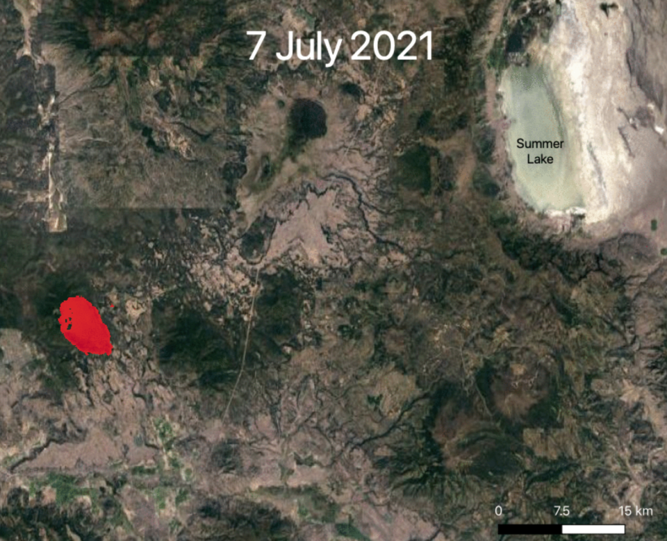
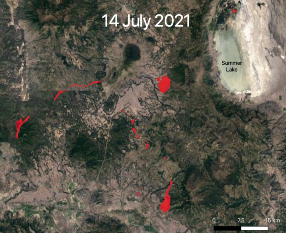
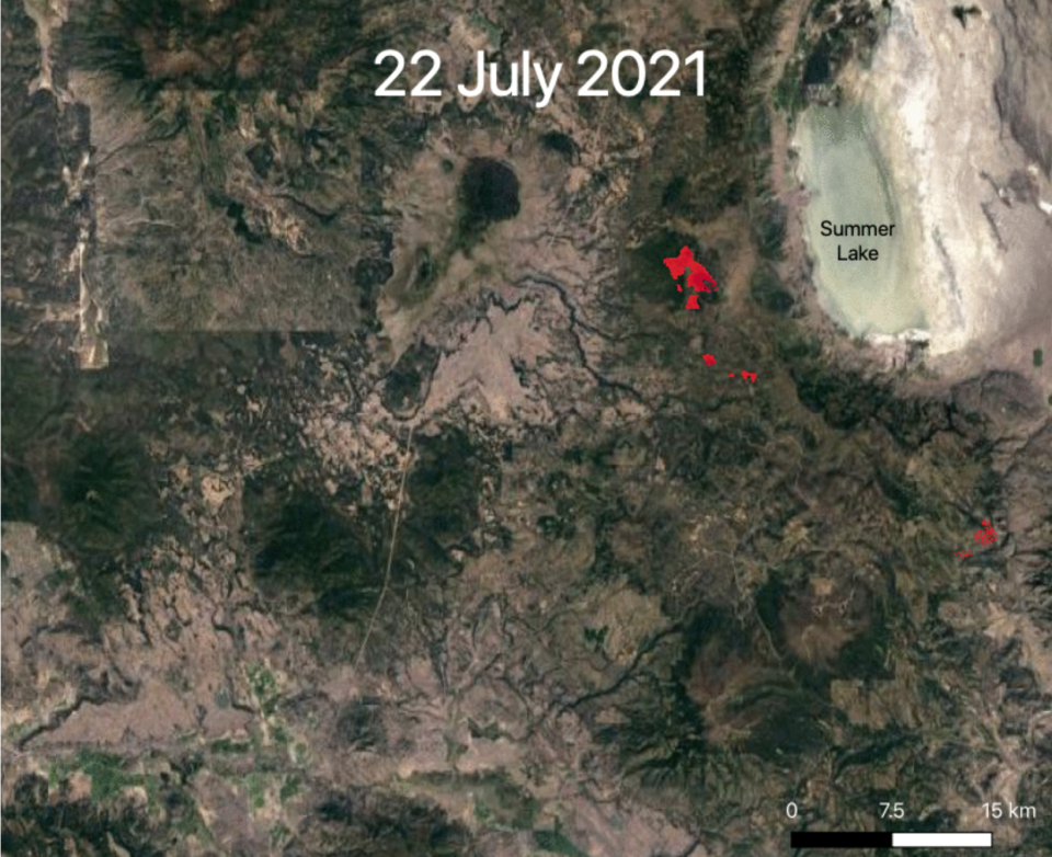
Images taken by the satellites from July 7 to July 22 show the path of the Bootleg Fire as it tore its way across southern Oregon, consuming 410,000 acres of land and hundreds of buildings and vehicles.
The NASA images are relayed to a team of researchers from the Rapid Analytics for Disaster Response, or RADR, at the Pacific Northwest National Laboratory in Richland, Washington.
There, scientists are able to process data from satellites, drones and artificial intelligence in minutes and pass it on to incident commanders on the ground.
“This can help with evacuation routes to help understand where search and rescue needs to go,” Andre Coleman, RADR’s lead researcher, told NBC News.
"A lot of the current operations just aren’t getting situational awareness as frequently as they would like,” he said.
Previously, firefighters would send planes into the skies above the wildfires to map fire lines, which would take hours rather than minutes.
The specialist heat-seeking instrument that captures these high definition images is known as an ECOsystem Spaceborne Thermal Radiometer Experiment on Space Station, or ECOSTRESS.
It works by measuring surface temperature twice daily in high resolution.
Its main purpose is to measure plant temperature, but it can also track wildfires, heat waves and volcanoes.
“The capabilities of ECOSTRESS are unique,” NASA’s Jet Propulsion Laboratory said.
“Satellites that acquire data more frequently don’t have high-enough resolution to track the fine line of the fire front, and satellites with higher resolution than ECOSTRESS cross over the same area much less frequently.”
The technology is helping to provide tactical help to the more than 22,000 firefighters tackling the dozens of wildfires burning across the US, which have sent ash clouds covering much of the continent and proven so powerful they can create their own weather systems.
Ilkay Altintas, a computer scientist with the University of California, San Diego, told NBC News the technology could prove crucial to helping reduce the impact of wildfires, which are being fuelled by climate change.
“The more science and data we can give firefighters and the public, the quicker we’ll have solutions to combat and mitigate wildfires.”
The Bootleg Fire had been 53 per cent contained by Thursday, but was still the largest in the US.
In California, the Dixie Fire, now the 13th largest in the state’s history, had been 23 per cent contained.
More than 7,000 wildfire personnel are tackling the two wildfires.
Read More
Three Americans produce enough carbon emissions in a lifetime to kill one person, study finds
‘Deeds not words’: Climate campaigners renew call to action for ministers 100 days before Cop26
Environmentalists slam ‘pathetic’ climate spending in infrastructure deal

