
 Yahoo News
 Storm-battered residents face more floods to come with further downpours forecast
Storm-battered communities are facing the prospects of more floods next week with torrential downpours forecast once again.
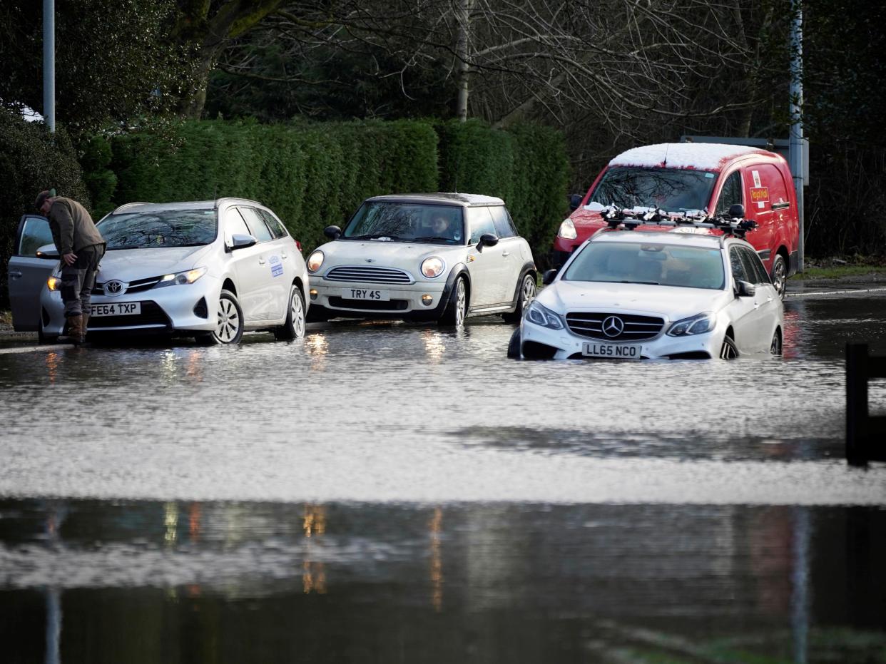
Hundreds of residents across the north west of England and north of Wales have been evacuated from homes over the last three days amid fears of deluge brought by Storm Christoph.
Scores of properties – mainly in Cheshire and Neath Port Talbot – were left under water. Residents in one hard-hit village, Lymm near Warrington, told The Independent how water had poured into their homes “relentlessly” after the River Bollin burst its banks and drains failed.
Now, those same communities are being warned they may face more problems when heavy rains return.
Other areas, including along large swathes of the River Severn in Worcestershire and the River Don in South Yorkshire, have been told they could also face flooding.
The Environment Agency has warned of "exceptionally high river levels" and said more rain – either this weekend or more likely next week – could easily lead to overtopping.
As of Saturday morning, 105 flood warnings were in place – including one severe warning in the Cheshire village of Farndon. Another 103 flood also remain active.
On a visit to nearby Northwich on Friday, environment secretary George Eustice said authorities were "watching closely" as water moves through the river system.
He told reporters: "The thing that concerns us most is that late next week we are expecting more rainfall, that falls on wet, soggy ground. It is possible that we therefore could have some additional challenges in a week's time."
To complicate matters further, a yellow weather warning for snow and ice has been activated across much of the UK until shortly before midday on Saturday.
Steve Willington, the Met Office’s chief forecaster, said cold air from Iceland and the Arctic was bringing a "a mix of wintry hazards across the UK".
He said: "In clearer conditions, overnight ice will remain a hazard, while a band of snow is likely to bring falls of 1-3cm quite widely across central areas of the UK, particularly the Cotswolds and higher ground in the East Midlands on Sunday.
"But snow outside these areas is also a potential hazard."
Read More
How Storm Christoph brought a night of trauma to a flooded village

