
 Yahoo News
 Storm Brendan: Britain battered by 80mph winds as airlines forced to divert flights


Airlines have been forced to divert flights as Britain was battered by 80mph winds brought by Storm Brendan.
Seven flights to Gatwick Airport were diverted to other locations on Monday night after gales in excess of 40mph struck the area.
Gatwick Airport said two Wizz Air flights, four easyJet services and one Norwegian Air flight were diverted. One easyJet flight from Edinburgh was forced to land at Birmingham.
The Met Office warned that stronger gusts could batter the area on Tuesday afternoon.
Gales of up to 80mph affected railways across the country on Monday, while drivers were advised to take extra care on the roads.
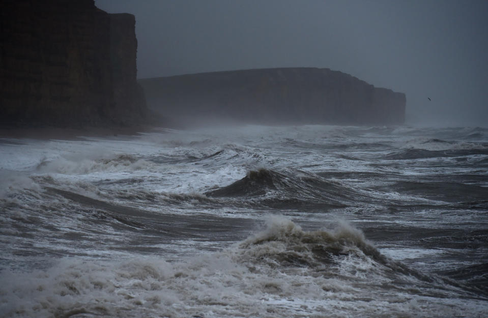
The strongest gust recorded by the Met Office on Monday was 87mph at South Uist, in the western Isles of Scotland.
After plaguing parts of Ireland, causing thousands of homes and businesses to lose power, the storm brought high winds to parts of England and Scotland.
A yellow wind warning issued by the Met Office, covering the west of the UK, the island of Ireland and the north-east coast of Scotland, was lifted at midnight.
Read more
Stardust from seven billion years ago found on Earth is ‘oldest ever and older than the sun’
Queen's regret as Harry and Meghan told they can live independently
Iranian protesters burn British flags outside UK embassy and chant ‘Death to England’
But forecasters said winds of 60mph-70mph could continue to batter north-western Scotland into Tuesday, when a yellow warning of wind has been issued for much of England, although it will no longer be classed as Storm Brendan.
Meteorologist Alex Burkill, from the Met Office, said more wet and windy weather is forecast to come up from the South West on Tuesday afternoon.
"That's not Storm Brendan – Storm Brendan has moved northwards by this point," he said.
"It's not too far away so we're still under the influence of it, but this new feature that comes in is going to bring some heavy, persistent rain across much of the UK, to be honest, with very strong winds."
Mr Burkill said the gales were much less likely to reach Monday's highs of over 80mph, but inland areas could be hit with gusts of more than 50mph.
He added: "For many, tomorrow will actually be a windier day than today, despite the fact that today was named and tomorrow isn't."
#StormBrendan has eased but is still sitting just to the north of the UK.
Another low pressure is now heading across England and Wales, this will bring strong winds today.
Disruption is possible and weather warnings remain in force.
Stay #WeatherAware pic.twitter.com/mZQcQEAxNn— Met Office (@metoffice) January 14, 2020
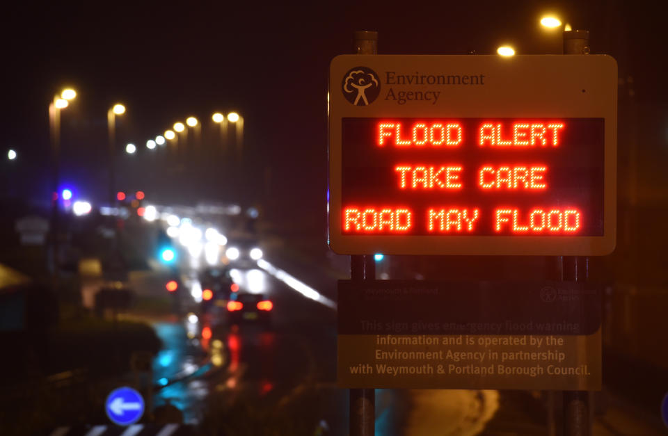
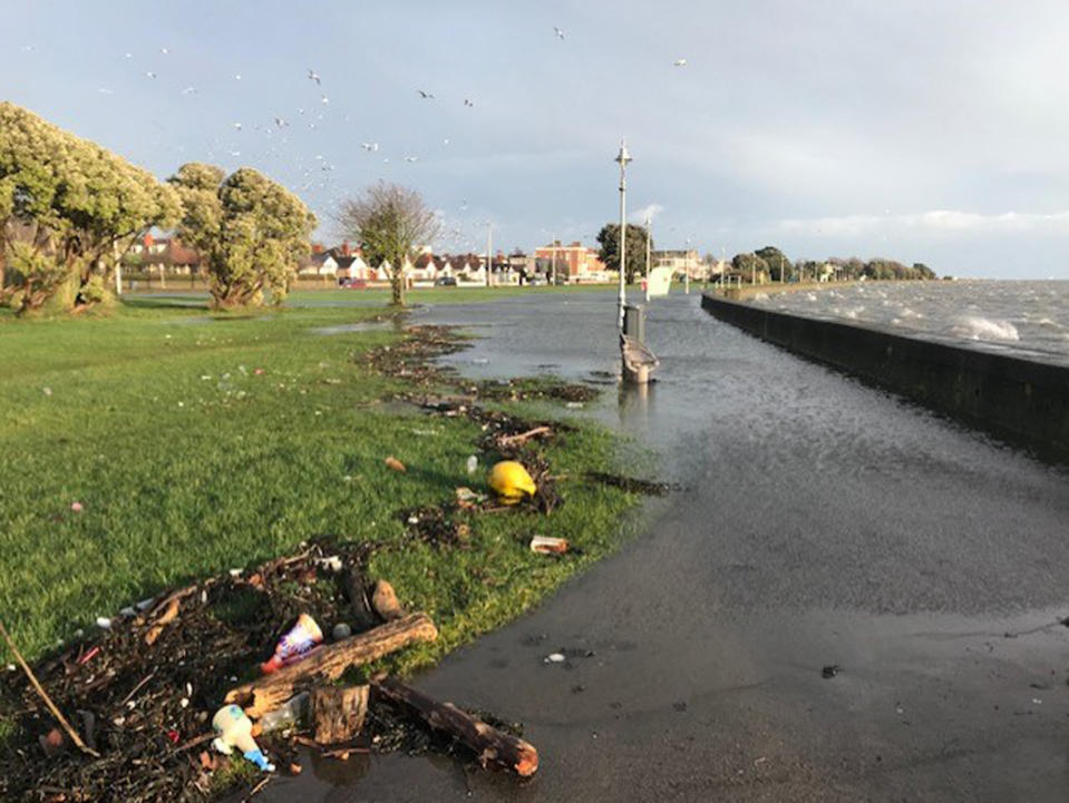
Eight flood warnings and 79 alerts issued by the Environment Agency remained in place on Monday night.
The Met Office has issued a yellow warning of rain to cover the South East on Tuesday, where heavy rain is expected to cause disruption and the flooding of a few homes and businesses is "likely".
"In those areas, the ground is already saturated after what was a very wet December, and also a wet autumn, so that's why we're going to see some localised issues due to the heavy rainfall," Mr Burkill said.
Although the rest of the week looks unsettled, conditions are set to be drier and brighter at the weekend.

