
 Yahoo News
Alaskans evacuate after 7.9 magnitude earthquake prompts widespread tsunami alert
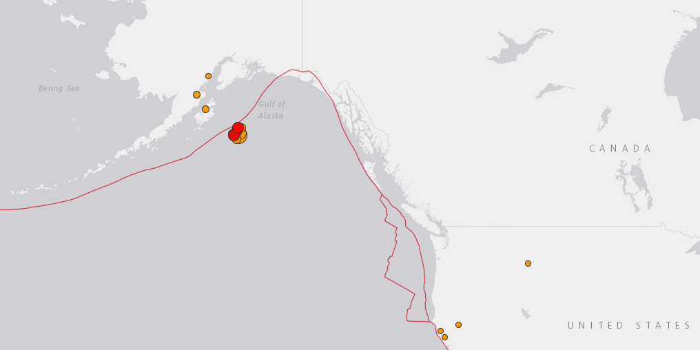
US Geological Survey
A 7.9 magnitude quake hit off coastal Alaska early Tuesday morning.
It prompted authorities to issue widespread tsunami alerts.
An area from Alaska to the edge of Mexico was initially covered.
These warnings were later rolled back to just Alaska.
Locals in the island of Kodiak were woken by sirens and warned to seek high ground.
Thousands of Alaskans evacuated their homes Tuesday after a powerful earthquake struck off the coast of the state, generating a small tsunami.
People on Kodiak Island, off the coast of Alaska, were woken early in the morning by sirens and police officers urging them to retreat to high ground further inland to avoid the worst effects of a surge.
The 7.9 magnitude quake struck 25 kilometers, or about 15.5 miles, below the sea floor in the Gulf of Alaska at 12:23 a.m. Alaska Standard Time (9:23 a.m. GMT, 4:23 a.m. ET).
Authorities initially thought a resultant tsunami could travel much farther than Alaska, issuing a tsunami watch for the entire western coast of the United States, but this was later canceled.
Initial data recorded by Alaskan weather monitors said a tsunami did occur but was very small: less than 1 foot in height. Earlier reports from deep-sea buoys in the Gulf of Alaska had suggested the waves could be as high as 10 meters.
Tweet Embed:
https://twitter.com/mims/statuses/955777703273115648?ref_src=twsrc%5Etfw
pic.twitter.com/USAqGbRwUD
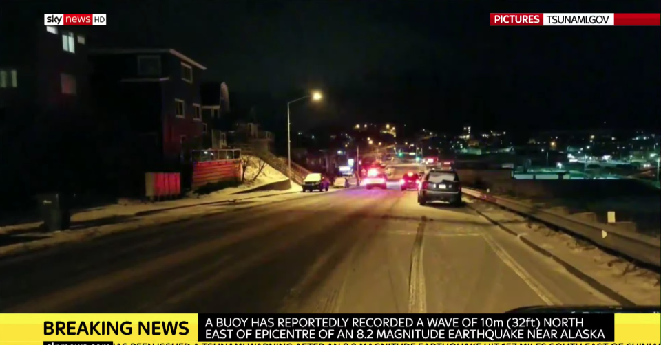
Sky News
Tweet Embed:
https://twitter.com/mims/statuses/955759731708133376?ref_src=twsrc%5Etfw
Listen as sirens ring out over Kodiak, #AK. A #Tsunami Warning is in effect after a 7.9 #earthquake was recorded about 175 miles southeast of #Kodiak. Officials are asking those in the affected coastal cities to move to higher ground. Get more alerts here: @NWS_NTWC pic.twitter.com/QEAnaj8VfM
The US Tsunami Warning System first alerted people in Alaska shortly before 1 a.m. local time, about half an hour after the quake struck.
According to the US Geological Survey, the earthquake hit 157 miles southeast of Chiniak, Alaska. Its magnitude, initially reported as 8.2, was later revised down to 7.9.
Eighteen more earthquakes, from magnitudes 2.5 to 5.6, have since been detected.

US Tsunami Warning Center
Alaska and parts of Canada were given tsunami warnings, the highest level of alert. As of 3:30 a.m. Alaska time, the warnings had been downgraded around Kodiak to a tsunami advisory, which indicates a moderate risk.
The tsunami watch, a lesser state of readiness that was active from Washington state down to California, as well as in Hawaii, was called off.
Tweet Embed:
https://twitter.com/mims/statuses/955776513286254592?ref_src=twsrc%5Etfw
415 am: Tsunami watch is cancelled for coastal areas of WA, OR and CA. A small tsunami was generated in AK, but this event does not pose a threat to WA, OR or CA coastal areas. #tsunami
See Also:

