
 Yahoo News
 Typhoon Nanmadol: Millions in Japan bracing for ‘very dangerous’ storm
Japan is bracing for one of the most powerful typhoons of the year, with an estimated 39 million people exposed to potentially “very dangerous” wind and lashing rains.
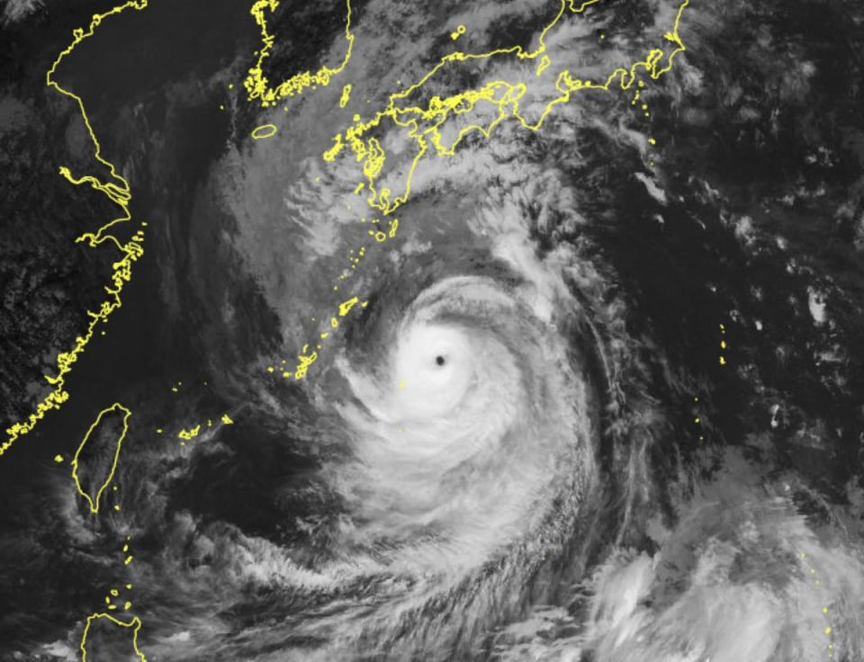
Typhoon Nanmadol is expected to make landfall on Sunday, slamming into the southern island of Kyushu, before curving east and passing over Tokyo by Tuesday.
It has been classified as a “super typhoon” by the US Navy’s Joint Typhoon Warning Centre and described as a “very strong” typhoon by the Japan Meteorological Agency (JMA).
On Saturday the strength of the typhoon was equivalent to a Category 4 hurricane with maximum sustained winds of 130-156mph or 209-251km/h, according to AccuWeather.
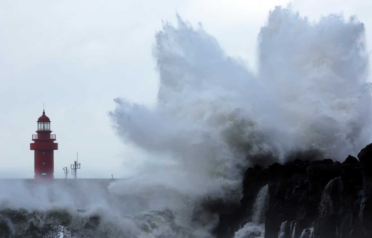
The JMA said the typhoon would hammer parts of the country with half a metre of rain and “unprecedented” storms on Sunday.
A “special warning” might be issued for Kagoshima prefecture and other parts of Kyushu, Japan‘s southernmost main island, on Saturday evening because the typhoon is expected to cause high waves and heavy rains in the region.
In a televised press conference, the head of the JMA’s forecast unit, Ryuta Kurora, warned people to stay alert.
“There are risks of unprecedented storms, high waves, storm surges and record rainfall,” he said.
“Maximum caution is required,” he added, asking residents to evacuate early. “It’s a very dangerous typhoon.”
The southern Kyushu region is expected to be hit with 500mm of rain on Sunday, while the central Tokai region could see 300mm, the agency forecast.
Mr Ryuta said the “winds will be so fierce that some houses might collapse” and warned of flooding, high waves and landslides.
Broadcasters aired footage of strong winds whipping the seas and rain lashing down on Japan‘s southern island chain of Okinawa as the storm approached.
The Global Disaster Alert and Coordination System warned that more than 39 million people could be exposed to a storm of Category 1 level or higher.
This could have “high humanitarian impact” based on the forecast maximum sustained wind speeds, it said.
Nanmadol will be the country’s 14th storm of the season and would become the fifth strongest should it hit with a central pressure of 27.76 inches.
The typhoon is expected to cause damage for extended periods of time because it is moving slowly while maintaining its strength. It is expected to move back out to sea by Wednesday.
Earlier this month, Japan was hammered by Typhoon Hinnamnor, which snapped power and mobile phone connections while disrupting transportation services in wide swathes of western Japan.

