
 Yahoo News
 UK flooding: Maps show extent of heavy rain and flooding to come
Over 800 homes have been flooded this weekend, mainly in the south-west of England, with those in north-east England and north Wales now bracing themselves as storms move north.

As heavy rainfall and widespread flooding battered Britain, the Environment Agency have released a number of maps showing the scale of the weather-related chaos.
Their map of England shows the extent of the 300 flood alerts in place across the country, as well as the 210 flood warnings caused by the influx of wet weather.
Over 800 homes have been flooded this weekend, mainly in the south-west of England, with those in north-east England and north Wales now bracing themselves as storms move north.
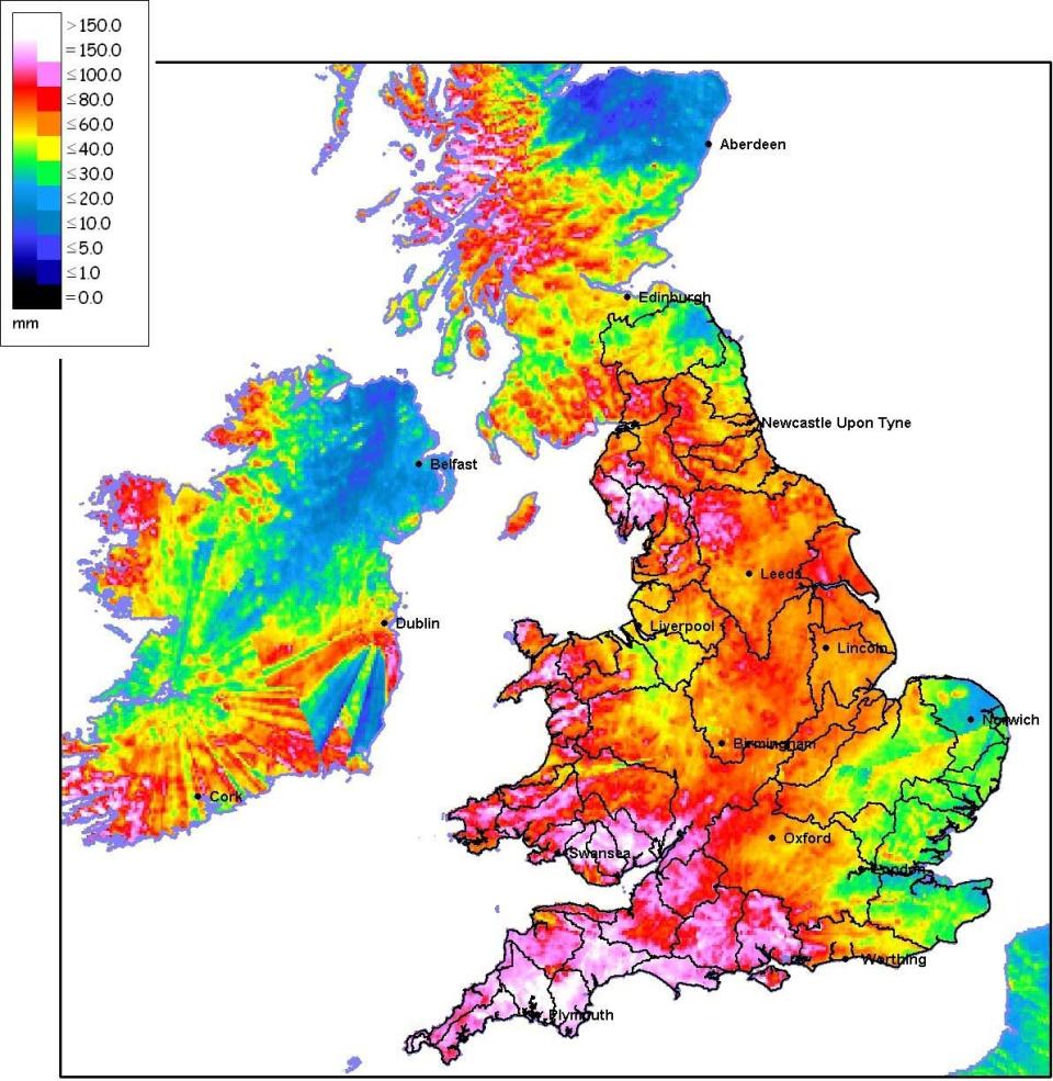
The Environment Agency have also released a map of the UK showing the level of rainfall over the past seven days - with Devon and Somerset in particular taking a battering from the elements.
Flood-hit areas in Plymouth, south Wales and the north-west had over 15cm (six inches) of rain in a week.
Weather experts said this figure included around 60cm of rain in the south-west at the weekend alone.
Meanwhile, the Met Office gave amber weather warnings for 50-70mm (2-3in) of rain in north-east England and Yorkshire and Humber regions.
An additional amber alert for north Wales warned there could be more than 90mm (3.5in) of rain on high ground.
