
 Yahoo News
 UK weather: -3C freeze as wintry showers and ‘dangerous’ winds descend
Wintry showers are set to tear through parts of the UK this week as “dangerous” winds send temperatures plunging below freezing.
Lows of between -2C and -3C are expected overnight in rural areas across the north of England, as well as in some major urban centres.
The Met Office told The Independent that some of the coldest temperatures in the coming days would likely descend on Newcastle, Manchester and Leeds, while temperatures further north in Glasgow and Edinburgh are expected to sit above freezing.

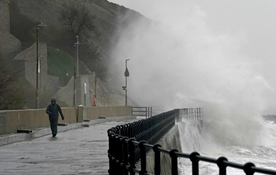
North and northwestern Scotland will be the epicentre for much of the UK’s more dramatic weather this week, with biting showers and strong winds forecast from the Hebrides further southwest up to Durness further north.
The Met Office told this news site that wintry showers would fall across the region tomorrow, with the heavy rain turning to sleet for some.
A yellow weather warning for strong winds is also in place between 6am and 5pm on Wednesday, with forecasters warning of some travel disruption and “dangerous” coastal conditions.
Met Office meteorologist Alex Deakin said gusts of 70mph to 75mph are expected as a high-pressure system takes “control” of the weather.

“We have another one of these cold fronts heading in,” Mr Deakin said. “The winds are going to be strengthening – getting very blustery across Scotland on Wednesday.
“It will be windy throughout the day with the strongest winds likely to be in the afternoon as this weather front moves south, bringing a spell of heavy rain as well.”
The alert, covering swathes of north and northwestern Scotland, warns that coastal communities will be inundated by spray and large waves.
Delays to and cancellations of some air, ferry, train, and bus routes are also expected.
Following “plenty of winter sunshine” on Tuesday, Wednesday morning will bring fog and a hard frost to much of the country, before making way for another bright afternoon.
Met Office five-day weather forecast
Today
Any early mist or freezing fog patches, mainly in the east, will steadily lift and break to leave a dry and fine day with bright or sunny spells. Feeling pleasant in the sunshine, with highs of eight degrees.
Tonight
Clear skies will allow temperatures to fall away with another widespread frost developing. With mostly light winds, a few mist and fog patches will develop in the east as temperatures drop to minus two degrees.
Wednesday
A cold and frosty start with patches of fog or freezing fog lifting during the morning, leaving the afternoon with mostly blues skies, with highs of seven degrees.
Thursday to Saturday
Mostly dry and settled with some sunshine at times. Cloudier periods are likely, perhaps giving some outbreaks of rain especially early Thursday. Mostly light winds and temperatures trending towards average.

