
 Yahoo News
 UK weather: Britain to roast on hottest May day in 176 years - but thunder is on the way
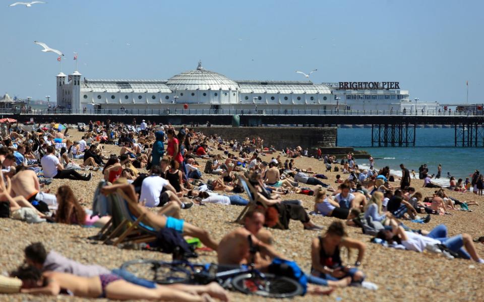
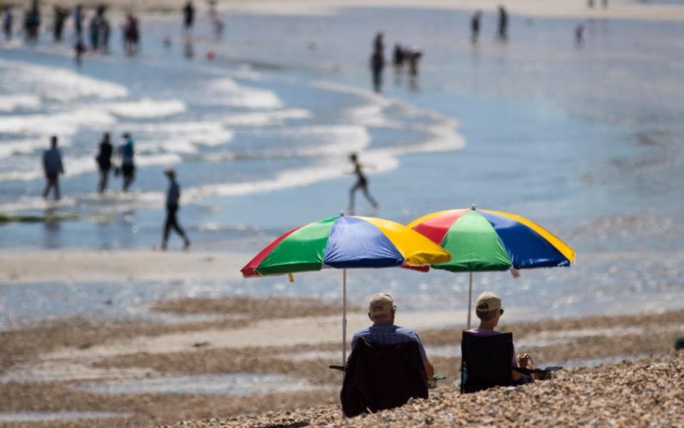
Northern England and Scotland will be hotter than Morocco and Mexico City today as Britain roasts on the record hottest May day for 176 years.
Grahame Madge from the Met Office said: "It is very, very clear today. There are clear skies virtually across the UK."
The warmest place in the country today and Saturday is likely to be Scotland.
"Whether we'll see that magic 30 we're not sure, it might just get there," said Mr Madge.
Thunderstorms will wash out Bank Holiday Monday, forecasters say, but the mercury is set to hit the "low 30s" as a tropical blast moves in today and Saturday leaving a "chance" of smashing the 32.8C May temperature record.
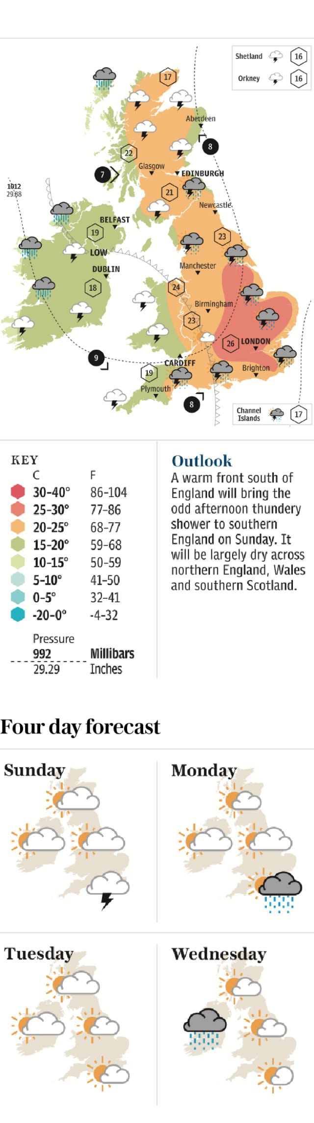
The Met Office have put out a weather warning for the west of Northern Ireland for rain between 4pm and 10pm on Friday evening, with the risk of isolated thundery showers, hail and lightning.
That was set on on May 22, 1922 at Camden Square, London, and May 29, 1944, at Horsham, West Sussex, Tunbridge Wells, Kent, and Regent's Park, London. Met Office records began in 176 years ago in 1841.
But the Met Office said showers will hit parts of the the west on Saturday and, after a dry 28C Sunday, thunderstorms threaten much of England into a 25C Bank Holiday Monday.
Met Office forecaster Emma Sharples said: "There is a chance of a 32.8C May record temperature, with the low 30s possible on Friday and, most likely, Saturday.
"Tropical maritime air and a southerly feed will be across the country from late Thursday, with sunshine boosting temperatures.
"After around 26C on Thursday, Friday sees the highs 20s or low 30s, with a good chance of over 30C on Saturday, with the London area around 31C.

"The North should see 28C, with a risk of showers for western edges of the UK.
"Sunday could see 28C in the South-East.
"But thundery showers could sweep in late Sunday into Monday, and could well extend from the South-East to the North-West, before retreating later on Monday, with 25C highs."
There is a warning for persistent and heavy rain in parts of Scotland from Sunday.
Exeter-based Met Office spokesman Oli Claydon said: "The key thing I would point out is a lot of the rainfall that's likely to come over the weekend is showers and some may get it and some may not.

"It is variable but where those showers do occur they could be quite intense."
Those living in the southern half of the country will not escape the deluge with a weather warning in place for 24 hours from lunchtime on Sunday to 12pm on bank holiday Monday.
Mr Clayton said of Sunday: "If you were to draw a line from the Wash (East Anglia) to the Bristol Channel, anywhere south of that is likely to get fairly intense thundery showers.
"Not everyone will necessarily see them but where you do see them they will be quite intense."
The Met Office have warned that the torrential thundery outbreaks will also bring the possibility of localised flooding which could cause travel disruption.
The inclement weather is expected to continue on Monday with cloud, scattered showers and the lowest high temperatures of the weekend are expected to be recorded in London (20C -21C).
Another front is set to move in from the west bringing more cloud and rain in time for the return to work on Tuesday.
