
 Yahoo News
 UK weather news: Storm Atiyah causes disruption as Britain to be battered with winds of up to 70mph
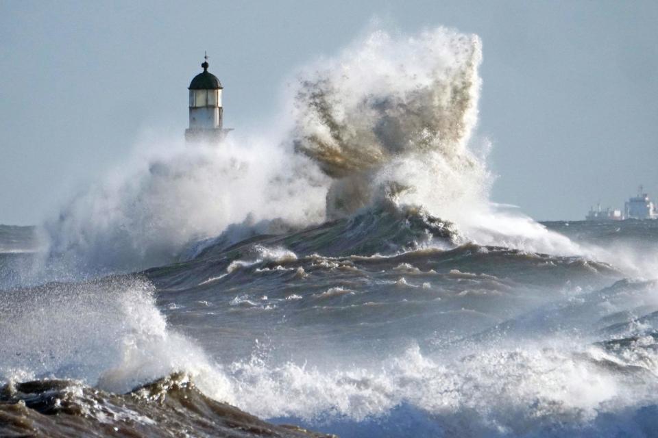
Britain is set to be battered with gale-force winds of up to 70mph after Storm Atiyah hit the mainland sparking power failures and disrupting transport.
Many parts of the UK are set to suffer more wet and windy weather on Tuesday morning, with warnings issued across much of northern England and Scotland.
Storm Atiyah is expected to continue to cause disruption but forecasters have said they were not expecting a second storm, despite two yellow warnings remaining in place.
Met Office Meteorologist Alex Burkill said Tuesday was going to be a "wet and windy" day for most of the country with gales reaching speeds of up to 70mph in some places.
Tuesday morning's commute looks like this...
⚠️ 🌧️ 🌬️ Wet and windy in the north and west with warnings in force
🌥️ 🥶 Dry and cold in the south and east with a touch of frost in the far east pic.twitter.com/zYZgi34w0L— Met Office (@metoffice)
He said: "Many parts of the UK, particularly in the North West, will get off to a wet and windy start."
Two weather warnings are in place for wind across the north of England and southern Scotland, as well as rain across the west of Scotland.
Mr Burkill continued: "In that warning, we talk about rain of between 20mm and 40 mm, and perhaps up to 60 mm across the western part of Scotland.
"The greatest impacts from the winds look to be from southern Scotland, Northern Ireland, northern Wales and northern England, so quite a big patch.
"We can see gusts of 50 to 60 miles per hour up to 70 in parts.
"Despite the wind and rain, it is going to be a remarkably mild day. There will be highs of 13C (55.4F) to 14C (57.2F) and that is quite a few degrees above average."
Mr Burkill added that the worst of the rain will clear over the next two days, but most places will see "quite a drop" in temperature between Tuesday and Wednesday.
It was previously thought that today would bring Storm Brendan to the shores of the UK but the Met Office said there will not be enough of an impact from Tuesday's winds to warrant a storm name.
The South West of England and Wales were hit with gales of up to 70mph over the weekend after Storm Atiyah first hit Ireland on Sunday. Trees were felled by the gusts, which also caused power faults in the South West and Wales.
Temperatures are set to sink to 9C (48.2F) on Wednesday, a drop of about 4C (7.2F) from Tuesday's expected temperature.
Mr Burkill also gave a forecast ahead of Thursday's General Election.
"It looks like there will be wind and rain for most places," he said, adding that central and southern parts of England were most likely to be hit with the rain.
Small amounts of sleet and snow are also expected in the highest parts of Scotland, with highest national temperatures of between 10C (50F) and 11C (51.8F).
