
 Yahoo News
 UK weather: People ordered to 'leave homes immediately' after flood defences overwhelmed
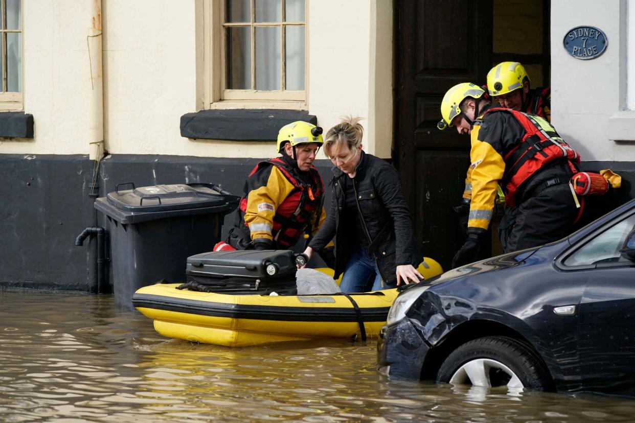
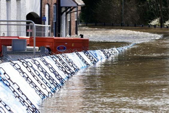
Police are carrying out "an immediate evacuation" of at-risk riverside areas in Ironbridge, Shropshire, because temporary barriers have been overwhelmed.
The West Mercia force said on Twitter: "We are urgently requesting that people in the area leave their properties and businesses immediately."
Heavy rain overnight has caused river levels to rise further, with parts of the River Severn expected remain close to their highest level on record.
At Bewdley, the Severn stood at 5.45 metres at 10am on Wednesday - just below the all-time record of 5.56 metres which was set on 2 November 2000.
The level has risen more than two metres in the past 72 hours, jumping from 3.36 metres at 9.15am on Sunday.
The agency forecasts the level at Bewdley will peak at 5.48 metres later on Wednesday and will remain at a near-record high into Thursday.
Upstream at Buildwas, near Ironbridge, the Severn had reached 6.79 metres at 10am on Wednesday, a little under the record for that stretch of 7.04 metres.
Railway lines into nearby Shrewsbury were closed due to the rising water levels close to the viaduct.
Network Rail said: "The exceptionally high-water levels in the Severn and the closure of these lives serve to highlight the extreme weather we've experienced across the network over the last few weeks.
"The current situation in Shrewsbury is very much a once-in-a-generation event."
It comes after residents of Snaith, in East Yorkshire, were evacuated on Tuesday after the River Aire burst its banks following three weeks of heavy rain.
England has experienced 200 per cent of its rainfall in the month of February, with more expected over the next couple of days.

Oli Claydon, a spokesperson for the Met Office, said western parts of the UK would see a pattern of sunshine and showers over Wednesday and Thursday.
He said the volume of rain would ordinarily "be nothing to be overly concerned about", but added any further rain could have an impact on flooded communities.
"In some of those regions through that period of rainfall, particularly into the Severn catchment, the total won't necessarily be a huge amount but in any of those places that are seeing flooding, any further rain is not welcome," he said.
Mr Claydon said that most of the UK would be dry by Thursday evening, before more heavy rain moves in from the west on Friday.
"In terms of impact, the main thing we are keeping an eye on now is Friday," he said. "That is another area of concern - there could be yellow rain warnings on Friday in terms of the accumulations that could be expected from that rainfall."
He said south-west England, southern parts of Wales and north-west England were expected to see the most rain on Friday and into the weekend.
Additional reporting by agencies
Read more
Flood defences cannot protect every home, warns Environment Agency

