
 Yahoo News
 UK weather: Flood warning as melting snow and heavy rain cause perfect storm
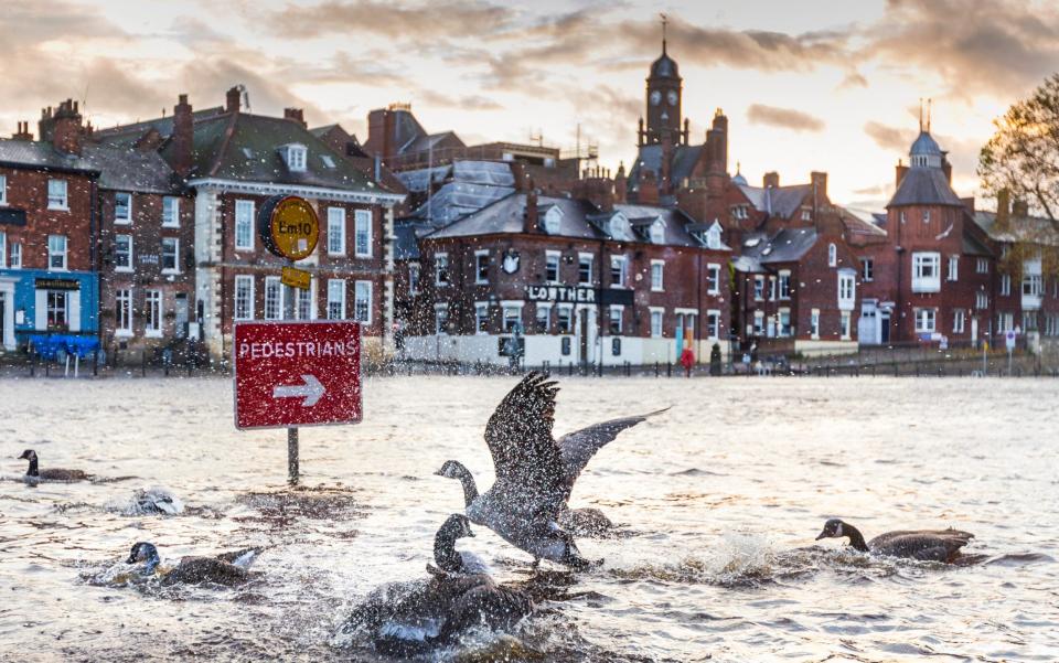
York and Leeds are set to be hit by floods this week as those in severely hit areas are advised to pack a bag and prepare to evacuate their homes.
The melting snow is expected to top up the heavy rain set to sweep in at the beginning of this week, creating a deluge which is likely to cause rivers running through Yorkshire cities to overflow.
This deluge comes after many parts of England were hit by deep snowdrifts, blanketing the country in white and causing travel disruption.
The Ouse in York is set to swell further, putting properties and businesses at risk, and in Leeds, the Aire has been singled out as a potential flood risk for next week.
Martin Christmas, the Environment Agency Operations Manager, warned that tens of thousands of people in Yorkshire cities could be impacted by incoming floods.

Standing in his sodden garden, among lumps of melting snow, he said: "As you can see, the thaw is here, so we have snowmelt topping up the rivers across Yorkshire, and more importantly we have a system of frontal rain coming through on Tuesday morning.
"We are likely to be issuing a number of flood warnings and the flood event duration is likely to last through to Thursday. Starting to the pennine catchments to impact on the lower rivers including the River Ouse in York, the Lower Don and the Aire. If you are part of the flood warning service please keep an eye on the alerts we will be issuing."
The Met Office has said that those who live in an area with severe flood risk should pack a bag in case they have to evacuate at short notice. Those concerned about flood warnings where they live should sign up to Environment Agency updates.
An amber rain warning has been issued by the Met Office for Tuesday and Wednesday, covering parts of north-west England.
A yellow rain alert is also in place for most of northern England and Wales from Tuesday to Wednesday, before most of the UK falls into the warning on Thursday.
Up to 200mm of rain is possible across parts of north Wales.
The Met Office said this was because of an area of "low pressure" set to move in on Monday evening.
The warning says there could be a "danger to life" from possible "fast flowing or deep floodwater".
Such conditions could bring delays to public transport, damage to buildings or power-cuts, the Met Office said.
It comes after a mixed bag of weekend weather, which saw between four and eight centimetres (1.5-3in) of snow in eastern England on Saturday, before a sunnier and milder day on Sunday.
The Environment Agency had 14 flood warnings in place across England on Sunday evening, stretching from the South East to the North East, meaning "immediate action" is required.
John Griffiths, a Met Office forecaster, said: "An area of low pressure will move in late on Monday, bringing with it quite a lot of rain over the following three days.
"Between Tuesday and Wednesday around 40-70 mm of rainfall is expected to fall in the north-west of England, potentially rising to 100-120mm in the hilly areas.
"On Thursday more deep low pressure will start travelling south to the rest of England, with strong downpours and heavy gales coming in from the North Sea."
