
 Yahoo News
 Amber warning for heavy snow and ‘blizzard conditions’ from Thursday
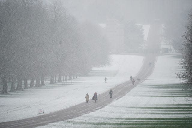
Snow storms are expected to hit large swathes of central and northern England on Thursday, forecasters have warned.
The Met Office has issued an amber warning for “strong winds bringing blizzard conditions” and up to 40cm of snow to the area stretching from Stoke-on-Trent to Durham.
The warning lasts for 21 hours from 3pm on Thursday – and “significant disruption” to transport, power lines and phone network coverage is likely.
⚠️⚠️ Amber weather warning issued ⚠️⚠️
Snow across parts of northern England.Thursday 1500 – Friday 1200
Latest info 👉 https://t.co/QwDLMfRBfs
Stay #WeatherAware ⚠️ " pic.twitter.com/2VLZHLUvwf
— Met Office (@metoffice) March 8, 2023
Several milder yellow weather warnings for snow have also been issued, covering much of the nation from Wednesday to Friday.
Tuesday marked the coldest night of the year so far, and more sub-zero overnight temperatures are expected in all four UK nations in the coming days.
Temperatures at Kinbrace in the Highlands dropped to this year’s low of minus 15.4C overnight.

Met Office spokesperson Nicola Maxey said this was the coldest March temperature recorded since 2010, but that it is “not that unusual to see snow in March”.
“March is a transition month from winter into spring,” she said. “Statistically, you’re more likely to see snow in March than in December.”
The UK Health Security Agency (UKHSA) has placed all regions of England under a level 3 cold weather alert – lasting until midnight on Thursday.

Agostinho Sousa, a consultant at UKHSA, said the cold weather could have a “serious impact” on people’s health, particularly the elderly, while Age UK has urged people to check in with their older neighbours and relatives.
National Highways has warned drivers in the West Midlands and the east of England not to travel unless their journey is essential.
RAC Breakdown said there was “an increase in breakdowns” in a zone stretching west from London along the M4 corridor and into Wales.
Rod Dennis, from RAC, said: “We’re continuing to monitor the weather situation closely, but with further snow expected over the next few days there is still the potential for some significant disruption to journeys.
“Even a little snow and ice can make roads treacherous, so we’re advising everyone who does set out to proceed extremely cautiously.
“We’re also conscious that there will be a large number of new drivers who may never have experienced snow on the roads before, so we urge them to take particular care and drive well within the speed limit to give themselves plenty of time to react should the vehicle in front run into difficulty.”

Mr Dennis advised motorists venturing out to prepare for their journeys by packing warm clothes and blankets, sturdy footwear, food and drink, and a portable phone charger.
A Met Office yellow warning for snow and ice covers northern Scotland until 10am on Thursday, along with central and southern areas of England and Wales from midnight until 7am.
Another yellow warning for snow and ice covers north-east England and south-east Scotland from 5pm on Wednesday until 7am on Thursday.
A fourth yellow warning for snow covers all of the UK north of Birmingham, spanning from 7am on Thursday until 2pm on Friday.

