
 Yahoo News
 Back-to-back storms to bring rain, snow to Northeast and Midwest


As the flow of air flips from Canada to the Gulf of Mexico, milder conditions will return, and temperatures will rebound to historical averages in much of the Midwest and Northeast into the weekend. However, AccuWeather meteorologists caution that storms from the South will funnel moisture into both regions, creating problems for travelers in the form of wet snow, rain and fog.
Following an outbreak of Arctic air with gusty winds that felt more like the middle of January, temperatures more typical for late November and early December are in store in the coming days.
The cold winds were strong enough to topple the National Christmas Tree on the White House Lawn in Washington, D.C., on Tuesday. AccuWeather RealFeel® Temperatures dipped as low as the single digits in some areas and even a bit below zero in a few locations as feet of lake-effect snow piled up downwind of the Great Lakes.
With the lake-effect snow and strong, cold winds moving out, highs from through Saturday will range from the mid-30s in the northern tier to the 50s around the Chesapeake Bay.
 |
"In the days following the stretch of wintry weather across the Midwest and Northeast, there is the potential for foggy nights and mornings, especially in areas that continue to have snow on the ground," AccuWeather Meteorologist Brandon Buckingham said.
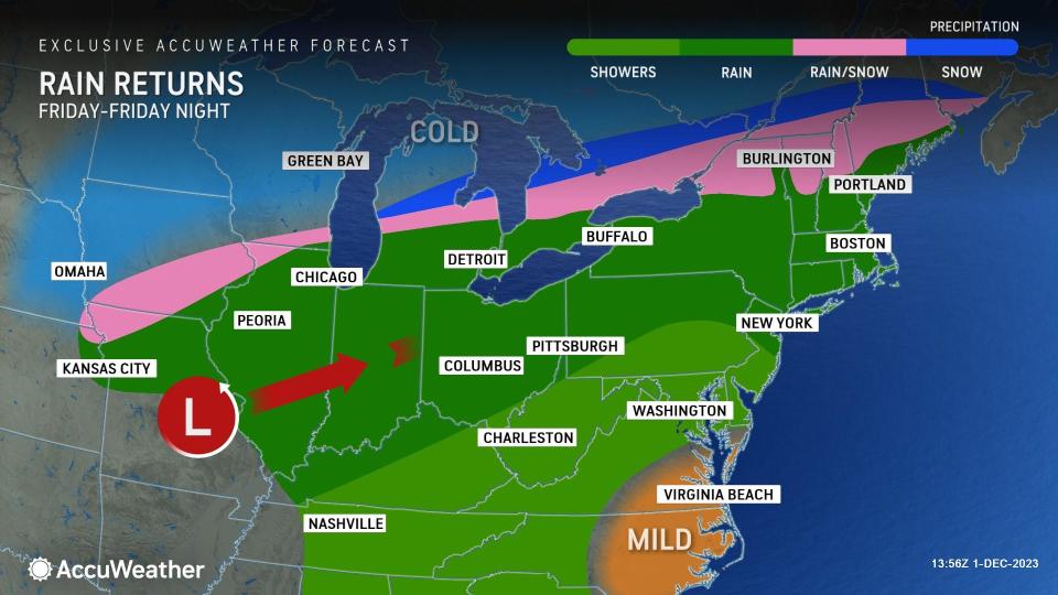
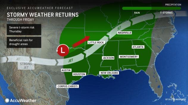
AccuWeather meteorologists have also had their eye on a brewing storm for the South Central states for over a week and expect this storm to produce a large shield of rain and even severe weather.
Southern Missouri to much of Illinois and Indiana and northern Ohio could pick up a general 0.50 of an inch to 1 inch of rain through Friday evening, which will help ease the abnormally dry to drought conditions in the area but will also make for rain-slickened highways.
However, on the northern edge of that rain, the air will be chilly enough to allow wet snow or a wintry mix to occur, AccuWeather Senior Meteorologist Courtney Travis said.
 |
"Right now, the wintry mix zone, which includes wet snow and sleet, looks like it will set up to the north and west of downtown Chicago and north of center city Detroit on Friday," Travis stated.
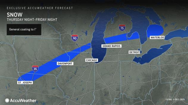
A narrow swath of accumulating snow is in store from the storm with a general coating to an inch of snow on the northern flank, Buckingham said.
 |
As milder air filters in during the storm, any wintry mix will likely transition to rain and drizzle.
However, AccuWeather meteorologists believe that as another weak storm rolls across the region, another period of snow or wintry mix may bring an additional accumulation in roughly the same zone of the Midwest from Saturday night to Sunday.
Farther to the east, there will be a similar setup from part of upstate New York to portions of central and northern New England, where the air may be just chilly enough to wet snow or a mix of rain and wet snow from Friday to Friday night. It is possible that some of the higher elevations in the region pick up a few inches of wet snow from the storm.
 |
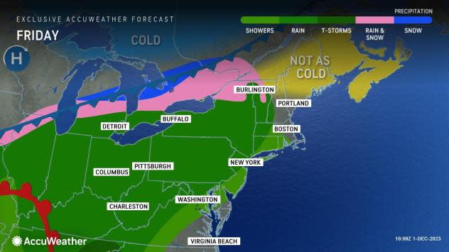
Milder air surging into the interior Northeast late this week will likely bring rain to many of the hard-hit lake-effect snow areas from northeastern Ohio, northwestern Pennsylvania and western New York Friday into Saturday, Buckingham said. The combination of rain and melting snow could lead to area creeks and rivers rising to near bankfull this weekend.
The storm will also bring rain to areas from Washington, D.C., to Philadelphia, New York City and Boston, mainly from Friday afternoon to early Friday night. However, there also will be the potential for patchy fog soon after the rain begins that may linger into Saturday morning.
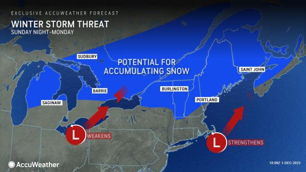
Much of the Northeast will get a break of dry weather on Saturday, ahead of a second storm from the Southern states that is likely to spread rain along the Interstate 95 corridor and parts of the Appalachians from Sunday to Sunday night.
 |
Some chillier air will seep southward in the wake of Saturday's storm in the Northeast and the Upper Midwest that will likely be enough to allow snow to fall on northern New England and perhaps the northern tier of the Midwest on Sunday. A wedge of dry air in the middle part of the atmosphere may prevent any precipitation from Chicago to Detroit late this weekend.
Want next-level safety, ad-free? Unlock advanced, hyperlocal severe weather alerts when you subscribe to Premium+ on the AccuWeather app. AccuWeather Alerts™ are prompted by our expert meteorologists who monitor and analyze dangerous weather risks 24/7 to keep you and your family safer.
