
 Yahoo News
 Cold weather over Australia’s south-east to linger as high pressure nudges national records
The frigid weather gripping parts of south-eastern Australia will linger into next week as a giant high pressure system dominates the region and nudges national records.
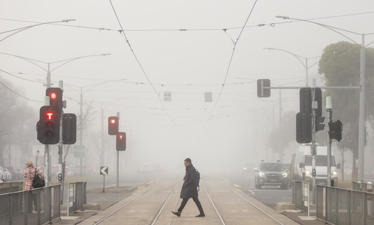
Melbourne’s overnight temperature dipped to 1.3C on Thursday after Wednesday morning’s 1C reading, making it the coldest couple of days for the Victorian capital in two years, according to Yoska Hernández, a Weatherzone meteorologist.
A number of sites in the Melbourne region dropped below 0C on Thursday morning. Viewbank near Heidelberg was at -1.6C just after 8am. Coldstream matched its name with a -1.5C reading just after midnight.
Increased cloud cover should stop the mercury sliding back to zero in the Victorian capital for the next couple of days. The chill is expected to return for Sunday morning, with the Bureau of Meteorology predicting 1C for Melbourne’s city centre.
A large high pressure system over southern Australia is contributing to the midwinter cold. Preliminary readings by the bureau on Thursday morning had pressure readings reaching as high as 1,044.6 hectopascals for the Tasmanian town of Sheffield.
Sheffield, TAS is reporting a mean sea level pressure of 1044.4 hPa at present which, if it checks out, is the highest on record in Australia. pic.twitter.com/ThxgrHYyY9
— Andrew Miskelly (@andrewmiskelly) July 4, 2024
If confirmed, that reading would set a record for mean sea level pressure, beating the 1,044.3hPa level recorded at Launceston on 7 June 1967.
Related: Melbourne shivers through coldest morning of year with temperatures of -1.5C in some suburbs
Sites nearby, though, did not record readings nearly as high.
A bureau spokesperson said that as of noon Aest, the highest mean sea-level pressure recorded so far under the current high pressure system was 1043.9 hPa at Ouse in Tasmania.
“Any higher readings than this are currently being verified for quality assurance purposes,” the spokesperson said.
The strong high pressure system was influenced by a split jet stream over Western Australia and large upper lows over South Australia and the Tasman Sea “enhancing the subsidence into the high”, she said. A large dome of very cold air was also working to strengthen the high, along with natural variability in global pressure patterns.
Hernández said the forecasts indicated the high pressure system was in the 1,042Pa to 1,043hPa levels over Tasmania. The pressure could reach “around 1,045hPa” on Saturday morning, she said.
Current forecasts have the high pressure system over southern Australia reaching 1044hPa late on Friday night (Aest). (Via @bom_au) pic.twitter.com/YZnUGWm8fk
— @phannam@mastodon.green (@p_hannam) July 4, 2024
Melbourne’s pressure reading reached about 1,040.8hPa on Thursday morning, not far from its record high of 1,041.2hPa. Weatherzone has predicted that Canberra and Sydney may also find their records for pressure under threat from the system.
“By early-to-mid next week we expect the high pressure will weaken completely and move eastwards” away from Australia, Hernández said.
The cold weather has been particularly notable for part of Tasmania this week, with the mercury dropping to -13.5C overnight in Liawenee, a record low for the state in July, Weatherzone said.
Liawenee is enduring a phenomenal run of icy mornings this week. 🥶 Thursday morning's minimum of -13.5°C was the 2nd lowest temperature ever recorded in Tasmania and the state's lowest on record for July. pic.twitter.com/5oairlLZbo
— Ben Domensino (@Ben_Domensino) July 4, 2024
The high pressure has also contributed to a week of showery weather up the east coast, including for Sydney. Each day until the middle of next week should have showers for the harbour city, with a trough for the west arriving to extend the wet, Hernandez said.
Along with the cool conditions, the high pressure has brought low wind levels for many regions, cutting electricity generation for that source and triggering more burning of gas for power.
Gas storage levels at Victoria’s main Iona site dropped 2.6 petajoules in the week of 17-23 June, a record reduction, the Australian Energy Market Operator said. Over a fortnight, Iona’s storage lost 4.1PJ, dropping from 78% full to 60%.
An Aemo note sent to industry members said gas output from the Longford facility tapping Bass Strait gas had increased to help meet demand. Even so, “Iona inventory decline needs to be less than [0.2PJ/day] on average (6PJ/month) to prevent deliverability risks before the end of August”, indicating supply conditions could remain tight until the end of winter.
Some relief is on the way in the form of a series of cold fronts that will start to cross Victoria from the middle of next week, Hernández said. With more wind generation, there should be less need to use gas-fired power stations.

