Cross-country storm to hit the Northwest with severe weather before heading East

A new cross-country storm is expected to begin Sunday in the West and travel across America, hitting the East Coast by Wednesday evening.
On Sunday morning, 11 states from Washington to New Mexico were put on alert for heavy snow and strong winds.
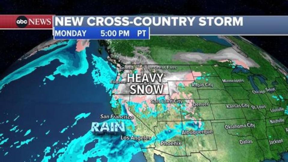
By Monday, the storm will stretch from California to the Rockies with snowfall, strong winds and coastal rain expected.

Heavy mountain snow will continue in the Northwest throughout the day on Monday extending from Washington and Oregon into Montana and Utah.
This is not expected to be a major storm for California. San Francisco to Los Angeles could see some light rain showers while up to a foot of snow could fall in the highest elevations of the Sierras.
MORE: 37 million California residents on flood watch amid back-to-back storms
On Tuesday afternoon and evening, the storm will move into the Midwest with severe thunderstorms possible from Missouri to Michigan, including major cities such as Chicago, St. Louis and Indianapolis.

The biggest threat with these severe thunderstorms will be damaging winds, large hail and a few tornadoes.
On Wednesday, the severe weather will move into the Mid-South with a threat for damaging winds possible from Kentucky to Alabama, including major cities such as: Louisville, Nashville and Memphis.
MORE: Why extreme rain pouring into Southwest US hasn't fully eliminated the region's megadrought
On the back side of this same storm, snow will be possible from Denver to Minneapolis and Green Bay.
Ahead of the storm, the Plains to the East Coast will enjoy spring-like temperatures from Monday to Wednesday as high temperatures soar to 10-30 degrees above normal.

The core of the storm will move to the East Coast and I-95 corridor late Wednesday with heavy rain and very warm temperatures possible from D.C. to Boston.
The storm is projected to exit to the East early Thursday morning with colder, more seasonable, air filtering in behind it.
ABC News' Max Golembo and Melissa Griffin contributed to this report.
Cross-country storm to hit the Northwest with severe weather before heading East originally appeared on abcnews.go.com

 Yahoo News
