
 Yahoo News
 'Danger to life' warning issued by Met Office amid 'severe' yellow rain and flooding alert
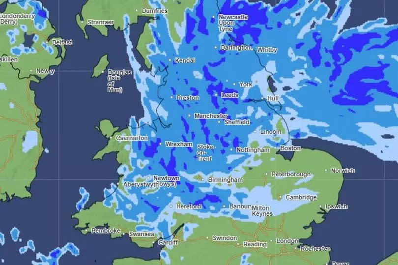
A 'danger to life' alert is in place across Greater Manchester amid a 'severe' yellow weather warning from the Met Office. Forecasters have issued the alert across the region and much of the north of England over the coming days.
Heavy downpours are set to batter the region overnight into Wednesday morning (May 22), with the yellow warning for rain also in place onThursday (May 23).
Forecasters are warning that the heavy showers could lead to flooding and travel disruption in some areas, with the alert covering the entire region, as well as a large part of the north of England and the midlands.
READ MORE Met Office weather warning issued for Greater Manchester with chance of flooding as heavy rain hits
The downpours are also likely to cause difficult driving conditions and flooding that may lead to some road closures, possible cancellations to public transport services and 'fast flowing or deep floodwater, causing a danger to life', the Met Office said.
Communities could become cut off by flooded roads, with homes and business also possibly being flooded, causing damage to buildings.
The warning comes into force from 12.15am on Wednesday morning and will last 6am on Thursday. According to forecasters, lighter showers are expected in our region throughout the morning before the rain turns heavy during the afternoon. The showers are expected through until Thursday morning as rain clouds sweep over much of England.
On Wednesday, an area of low pressure will approach the UK from the east, bringing heavy and, in places, prolonged rainfall. The precise track of the low pressure will determine how far west across the UK the heavy rain will reach.
Chief Meteorologist, Andy Page, said: “The area of low pressure developing in the southern North Sea will push a band of heavy rain north and west across the UK.
“Areas exposed to the strengthening northerly winds are most likely to see the highest rainfall amounts, though exact details regarding the track of the low and thus where we might see the highest rainfall totals remains uncertain. Warnings are likely to be updated as more details emerge, and it is important therefore, that people to keep an eye on the forecast.”
It’s thought that many places could see 30-40 mm of rain, while a few areas may receive 60-80 mm. There is also a small chance that a few upland areas could see much higher totals, in the order of 150 mm.

