
 Yahoo News
 Day by day Kent 'mini heatwave' forecast as Met Office expects tempratures up to 27C
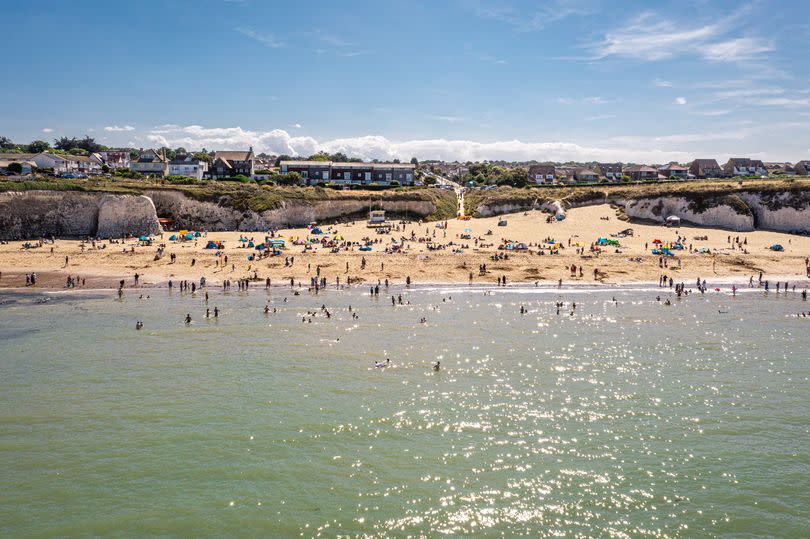
A heatwave is set to bring a long spell of hot weather and sunshine to Kent as summer has now officially begun. Thursday, June 20 marked the first day of the new season, and Met Office forecasters have now predicted balmy temperatures of between 25C and 27C headed to the south east very soon.
Following a “brief, less settled, interlude” today (Friday, June 21) and on Saturday, “fine” conditions will make a return from Sunday and into the new week. By the middle of the week, much of the UK will see the mercury rise up to the mid 20Cs, and Kent will be no exception.
Met Office chief forecaster Neil Armstrong said: “Some central and southern areas are likely to see temperatures approaching the values needed for heatwave conditions. Heatwave conditions need to remain in situ for three consecutive days, and by the middle of next week it is possible that some parts of the UK could be reaching heatwave thresholds.
Read more: Kent dad's 'life-changing' diagnosis motivates son to smash charity target
Read more: 'Magical' Kent glamping site named one of the best in England
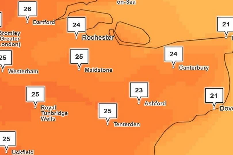
“However, whether or not everyone experiences heatwave thresholds, the majority of the UK will experience the finest conditions and highest temperatures so far this year.” Current temperature maps from the Met Office show peaks between 23C and 25C in Kent on Sunday, June 25.
Such temperatures can be expected in Dartford, Maidstone, Tunbridge Wells, Medway and Tenterden during the late afternoon at around 4pm after a cloudy start in the morning. Over on the coast, the day will feel slightly cooler but still rather warm, with highs of 21C expected in Thanet and Dover.
On Monday, similar high temperatures are forecast throughout the county, rising again to 24C and 25C highs in most areas. This trend will then continue into Tuesday, rising up to 26C for some areas, particularly in the north of the county, such as Dartford.
Wednesday will see even more hot weather as temperatures sit firmly in the mid 20s throughout the afternoon, feeling the hottest toward the north of the county once more. Throughout this period, it is going to feel quite warm overnight too, as temperatures sink down to the mid teens on most nights.
It seems the heatwave might not hang around for too long after Wednesday, with the chance for more rain and even some thunderstorms later in the week. The long range Met Office forecast for Tuesday, June 25 to Thursday, July 4 adds: “There is some uncertainty in how long this warm, settled weather will persist over the UK and there is a chance that conditions could transition back closer to average towards the end of next week.
"This transition brings with it the risk of some showers or longer periods of rain and potentially some thunderstorms, particularly in the south, from the end of next week. However, the remainder of the period is more likely to be settled with temperatures above average.”
Get more news from KentLive straight to your inbox for free HERE.

