
 Yahoo News
 The dramatic change in the weather we're going to see today
Thursday morning has started off quite sunny and dry in Wales, but it is not set to last. Weather forecasters are warning of winds of more than 50mph and heavy rain affecting most of the country by the end of the day.
It might be June, but it looks set to feel more like the middle of autumn as an area of low pressure moves in from the east.
BBC Breakfast Carol Kirkwood is warning of a "wet afternoon" as the rain and high winds move across the country. Temperatures plummeted to 11°C in North Yorkshire, yesterday as the UK continues to see a significantly dreary June.
READ MORE: When it will get hot again according to the Met Office
READ MORE: Club comes together in tribute to rugby player who collapsed and died in training session
Earlier this week temperatures in Bala in Gwynedd, dropped to 1°C with a ground frost as Arctic air made it feel over the UK. Welsh weather presenter Derek Brockway says the lowest on record in Wales is -4°C at St Harmon, Powys in June 1985.
His colleague Sabrina Lee said: "Most places will start out dry on Thursday, but it is going to turn increasingly unsettled. A band of rain will turn persistent and, in places, heavy and on top of that there is strengthening southerly winds. Gales are possible in the west, with highs of 50mph. They could cause disruption and it will feel cold."
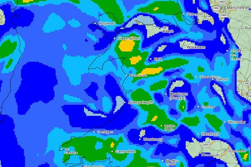
The Met Office forecast for Wales on Thursday says: "Showery rain soon reaching western coasts this morning and quickly spreading to the rest of Wales. Thereafter generally wet with periods of heavy rain. Becoming unseasonably windy for many with gales likely on western coasts. Feeling cool for June. Maximum temperature 15 °C.".
It adds for this evening: "Cloudy and damp this evening with drizzle and rain at times. Turning drier overnight but showers remain possible. Winds easing though staying breezy on coasts. Much milder than last night. Minimum temperature 10 °C."
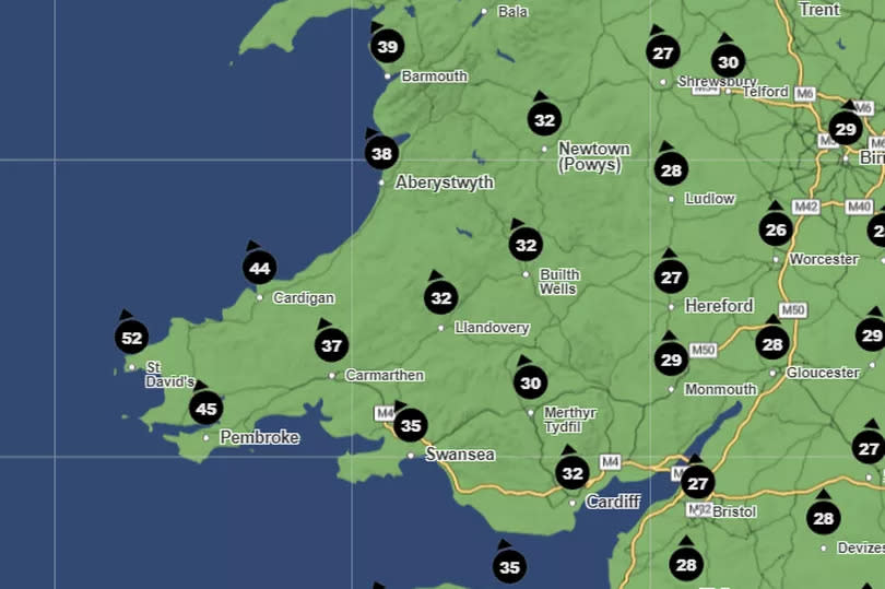
This is the Met Office weather map for 2.15pm on Thursday (June 13)
It will also be windy with highs of 52mph in west Wales, and 44mph in Cardigan.
The forecast for Friday shows another mixed day of "cloud, warm sunny spells and showers". The Met Office forecast adds The showers may be heavy with a risk of thunder but will generally move through quickly. Blustery winds at times. Maximum temperature 18 °C.
The outlook for the weekend is not what you want to see either with the Met Office saying: "Changeable and showery with some heavy downpours and thunderstorms in places, especially on Saturday. Occasional drier periods too, particularly on Sunday and Monday and feeling warm in the sunnier spells."
But there is some hope on the horizon, Derek Brockway has said that there are "hints of higher pressure and better weather" from late June into July

