
 Yahoo News
 Exact date UK mini-heatwave predicted to return as new July forecast issued

The UK is set to see a dip in temperatures this week as the recent heatwave begins to wane, but don't pack away your sunglasses just yet - sunny days may soon return.
Last week, the country basked in the hottest day of the year so far, with Heathrow hitting a scorching 30.3C, leading the UK Health Security Agency to issue multiple heat health warnings. However, the coming days will bring a noticeable cool down, with forecasts predicting mid-to-high teens across many regions by Monday.
Overcast skies are also on the cards for much of Britain throughout the week. But there's a silver lining for those craving more sunshine, as forecasts suggest warmer weather could make a comeback around mid-next week.
READ MORE: Sneaky East Lothian thief 'tried to attack staff' during raid on corner shop
READ MORE: Edinburgh pub has most expensive Wetherspoon pint in UK - double the cheapest
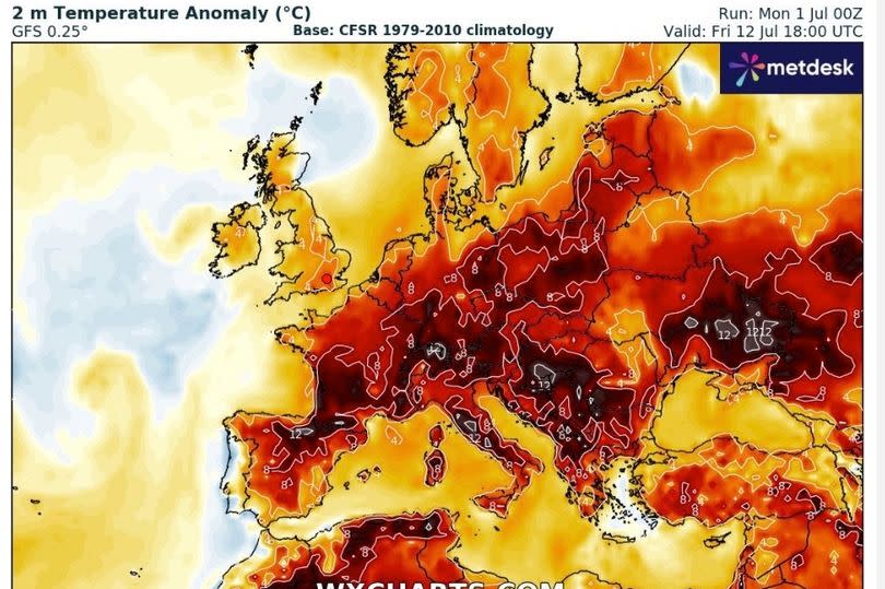
Accuweather is forecasting highs of 25C in London and the southeast by Wednesday, July 10, while WXCharts' weather radar maps show swathes of red, signalling temperatures higher than average for this time of year.
According to BBC Weather, meanwhile, the mercury is set to tip a balmy 19C in Edinburgh on Saturday, July 13.
Looking further ahead into July, the outlook is somewhat uncertain. James Madden from Exacta Weather has provided an update suggesting that the jet stream might usher in a sustained spell of warmth from next week onwards, stating: "We now expect the more southern-driven jet stream to start to drive northwards from in and around this time next week and during the following week, starting on July 8th.", reports the Mirror.
"This will allow for our shores (UK and Ireland) to come under a much warmer airflow over an extended period from this pattern change, and it will also place us in an extremely favourable position for high pressure rises and some hot to very hot temperatures on a widespread scale from in and around mid-July and throughout much of the second half of the month."
Meanwhile, the Met Office has forecasted a more "changeable" period, including some rainfall. Their long-range forecast for Friday 5 July to Saturday 14 July states: "This period is likely to see a continuation of the changeable conditions, with occasional bands of rain moving in from the west or northwest. There will be a good deal of dry, warm, and settled weather in between frontal systems, with the best conditions most likely in the south and east where winds will be lighter. In contrast, further north and west, it will generally be breezier, and any rain that does occur will be heaviest over the hills."
"Cloud cover will vary, with cloudier weather expected in the north and west, while clearer skies are likely in the south and east. Temperatures will be around or a little below average for the time of year, but on sunnier days with lighter winds, it will still feel warm."

