
 Yahoo News
 Forecasters issue 'dry spell' UK verdict and date when temperature will 'surpass 35C'
After what's been a rather wet and grey summer so far in 2024, forecasters are predicting a change in the weather that will bring 'drier than average conditions' and 'above average temperatures'. Europe is set to experience a heatwave and that scorching weather could rise temperatures in the UK to more than 35C.
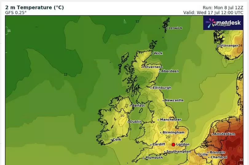
It comes as temperatures fell to below average for this time of year, as wind and rain batters the country in recent days. However new maps from WXCharts weather service show how change is expected soon where people can look forward to warmer days, reports MirrorOnline.
The temperature is expected to exceed more than 30C. And the change in weather is expected arrive after Wednesday, July 17.
READ MORE: West Midlands' cheapest and most expensive areas to rent in 2024
Get breaking news on BirminghamLive WhatsApp, click the link to join
Forecasters said: "As can often be the case at this time of year, predictability at this range is low. There are some signs of a slightly greater than normal chance of a more prolonged settled spell developing at some point during the period, at least for a time, and perhaps more likely in the south.
"However, by the same token further, perhaps shorter, unsettled interludes are probable too. Above average temperature s overall, and drier than average conditions overall, are very slightly favoured."
Before the change in conditions Brits will face more rainfall. In Scotland, yellow warnings are in place for today and tomorrow where people are warned of flooding which may cause havoc with travel routes. The Met Office said: "Areas of rain moving into northern Scotland from late Tuesday into Wednesday are expected to become heavy with some embedded showery outbreaks as the band slows down and focusses across the east coast and Moray Firth.
"Check if your property could be at risk of flooding. If so, consider preparing a flood plan and an emergency flood kit. Give yourself the best chance of avoiding delays by checking road conditions if driving, or bus and train timetables, amending your travel plans if necessary.
"Into the weekend conditions will be mostly cool to average with some showers at times, most settled in the north west but increasingly showery to the southeast with a low risk of a more humid and thundery plume affecting eastern areas at first. The first part of the new week likely to see a mostly showery westerly breeze establish allowing temperatures to recover to around or just above average, feeling warm in sunnier periods outside of showers/heavy showers or thunderstorms.
"A more settled spell in the southwest mid-week possibly spreading to much of the UK, though this likely only brief before a more showery northwest flow resumes. Winds after the weekend will be mostly light to moderate, though gusty conditions near heavy showers and thunderstorms remain likely."

