
 Yahoo News
 A gem of a walk in North Lincolnshire
A walk along the beginning of the 149 mile Viking Way in North Lincolnshire provides a reminder of the natural wonder on our doorstep.
On a Saturday earlier in June, I walked from Barton-upon-Humber to South Ferriby, part of the Viking Way. It is a gem doubtless familiar to residents of those two settlements, though perhaps less so in other parts of northern Lincolnshire.
North Lincolnshire Council's own website states there are approximately 320 miles of public footpaths and bridleways in the local authority. The walk served as a reminder of the importance of public rights of way to access stunning countryside locations - a topic of considerable relevance currently in part of North Lincolnshire.
Read More:
Architectural wonder
I started my journey from the Humber Bridge viewing area at Barton-upon-Humber. The town is well accessible via the A15, Barton to Cleethorpes railway line, and Hull to Scunthorpe and Grimsby bus services. The Scunthorpe buses, 350s, also stop off at South Ferriby.
The sight of the UK's longest suspension bridge is quite an architectural wonder, and the most Instagrammable views are marginally more on the Barton than Hessle side. The bridge can be appreciated in its splendour while getting a bite to eat at the Viking Way Café Bar. Heading out to South Ferriby, you pass under the bridge and can appreciate more the upturned runway design it has.
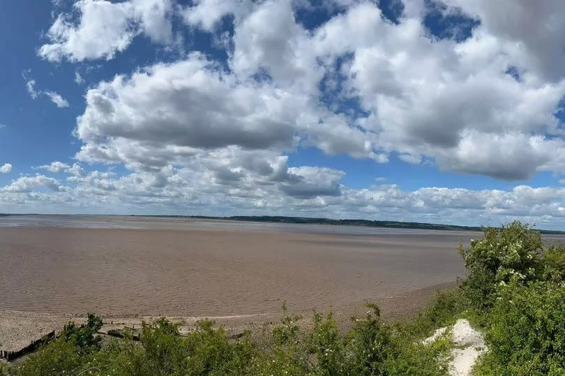
The path is flat and loose gravelled for a long portion of the approximately hour and a half journey to South Ferriby, certainly well beyond the Far Ings national nature reserve's visitor centre. Run by The Wildlife Trust, the lake-covered site is a stopping off point for many migrating birds.

The first time I attempted to complete the Barton to South Ferriby walk, last year, it was also my undoing. Keen as I am on wildlife, it was too great a temptation to not visit briefly. But a short visit soon turned into over an hour. I ploughed on ahead this time.
Far Ings lakes are formed out of the clay pits of previous cement and tile industry in the 19th and 20th century. Heading from Barton, views of the Old Tile Works, where Humber Bridge Garden Centre is located, precede it. Old, abandoned to the element cement work buildings can still be spotted on the Humber Estuary side of the Viking Way path.
A concrete section of path takes over just before the journey past Far Ings ends. After a couple of minutes on the quiet Far Ings Lane, moving away from the estuary, the public footpath snakes around South Cliff Farm, returning back to the estuary side.

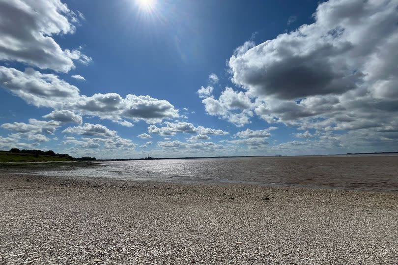
There is more marshland to see here, before you come across a stone beach, made from the chalk cliffs, at a footpath fork. Known locally as Pebbly Beach, you can walk along and see the wreck of Mary Maria and the steep South Ferriby Cliffs from below. I did not realise this when doing the walk myself. After thoroughly enjoying a book read at the furthest eastern point of the beach, I followed the public footpath route inland and onto the ridge of the cliffs.
Whichever of the routes taken at the fork, beach or straight to the ridge, both end up with entering South Ferriby past Goss Wood. A village pond with ornamental sculptures of wildlife is next to an information board.
I concluded my own walk with a drink at the Nelthorpe Arms, but it is only a little further to get to the Hope & Anchor. Except for a narrower section close to the farm, the Barton to South Ferriby route I took was wide, well-maintained and accessible.
Public rights of way
Landowners are responsible for keeping public paths free from obstructions. North Lincolnshire Council, as the local highways authority, is responsible for the overall condition of public paths in its area, including signposting. There were clear signs at the Far Ings Lane point, where without it could be easy to not realise the right of way follows around South Cliff Farm.
Public notices must be advertised when orders to modify a public footpath are made. For example, there is currently one for Cadney cum Howsham, footpath 279.
Want to sign up to the Scunthorpe newsletter, but can’t access the link below? Click here .
Anyone can apply to make a definite map modification order to set out a public footpath route, if they believe the council's definitive map is incorrect. A minimum twenty year use is required to be evidenced to establish a public right of way.
Worlaby villagers currently await the outcome of a multi-day public inquiry into a disputed right of way over the nearby railway line to the River Ancholme. The inquiry pitted the council against Network Rail, who closed the level crossing several years ago.
The route is the village's access to the Ancholme Valley Way. This is a route between South Ferriby and Brigg along the river. Though improvements have been made, a significant middle section remains without a laid-out footpath, something the council is committed to doing.
Public rights of way provide precious access to the countryside and associated wildlife and stunning views. There is currently a 2031 cut-off point for people to get recognised historic rights of way that predate 1949, which are not officially recorded.

