
 Yahoo News
 'Lightning hunter' animations show spectacular storms across Earth
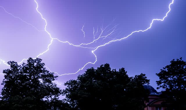
Spectacular animations showing lightning storms across the Earth have been put together with data from a new satellite project that will make it easier for forecasters to predict severe storms.
The European weather agency, Eumetsat, and the European Space Agency (ESA) released the first animations using data captured by the Leonardo Lightning Imager, which was launched on the Meteosat Third Generation satellite system above Africa last December.
Described by the ESA as the "first European lightning hunter", the system has cameras covering Europe, Africa, the Middle East and parts of South America and can detect a single bolt "faster than the blink of an eye".
Project manager for the imager, Guia Pastorini, said: "The Lightning Imager has four cameras and each one can capture 1,000 images per second, day and night, detecting even a single lightning bolt faster than the blink of an eye.
"Thanks to specific algorithms, data is processed on board to send only useful information to Earth, supporting the development of more accurate weather forecasts, as well as contributing to the study of weather phenomena and air transport safety.
"Together with ESA and Eumetsat, and coordinating an international industrial team, Leonardo has been working on this outstanding technology for 10 years, and today we are very proud to present the images of the first European lightning hunter, the only in the world with these unique performances."
Animations of the storms have been created using a sequence of images and raw data from lightning measurements captured across a time of one minute.
Data from the Meteosat satellite's other main Earth observation instrument, the Flexible Combined Imager, will also be used to help forecasters and weather experts track future storms.
Eumetsat director-general, Phil Evans, said: "Severe storms are often preceded by abrupt changes in lightning activity.
Read more on Sky News:
How will El Nino impact the UK's weather?
Tropical storms form in Atlantic in June for first time
"By observing these changes in activity, Lightning Imager data will give weather forecasters additional confidence in their forecasts of severe storms.
"When these data are used in conjunction with the high-resolution data from the Flexible Combined Imager, weather forecasters will be better able to track the development of severe storms and have a longer lead-in time to warn authorities and communities."

