
 Yahoo News
 Met Office issues new nine-hour thunderstorm warning for Devon and Cornwall
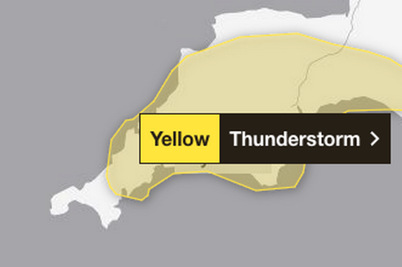
A new thunderstorm warning has been issued by the Met Office. The nine-hour alert, that covers most of Devon and Cornwall, is in place for Tuesday.
Starting at noon and ending at 9pm, the Met Office warns thunderstorms are likely to develop in places on Tuesday afternoon leading to some travel disruption and surface water flooding. Up to 50mm of rain could fall in just three hours in some parts, the forecaster said.
A spokesperson added: "Heavy showers and thunderstorms are expected to develop during the afternoon across parts of south west England before slowly dying out during the evening. Many places will miss the worst, but where they do develop, some slow-moving and intense downpours are possible, giving accumulations of 20-30 mm in around 1 hour, and a lower likelihood of 40-50 mm in 2-3 hours in a few locations. Frequent lightning strikes and hail are also possible."
Read next:
UK put on high alert as deadly Asian hornets set to invade - here's what to do if you spot one
Met Office says Northern Lights visible in UK on Monday, May 20
What to expect
Spray and sudden flooding could lead to difficult driving conditions and some road closures
Where flooding or lightning strikes occur, there is a chance of delays and some cancellations to train and bus services
There is a slight chance that power cuts could occur and other services to some homes and businesses could be lost
There is a small chance that homes and businesses could be flooded quickly, with damage to some buildings from floodwater, lightning strikes, hail or strong winds
Five-day forecast for South West England
Today:
Early cloud and coastal mist will lift and break through the morning to leave a dry day with plenty of sunny spells and an isolated light afternoon shower. With light winds it will feel pleasantly warm in the sunshine. Maximum temperature 22 °C.
Tonight:
It will be a fine evening with warm sunny spells. A dry night then follows with clear spells and some low cloud and fog patches developing towards dawn. Minimum temperature 6 °C.
Tuesday:
Early low cloud clearing through the morning to leave sunny spells with scattered showers developing into the afternoon, these possibly turning heavy or thundery at times. Maximum temperature 21 °C.
Outlook for Wednesday to Friday:
Further showers through this period with bright or sunny spells at times. Showers possibly thundery on Thursday and Friday. Temperatures remaining just above average for the time of year.

