
 Yahoo News
 The most infamous roads and motorways in and around Greater Manchester
Most motorists will have roads they love and those they hate driving on. But whether it's due to design, congestion, or even their perilous nature, some of the UK's roads are more infamous than others.
Greater Manchester boasts a diverse network of roads and motorways connecting its towns and city centres. While many run through heavily urbanised areas, others flow through some of the most idyllic and rugged countryside Britain has to offer.
So whether you see driving as a pleasure or just a necessary evil, we thought we'd take a look at roads in or around Greater Manchester that have achieved fame - for reasons good and bad. From the hair-raising Snake Pass to the first motorway built in Britain, here are six roads many regular commuters will be well acquainted with.
READ MORE: Ten amazing things Oldham has given the world
READ MORE: 25 brilliant dad sayings and threats you'll have heard growing up in Manchester
Of course, this isn't a complete list of all the roads in or around Greater Manchester that have gained fame, or notoriety. So if there are any you think should be included, tell us why in the comments below.
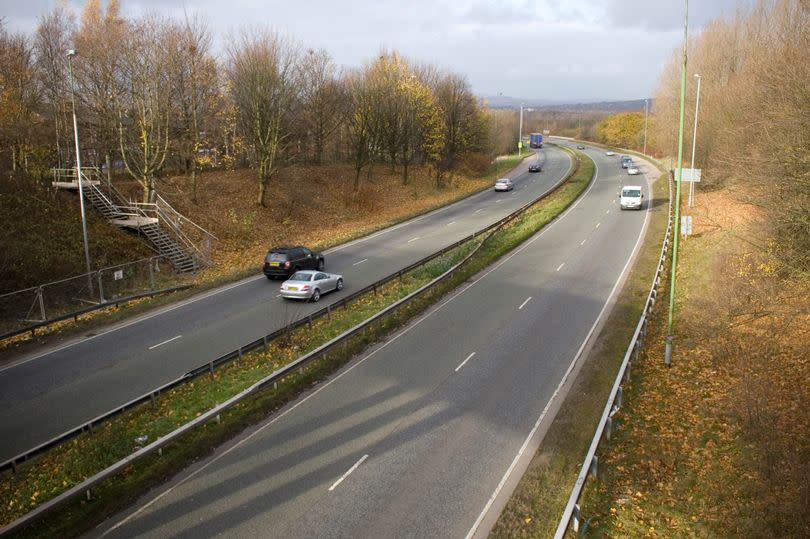
The legendary 'Snake Pass' - A57
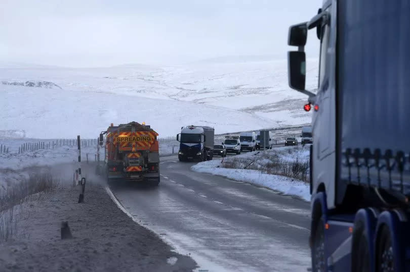
Snake Pass is known for being one of the most scenic drives in the UK. But the twists and turns which make it so spectacular have earned it a place on a list of the most dangerous roads in the world.
The 26-mile route, stretching across the Peak District, is a popular driving route, although it can be hazardous. First opened 200 years ago in August 1821 to link the steel city to Glossop in Derbyshire, the route was named Snake Pass after the local Snake Inn pub.
Join our WhatsApp Top Stories and, Breaking News group by clicking this link
But the namesake Snake Inn has since been renamed the Snake Pass Inn - meaning it's named after the road named after itself. In fact, Snake Pass - or the A57 as it's officially known - is closed for an average 70 days a year due to bad weather and dangerous conditions, according to Transport for the North.
The Government even considered closing the road entirely in 1979 but never got around to it - something many drivers will be thankful for. Though Snake Pass is still the shortest route between Sheffield and Manchester, many commuters now prefer the Woodhead Pass just north as it's safer and links to the M1.
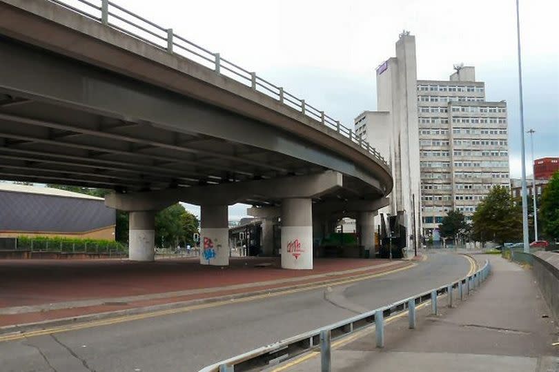
Mini motorway - A635(M)

If you are a regular motorist commuting in and around Manchester, there's a chance you've used this tiny motorway without realising it's a motorway. Forming a small part of the easternmost section of Mancunian Way, the A635(M) didn't even appear on maps until recently.
According to the SABRE Wiki site - an archive of British and Irish road networks - it consists of a single flyover. The mini motorway is signed as part of the A57(M) Mancunian Way and was until 2016 officially the shortest motorway in England, measuring just 0.3 miles.
Join our Greater Manchester history, memories and people Facebook group here.
It was opened in 1992 with no signpost or appearance on any map. Due to its short length, it has the privilege of being included in the Pathetic Motorways website, among its list of current but curious motorways.
The two-mile Mancunian Way was the first elevated motorway to be built outside London and was officially opened by Prime Minister Harold Wilson on May 5, 1967. It's been featured in films, paid tribute to in songs, and became the butt of internet jokes when a massive hole appeared in it in 2015.
Infamous Stockport slip road - M60
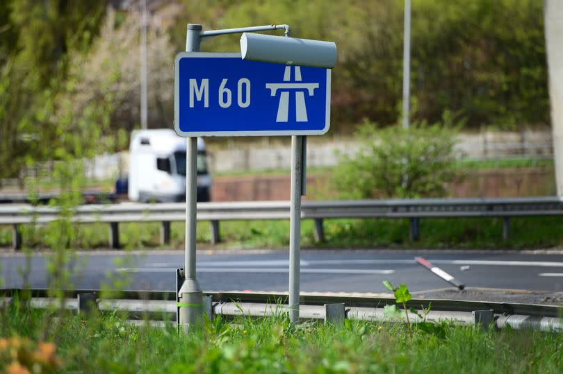
Motorists dubbed this Greater Manchester road the "most dangerous" slip road in the UK in 2021. A viral TikTok of the M60 junction between Bredbury and Stockport had commenters debating how treacherous the road really is.
It is reportedly one of only several slip roads in England where cars immediately merge with the fastest lane of traffic. The junction was originally intended to be a motorway cross-roads, joining pathways that would continue east and north.
Love Greater Manchester's past? Sign up to our new nostalgia newsletter and never miss a thing.
But the plans never came to fruition, and drivers were left with a slip road joining the motorway at its fastest point. Commenters also pointed out the danger for HGVs, which are usually not allowed in the right-hand lane of motorways.
Cat and Fiddle -A54/A537
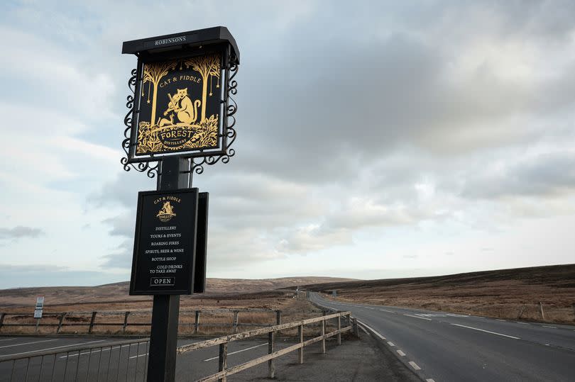
The Cat and Fiddle, which stretches between Macclesfield and Buxton, is regularly named one of the UK's most dangerous roads. Named after the former pub building at its summit, the road crosses parts of the Peak District and is famous for its wonderful vistas.
But don't let its beauty fool you. Often named the most dangerous road in the UK, the Cat and Fiddle has an abundance of blind bends, often unexpected for drivers, reports Derbyshire Live.
Despite fatalities reducing since road safety measures have been implemented, there are still many serious accidents and incidents. During winter the sharp bends, combined with reduced visibility from the weather, and a slippery, icy road surface, make driving along the Cat and Fiddle even more dangerous.
The devilishly named A666
Sometimes referred to as the Devil's Highway thanks to its association with the biblical 'Number of the Beast', the road runs from Pendlebury to Blackburn, taking in the West Pennine Moors along the way. Its journey lasts for just under 30 miles, with a terrain varying from motorway-standard dual carriageway to narrow urban town street, according to SABRE (The Society for All British and Irish Road Enthusiasts).
Along with the fame brought by the road number's biblical connotation, reports have been made of ghostly sightings on this road. One apparition said to have been spotted by motorists is that of a limping and hunched figure, known simply as the 'A666 Ghost'.
But perhaps the most interesting, non-paranormal, aspect of the A666 is where it connects to the Worsley Braided Interchange. The A666(M) Kearsley Spur is an unsigned motorway between Bolton and Salford.
At just over a mile and a half long, the A666(M), is referred to as a 'secret' motorway by SABRE, thanks to the secrecy of the route number being maintained by an absence of Driver Location signs while all overhead signs refer to either "M60" or "(A666)". Confusing? Just a bit.
Preston Bypass

Forming part of the motorway network dubbed the 'Backbone of Britain', the M6 - the UK's longest motorway - has its foundation stone in the heart of Lancashire. Running just over 230 miles long, the M6 motorway runs from the Midlands to the borders of Scotland, passing through Coventry, Birmingham, Wolverhampton, Stoke-on-Trent, Preston, Lancaster and Carlisle.
And famously, the first piece of this gigantic motorway was put in place in Preston. The Preston Bypass was the UK's first motorway and was built to create a north-south motorway network that would later form part of the M6.
The bypass was officially opened on December 5, 1958, by then Prime Minister, Harold Macmillan. It was designed as a solution to relieve tailbacks and congestion on the A6 in Preston, and seen as an experiment for the future of motorway construction.
It was originally designed to handle vehicles travelling at speeds of 70mph but no speed limit was enforced for the first few years. However, during its early operation, drivers reported being apprehensive about using the bypass through fear of being overtaken by faster drivers, with average speeds recorded at around 38 mph.
The road was also purposely constructed not to be a long stretch of straight road and to include bridges and trees, with the aim of preventing driver boredom reported on foreign motorways. An additional third lane was added in each direction in 1966, but the bypass underwent its most significant change in the 1990s when it needed to be completely rebuilt to become four lanes in each direction.
This meant all bridges needed to be removed so a hard shoulder could be installed. A year after the Preston Bypass was opened, the M1 was fully completed, becoming Britain's first full length motorway in 1959.
In the years since the Preston Bypass was built, the M6 it became part of has become well-known for tailbacks around Birmingham, encouraging drivers travelling between Greater Manchester and London to take the newer M6 toll road.

