
 Yahoo News
 Northumbrian Water launches interactive map to show storm overflows in real time
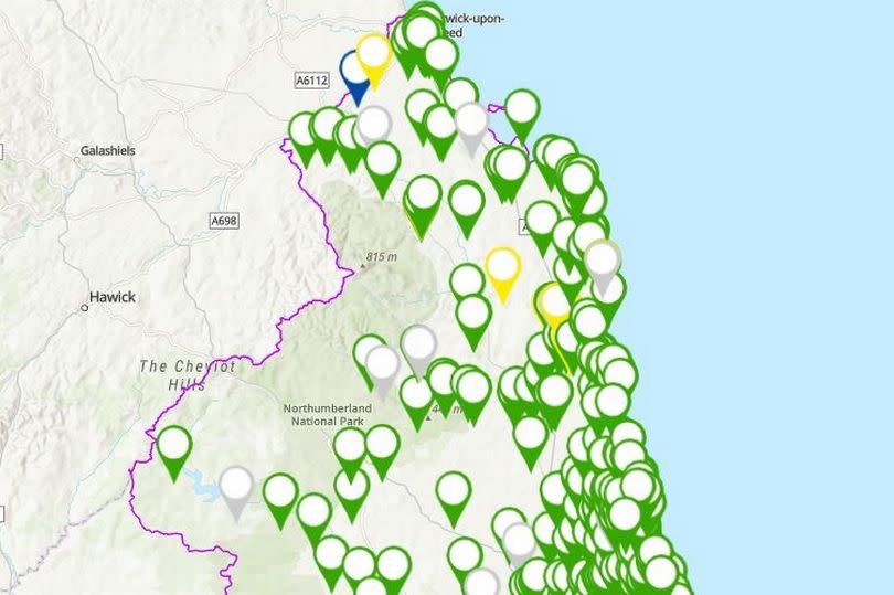
Northumbrian Water has launched an interactive digital map, which it says gives up-to-date information on storm overflows across the North East.
The company says that members of the public can use the map to make "informed" choices about how they use their local rivers and coastal waters. Northumbrian Water has been under fire recently after figures from the Environment Agency showed that raw sewage had been discharged from its storm overflows for 280,029 hours in 2023, from a total of 46,492 spills.
They put this down to 2023 being one of the wettest years on record, with storm overflows "necessary at times of heavy rainfall" to prevent homes from flooding. The online map will show the location of all Storm Overflows and outfalls in Northumbrian Water's operating area, and uses data from sensor monitors which are attached to each overflow.
The company says that this will ensure people have the most up-to-date information about their local area. Bosses have described the launch of the digital map as a "significant" step forward in the sharing of data and information with customers and the community, which has never been available before.
Richard Warneford, wastewater director at Northumbrian Water, said: "As part of the Cleaner Seas Forum, we have been taking part in a voluntary trial to notify Surfers Against Sewage and Beach Controllers when we discharge to a beach. This began with Saltburn Bathing Water in 2011, but this is the first time we can show our customers and all water users our entire wastewater network in one place in real time.
"What we’ve built will allow our customers to see what is happening, and where, and with 100% of our storm overflows monitored, it gives people a transparent view. That means people can see and fully understand where Storm Overflows are operating, so they can make informed choices about how and when they use their local rivers and coastal waters."
The map can be viewed here.

