
 Yahoo News
Ball of rags used to stuff chimney turns out to be rare 17th century world map

A bunch of old rags stuffed up a chimney to prevent draughts have turned out to be a rare antique map of the world from the 17th century.
The wall map, one of only three of its kind in existence, was recovered following intricate conservation work at a house in Aberdeen, Scotland.
However, it was on its way to a skip when it was first pulled out of the chimney during renovations at the property.
Someone had the presence of mind to donate the map to the National Library of Scotland.
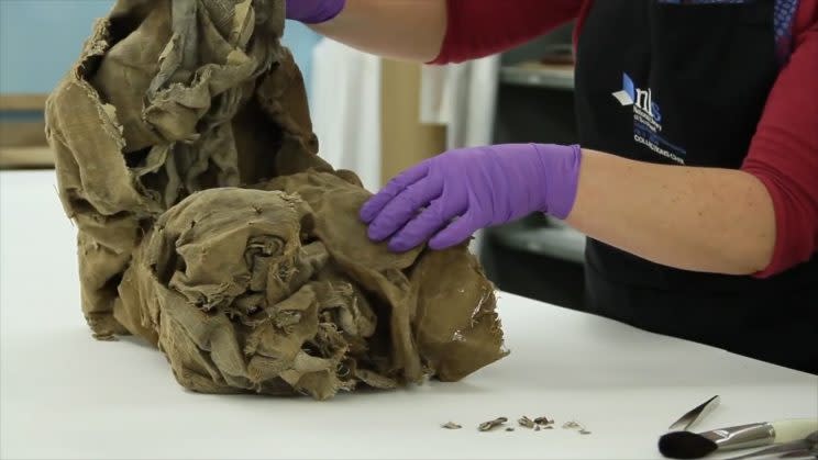
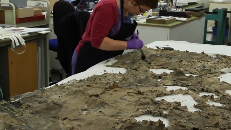
When it was found up the chimney, the map was covered in dirt and had been damaged after being attacked by vermin and insects.
MORE: Britain ‘faces coldest night in 25 YEARS’ as bookies slash odds of White Christmas
MORE: Noisy eaters and moaners: The most annoying office colleagues revealed
It was delivered to the library in a plastic bag and pieces would fall off when it was moved.
But after a conservation process the map has been restored.
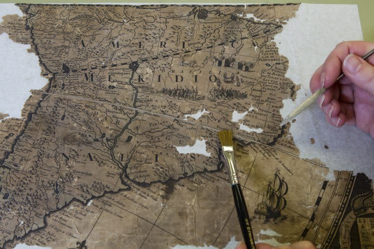
It was identified as the work of Dutch engraver Gerald Valck and dates from the late 17th century.
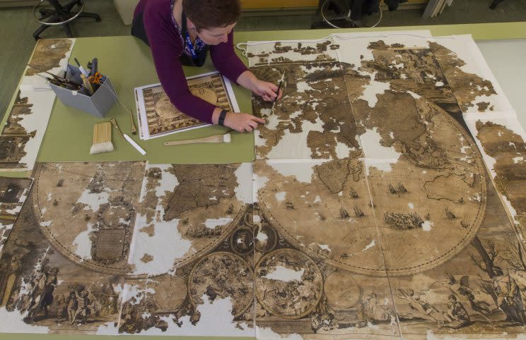
It measures 2.2m by 1.6m and would have been hung on a wall to be admired by visitors.
To restore it, staff at the library opened and flattened the map then separated it into eight sections.
Its linen backing was removed and the paper was dry cleaned and washed before being reassembled on to a new lining.
Claire Thomson, book and paper conservator at the library, said: “Once the map was unfurled I was able to assess its condition, which I must admit filled me with dread.
“Much of the paper had been lost, and the remainder was hard and brittle in places and soft and thin in others.
“We needed to stabilise it to prevent any further deterioration, make it robust and easier to handle to get to a point where it could be studied by researchers.”
The map was put in a humidifying chamber to make it easier to flatten out.
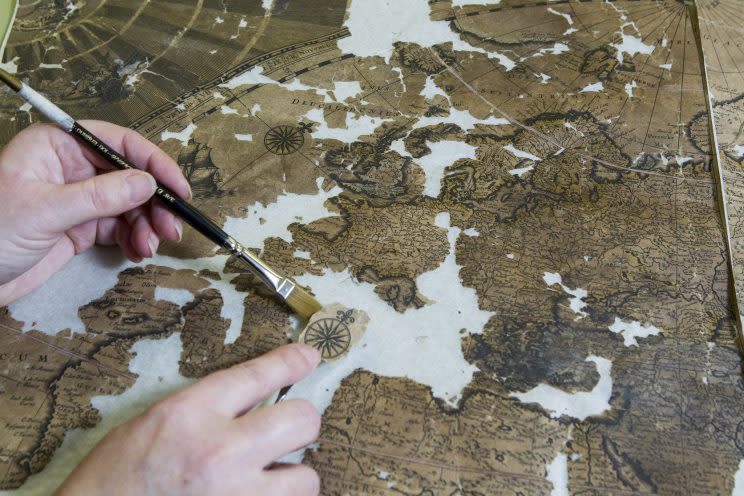
In order to remove the backing without damaging the paper further, staff used a thick cellulose solution to fix lightweight Japanese paper to the front of the map in two layers, securing the paper map while peeling off the backing.
Map sections were cleaned by being suspended in a heated sink at 40C for 40 minutes.
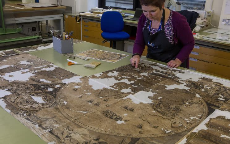
It was at this point the map’s detail was revealed.
National Librarian Dr John Scally said: “This is one of the most challenging tasks our conservation team has faced and they have done a terrific job.
“Although significant sections of the map have been lost, the remainder has been cleaned and stabilised for future study and enjoyment.
“It would have been very easy for this map to end up at the bottom of a skip but thankfully it can now take its place among the magnificent maps held within our collection.”

