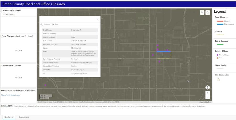
Smith County launches interactive road, office closures map
TYLER, Texas (KETK) – Smith County announced on Wednesday they have launched an interactive map to show Smith County roads and offices that may be closed.
‘We give two weeks and it’s just not returned’: Red Lobster employees speak out
According to a release, the Smith County Road and Office Closures Map is a specialized map site that gives a visual aid to compliment other forms of communications sent out by Smith County.
The map shows county roads that are closed due to hazards like flooding, maintenance or bridge construction, and displays detours along with how long the road is expected to be closed.
The map was created by Smith County GIS Analyst Ethan Robinson who said it is intended to be a “single pane of glass” for the public to be able to view road closures.
“This will aid emergency management in our service to the community by providing near real-time information to our citizens during disasters,” Smith County Emergency Management Coordinator Brandon Moore said. “By allowing each citizen to access this platform the individual can plan accordingly during disasters by utilizing information provided by county and first responder personnel.”

To view the interactive map, click here.
“The map is only intended to include county road closures, not city roads, highways or Farm-to Market Roads,” the county said in a release. “However, the bottom of the map tells users that they can visit https://drivetexas.org/ for city and TxDOT closures.”
Copyright 2024 Nexstar Media, Inc. All rights reserved. This material may not be published, broadcast, rewritten, or redistributed.
For the latest news, weather, sports, and streaming video, head to KETK.com | FOX51.com.

 Yahoo News
