
 Yahoo News
 Snow lovers in luck again this Valentine's Day, with multi-day storm beginning Wednesday
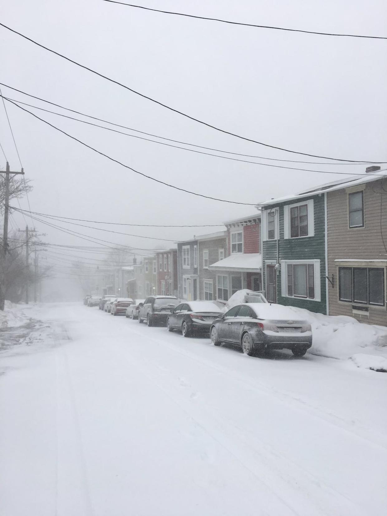
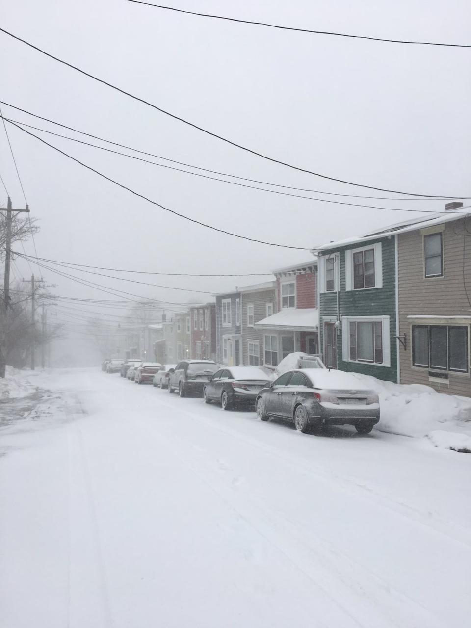
Snow is expected to be heaviest on Wednesday, and will eventually taper off by Friday morning. (Philippe Grenier/Radio-Canada)
For people living on Newfoundland's east coast, this Valentine's Day may be spent in the company of a snowman and a dependable shovel.
It won't be the first time, says CBC meteorologist Ashley Brauweiler — this year will mark the third winter storm in a row in St. John's over the holiday.
"Valentine's Day storms seem to be a thing," said Brauweiler in a Facebook post, adding that there have been eight major storms in St. John's on Feb. 14 since 1982, though not all of them were snow storms.
This year, snow is certainly on the way, she says. A days-long storm is expected to bring 30 to 50 centimetres of snow over several days to eastern and northeastern Newfoundland, including the northern Avalon Peninsula, according to Environment Canada.
Snow is expected to be heaviest on Wednesday, and will taper off by Friday morning.
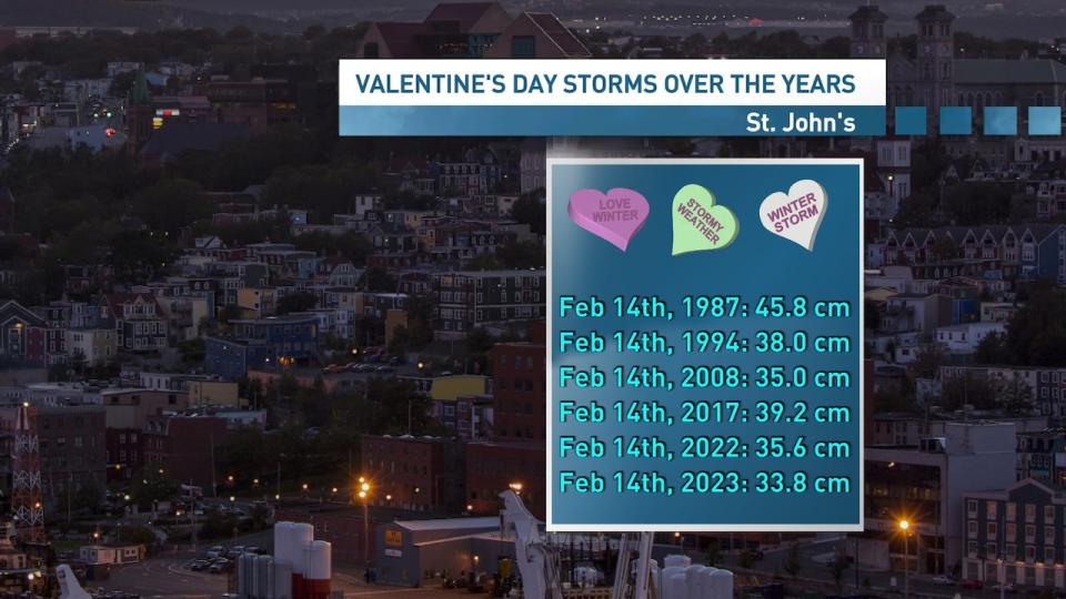
CBC meteorologist Ashley Brauweiler says there have been eight major storms in St. John’s on Feb. 14 since 1982, though not all of them were snow storms. (Ashley Brauweiler/CBC)
Brauweiler says snow will begin through the early hours of Wednesday morning, around 3 to 4 a.m. Wind will ramp up in the morning, with winds gusting from 50 to 70 km/h.
The wind will be combined with a snowfall rate as high as 2 to 4 centimetres per hour, "so that's pretty heavy snowfall," says Brauweiler.
Blowing snow will cause reduced visibility throughout Wednesday. Thursday will bring some relief from high winds, but it will continue to snow throughout the day.
Instead of fluffy, light snow, it'll likely be on the heavy side, says Brauweiler — good for making a snowman, but perhaps a little more challenging on the shovel.
Whether snow will turn to rain at any point depends on changes to the weather system, says Brauweiler. Environment Canada says on its website that, as is typical for all nor'easters, slight changes in the weather system can alter the forecast.
Environment Canada says similar storms in the past have caused poor driving conditions, school closures and disruptions to public services.
Winter storm warnings extend from the Avalon Peninsula through to Gander, Bonavista and down through to the Burin Peninsula, says Brauweiler. Winter storm watches are also in place for the Green Bay and White Bay areas, through to Grand Falls-Windsor, the Bay of Exploits and Connaigre.
A storm surge warning is also in place for Cape Spear to Deadman's Bay, according to Environment Canada, with high water levels and 5- to 7-metre waves expected Wednesday night, which could affect vulnerable areas of coastline.
Download our free CBC News app to sign up for push alerts for CBC Newfoundland and Labrador. Click here to visit our landing page.

