
 Yahoo News
 Tropical rainstorm to bring deluge of rain to Texas, Mexico
After a tropical rainstorm brought heavy rainfall to portions of Florida last week, AccuWeather hurricane experts warn that yet another tropical rainstorm is expected to impact the southern U.S. in the coming days.
In addition to the tropical rainstorm, two other areas in the Atlantic Basin are being monitored for tropical development later this week, including one off the Southeast coast. It is possible that one of these areas could strengthen into Alberto, becoming the first named storm of the season.
 |
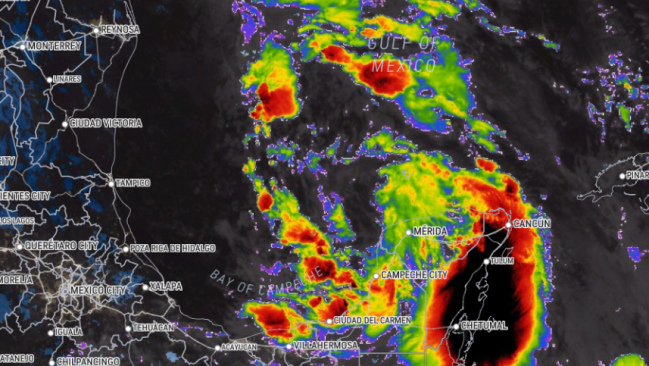
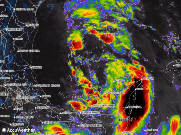
This AccuWeather Enhanced RealVue™ Satellite image from Tuesday morning, June 18, shows an area of showers and thunderstorms, dubbed a tropical rainstorm by AccuWeather meteorologists, in the Bay of Campeche. |
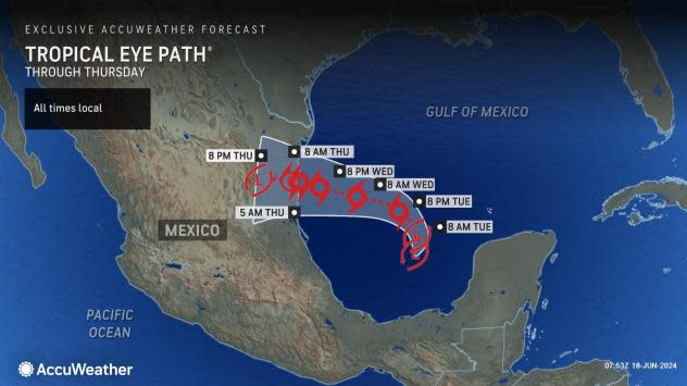
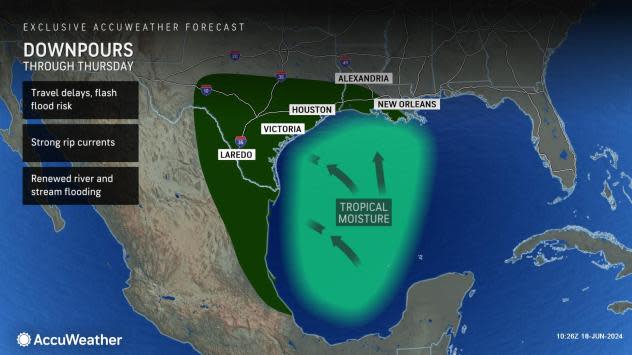
AccuWeather began to highlight portions of the western Gulf of Mexico with a high risk for tropical development last Thursday afternoon. A tropical rainstorm developed late on Sunday and is forecast to steer toward the border between Mexico and Texas into the middle of the week. The storm is expected to drift north-northwestward, bringing with it rounds of heavy rain.
A tropical storm warning has been issued along the Gulf Coast from Port O'Connor, Texas, southward to the mouth of the Rio Grande River, with a tropical storm watch southward from there to Puerto de Altamira, Mexico, due to the expected impacts from the strengthening system.
 |
"Very warm waters in this area of the Gulf, as well as low wind shear will make this a conducive environment for the tropical rainstorm to strengthen," said AccuWeather Senior Meteorologist Dan Pydynowski.
Given these factors, the rainstorm is forecast to strengthen into a tropical depression, then a tropical storm, right before making landfall along the northern Gulf Coast of Mexico. Should the storm produce sustained winds of 39 mph or greater prior to any other development in the Atlantic Basin, it will be given the name Alberto.
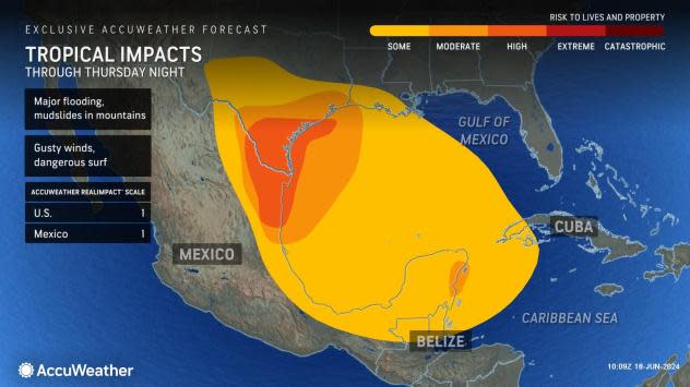
A tropical storm is likely to bring widespread strong wind gusts to the Mexican states of Tamaulipas and Nuevo Leon, as well as portions of South Texas. Some storm surge can also be expected along the coast north of the storm's landfall. For both Mexico and the United States, given the risk for damaging winds, storm surge and flooding rainfall, this storm is a 1 on the AccuWeather RealImpact™ Scale for Hurricanes.
 |
Given the limited time over water and close proximity to land, the tropical disturbance will need to intensify quickly in order to reach tropical storm strength before landfall Wednesday night. This is currently expected to occur, according to AccuWeather forecasters.
"Even if the tropical [feature] falls short of reaching tropical storm status, a plume of rich, deep tropical moisture is expected to surge into Mexico, Texas and Louisiana into the middle of the week," Pydynowski explained.
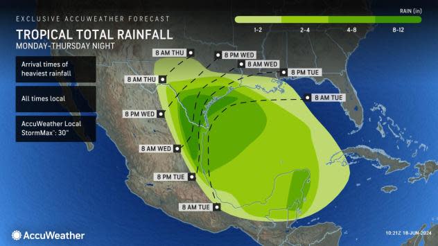
Heavy rain is forecast to extend well north of the center of the storm, spreading even into portions of central Texas.
 |
Commuters along the Interstate 10 corridor from New Orleans to Houston can expect slower travel times into Wednesday as downpours reduce visibility and potentially cause flooding.
The ample supply of tropical moisture could allow rainfall totals to add up quickly, bringing the risk for over half a foot of rain across parts of the Texas and Louisiana Gulf Coasts. An AccuWeather Local StormMax™ of 30 inches is possible in the hardest-hit areas, resulting in road closures.
 |
The Houston area has already received over 6 inches of rain through the first half of June, which is an amount more typical for the entire month. This new round of heavy rainfall to the already drenched area could bring renewed flooding woes for southeastern Texas.
Other zones along the Gulf Coast could use the rain. Brownsville, Texas, has only had 0.21 of an inch of rain so far in June, 15% of the historical average. In New Orleans, only 33% of the month's typical rain fell in the first 17 days of June. In these areas, the soil may be so dry from the lack of recent rain that flash flooding could occur in the heavier downpours.
AccuWeather meteorologists are closely monitoring the potential for heavier rain to extend farther north across Texas, including the San Antonio metro area, by the middle of the week. Any non-flooding downpours that stretch this far west and even to the Big Bend of Texas will be beneficial for the ongoing drought.
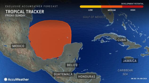
Behind this wave of tropical rainfall, it's not out of the question that another tropical system could form near the Yucatan Peninsula of Mexico late in the week.
 |
"With warm waters and low shear still present in the southern Gulf of Mexico and northwestern Caribbean next weekend, yet another opportunity for tropical development may present itself," warned Pydynowski.
Depending on the wind pattern in the atmosphere, any moisture from this area may again funnel into the Gulf Coast for the last week of June. Given the expected rain in the coming week, the risk for localized flooding may increase.
Want next-level safety, ad-free? Unlock advanced, hyperlocal severe weather alerts when you subscribe to Premium+ on the AccuWeather app. AccuWeather Alerts™ are prompted by our expert meteorologists who monitor and analyze dangerous weather risks 24/7 to keep you and your family safer.
