
 Yahoo News
 Timetable for UK to swelter in first 'heatwave' of 2024
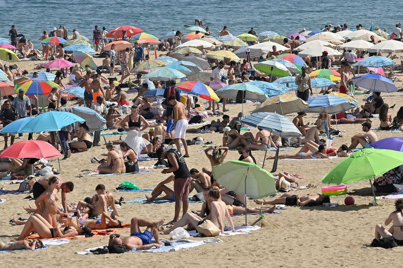
The exact dates for the first 'heatwave' of the year have been predicted by UK weather maps, with temperatures expected to soar to 28C. Next week, on Thursday, June 13, we can anticipate temperatures reaching a balmy 26C, increasing further by the following day.
Regions such as East Anglia, the Midlands and Wales are set to be the warmest, with London potentially hitting a high of 28C. The East of England is also forecasted to enjoy highs of 25C, with Norfolk, Sussex and Essex basking in mid-twenties temperatures.
Even the North East and North West could see temperatures rise above the 20C mark, BirminghamLive reports.
READ MORE: Psychiatrist's ADHD quiz for females who think they may require diagnosis
READ MORE: Cat owners only have days left to take action before new law could mean £500 fine
According to maps from Netweather TV and WX Charts, the heatwave will kick off from 3pm on June 13, with the following week seeing temperatures continue to climb. WX Charts, which uses Met Desk data, updates its forecasts daily on its website.
The BBC has hinted at a "warmer trend" between June 1 and June 16, stating: "In the third week of June conditions could be rather changeable again as areas of low pressure could approach or surround the UK at times.
"There is also the possibility of areas of low pressure moving generally north or north-west of the UK later this week, allowing the high pressure of the Azores High to spread across the southern part of the UK, at least temporarily.
"This would lead to warmer, calmer and slightly drier conditions particularly in the southern areas. However, a renewed build-up of a stronger block of high pressure over Scandinavia could lead to a drier and warmer easterly or south-easterly flow, particularly in the northern and eastern parts of the UK, and wetter conditions further west and south."
From 17 to 30 June, the prediction is: "The fourth week of June could be drier, particularly in eastern and southern parts of the UK. This would be due to areas of low pressure which could affect mainly west and north-western parts of the UK and an extended area of high pressure from the Azores or the Scandinavian High could affect regions of the UK at times. As a result it will continue to be warmer than average.
"During the last week of June there are signs that high pressure will become established near or over the UK for a prolonged period. This increases the chance of continued higher temperatures. There is even a chance of very warm weather in southern England and Wales and conditions could be drier almost everywhere. However, for Scotland at least, there remains a risk of wetter and slightly windier conditions."
While the hot, sunny weather may be on the horizon for the country the days ahead are not looking too great. With Bristol set to be largely overcast by cloud for the rest of the week, with the occasion burst on sunshine, temperatures do not breach into the 20s.
In the next few week, temperatures in Gloucestershire are not going to get above highs of 18C, according to the Met Office. There could be some rain today (Tuesday, June 4), but otherwise it should be dry.
Met Office South West forecast
Today Tuesday, June 4: A rather cloudy start and a little damp in places, otherwise, largely dry and bright at first. A band of cloud and patchy rain will arrive into the afternoon. Turning clearer, cooler and a little breezier into the evening. Maximum temperature 18 °C.
Tonight: A generally dry night will then follow with variable amounts of cloud and some clear spells. A fresh northwest wind and feeling cooler than of late. Minimum temperature 9 °C.
Wednesday: A rather cool start, then a dry day with sunny spells for all. Winds easing a little, but feeling a little cooler than recent days. Maximum temperature 15 °C.
Outlook for Thursday to Saturday: Dry with plenty of sunny spells on Thursday. Perhaps a band of rain sweeping south on Friday. Rather cloudy but mostly dry Saturday. Temperatures near normal, with some chilly nights.

