
 Yahoo News
 UK severe weather sees holiday park evacuations while others told 'stay home'
More than 100 people have been evacuated from a holiday park as flooding and 65mph winds battered the south west coast overnight. The fire service said they were dealing with a "severe flooding incident" at Medmerry holiday park between Bracklesham and Selsey in West Sussex.
South East Coast Ambulance confirmed a "number of resources" were sent to help evacuate and rescue a number of people from the site. One person showing signs of hypothermia has also been taken to hospital from the nearby town of Littlehampton, where local residents have been evacuated after the River Arun burst its banks.
West Sussex Fire and Rescue Service said: "Our crews are supporting rescue operations in Littlehampton near Ferry Road and Rope Walk where the River Arun has burst its banks, leading to severe flooding. Residents should remain in their properties if it is safe to do so and get as high as possible within their homes. Please avoid the area and remain in your homes where possible to allow our crews to work safely".
READ MORE: Small Heath Park Eid-ul-Fitr prayers cancelled due to rain
In Hampshire, the railway at Lymington Pier is currently affected by flooding, while parts of Southampton have seen coastal roads become impassable. Yesterday in Essex, dramatic scenes unfolded as motorists were rescued from their vehicles during high tide in Strood, near Colchester, reports the Mirror. Yellow weather warnings remain in place along the south coast this morning, April 9.
The morning rush hour has also been disrupted by widespread travel issues. South Western Railway has requested replacement buses between Lymington Pier and Brockenhurst in the New Forest, with disruptions expected to last until 10am.
Meanwhile, on the Great Western Railway, all lines between Clifton Down and Severn Beach are closed due to flooding that has risen above the tracks on the branch line. Trains running to and from Severn Beach will only operate between Taunton/Weston-super-Mare/Bristol Temple Meads and Clifton Down until approximately 10am.
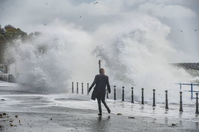
Forecasters have warned that heavy rain and strong winds will continue to batter parts of southern England, western Wales, Northern Ireland and Scotland over the next few days. The Met Office has issued six separate yellow weather warnings spanning from Monday to Wednesday morning.
Winds in the south-west of England - including Cornwall and parts of Devon - could reach speeds of up to 60-65mph along some stretches of the coast. In Birmingham, hours of rain are forecast today and tomorrow and the city's outdoor Eid celebrations at Small Heath park have been cancelled.
A yellow weather alert has been put in place for England's southern coast, including Southampton and Brighton, with winds expected to reach between 45-55mph, peaking at 65mph in some areas before easing off from 9am on Tuesday.
Another yellow weather alert has been issued for the west coast of Wales between 1am and 3pm on Tuesday, when "a spell of strong winds" will affect the region with gusts reaching up to 65mph overnight. In Scotland, rainfall of 20mm-40mm is expected in some areas between 1am and 6pm on Tuesday, while a few places could see as much as 50-60mm.
Areas under this warning include Edinburgh, Glasgow, Perth and Aberdeen. Further rainfall is forecast in western Scotland between 9am and 6pm on Wednesday which may lead to flooding, with 15-25mm of rain expected to fall in most places and 40-50mm predicted on high ground.
Between 10pm on Monday and 6am on Tuesday, eastern parts of Northern Ireland are forecast to experience heavy rainfall of between 25-30mm. The weather service has warned that rain and wind could cause disruption to rail and road travel across the country, as driving conditions worsen due to slippery road surfaces and limited visibility.
Brits have been warned to brace for more flooding misery after Storm Kathleen hit the UK, with the Met Office issuing almost 350 flood warnings and alerts. Met Office forecaster Simon Partridge said that while the rainfall is not a "huge cause for concern" on its own, it will fall onto "already saturated ground" which increases the risk of flooding.
The latest in a string of storms this winter and spring, Kathleen caused widespread travel disruption as hundreds of flood alerts were issued and thousands of homes lost power. The Environment Agency had 213 flood alerts and 100 flood warnings in place in England on Monday evening. National Resources Wales issued 13 flood warnings and 22 alerts.

