
 Yahoo News
 UK weather: Exact date mini-heatwave will return as forecasters issue July verdict
The UK has seen a dip in temperatures this week as the recent heatwave quickly vanished, yet there's potential for the sunshine to make a comeback soon.
Last week saw Britain bask in the highest temperatures of the year, with Heathrow recording a scorching 30.3C, leading the UK Health Security Agency to issue multiple heat health warnings. However, the upcoming days are set to bring a noticeable cool down, with forecasts predicting mid-to-high teens across many regions.
Overcast skies are also on the cards for much of the country throughout the week. But not all hope is lost for those craving more sun, as forecasts suggest warmer weather could return around the middle of next week.
READ MORE: Met Office issues hay fever warning as pollen levels rise across Yorkshire
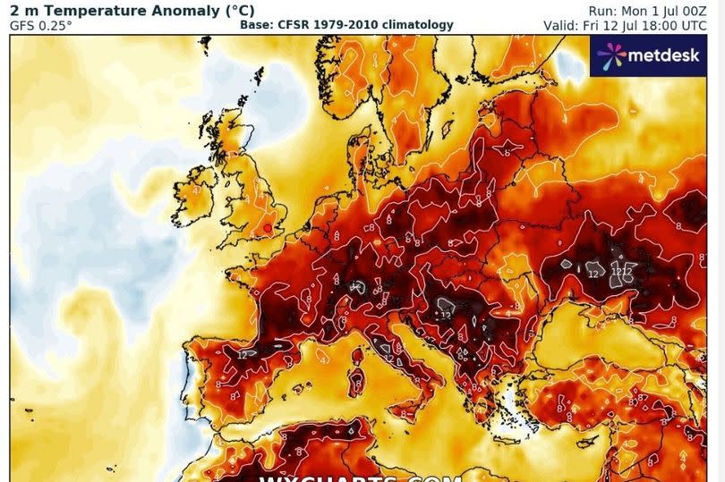
Accuweather is predicting highs of 25C in London and the southeast by Wednesday, July 10, with WXCharts' weather radar maps showing red hues indicative of temperatures above the seasonal average for that time of year.
Looking further ahead into July, the outlook remains uncertain. James Madden from Exacta Weather, in his most recent update, suggests that the jet stream may usher in an extended spell of warmth from next week, stating: "We now expect the more southern-driven jet stream to start to drive northwards from in and around this time next week and during the following week, starting on July 8th.", reports the Mirror.
"This will allow for our shores (UK and Ireland) to come under a much warmer airflow over an extended period from this pattern change, and it will also place us in an extremely favourable position for high pressure rises and some hot to very hot temperatures on a widespread scale from in and around mid-July and throughout much of the second half of the month."
Meanwhile, the Met Office has forecasted a more "changeable" period, including some rainfall. Their long-range forecast for Friday 5 July to Saturday 14 July states: "This period is likely to see a continuation of the changeable conditions, with occasional bands of rain moving in from the west or northwest. There will be a good deal of dry, warm, and settled weather in between frontal systems, with the best conditions most likely in the south and east where winds will be lighter. In contrast, further north and west, it will generally be breezier, and any rain that does occur will be heaviest over the hills."
Get all the latest and breaking news in Yorkshire by signing up to our newsletter here.
"Cloud cover will vary, with cloudier weather expected in the north and west, while clearer skies are likely in the south and east. Temperatures will be around or a little below average for the time of year, but on sunnier days with lighter winds, it will still feel warm."

