
 Yahoo News
 UK weather: Maps claim 'Icelandic storm' could bring 4cm of snow per hour in days
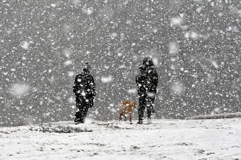
The UK could be on the receiving end of a major low-pressure system over the next week, according to the latest weather maps. The forecast predicts it will make landfall in the north of England toward the end of Saturday April 27, next weekend, with possible snowfall on the Sunday.
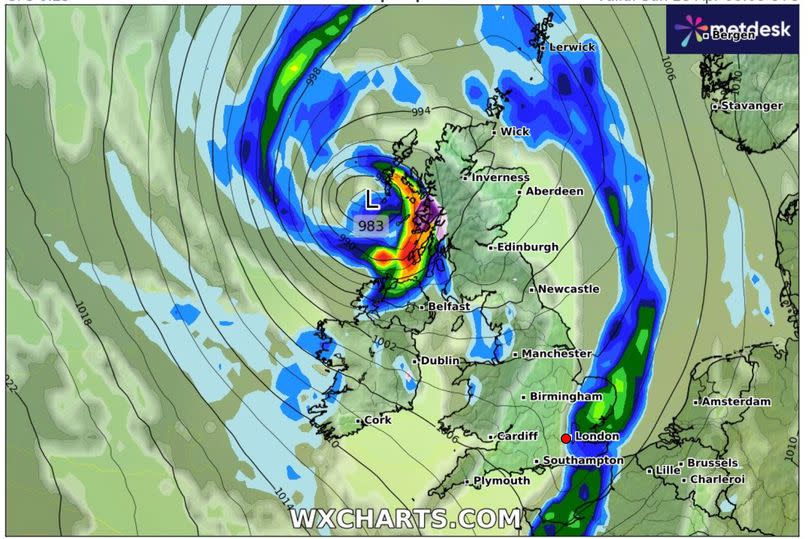
The low-pressure system seems to have originated off the south coast of Greenland, and heads east to Iceland on Friday April 26. As we move into Saturday, the weather system is expected to shift southeast, heading directly for the UK, reports the Mirror.
An initial burst of rain is predicted from about midday on the Saturday, primarily affecting Northern Ireland, Wales, the northwest of England, and the west of Scotland. In the worst-hit areas, up to 1cm of rainfall is expected to fall every hour.
Read more:
Car park football has curbed 'trouble' at a Bristol supermarket
Wetherspoons pub on edge of Bristol still on sale after nearly two years
By midday on Sunday, the centre of the low-pressure system is projected to be directly between Northern Ireland and Scotland. More than 4cm of snowfall per hour is predicted in the middle of Scotland.
In the evening, snow could also make an appearance in the middle of Wales, as well as the northwest of England, according to WXCharts. The storm is anticipated to pass beyond the south west of England and into the Atlantic Ocean by midday on Monday April 29.
The Met Office's extended forecast indicates that from Thursday, April 25 to Saturday, May 4, we're likely to see a shift from the drier conditions experienced at the start of next week to a more unsettled weather pattern due to increasing dominance of low pressure.
The forecaster's statement read: "High pressure will likely be retreating to the northwest of the UK at the start of this period, with conditions turning generally more unsettled than the previous few days as low pressure becomes more dominant. Wet weather is perhaps more likely to develop in parts of the south and east, with western and especially northern areas hanging on to the best of any drier interludes, though all parts may have some rain at times."
They added: "Onshore winds along eastern coasts will likely make it feel rather cold at times, though for all parts temperatures will often be a little below average. Into early May, something of a north-south split looks possible, with relatively drier conditions further to the north and the greatest chance of rain further to the south."
Despite the impending change, the UK can expect relatively settled weather for a brief period, although a cool breeze might persist. The east is set to experience light rain, but temperatures should remain around the average for this time of year, according to the Met Office.

