
 Yahoo News
 Vast wall of heat to engulf UK as charts and Met Office weather show dry and warm weather finally coming
Wales looks set to finally get a prolonged period of dry weather after what seems like one of the longest winters in memory. After a very rainy end to 2023 and start to 2024, things have been very unsettled thus far in April. But some good news might be on the horizon as most of next week promises to be dry with a fair amount of sunshine across Wales.
Sunday is largely dry throughout the country, and while Monday could be a bit of a wash-out the rest of the week could finally see the dawn of spring. From Tuesday onwards, it looks like we’re in for a nice spell of dry weather, with the warmest day of the week coming next Saturday (April 20). While some parts of Wales, particularly in coastal areas, could see colder temperatures and some showers next week, most places will be dry and fine, with Cardiff set for bright sunshine next Saturday. You can get the latest WalesOnline newsletters e-mailed to you directly for free by signing up here.
According to the Met Office, the outlook for the rest of next week after Monday reads: “Generally drier for the rest of the week though some showers possible at times. Often breezy. Temperatures around the seasonal average and not feeling as warm than of late. Through the weekend and into the new week a build of pressure will probably occur, meaning more in the way of dry weather across the UK as a whole.”
READ MORE: How a football club brought hope back to the people of a city dying on its knees
DON'T MISS: The pretty Welsh village with one huge problem - it stinks
And things could remain dry for the majority of April according to the BBC, whose forecast reads: “Through the latter part of April, high pressure will probably be close to the UK with a good deal of dry weather for many areas. Over time these settled conditions will probably move northwards, with the driest weather across the northwest of the UK as we move into May. Where more unsettled conditions develop, these are most likely in the south with a risk of some heavy rain or showers. Temperatures will probably rise above average overall, with warm days but some colder nights.”

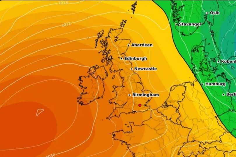
Across the UK, the Mirror is reporting that parts of the country could see a ‘mini-heatwave’ after temperatures reached 21C in London on Friday. And while temperatures are expected to drop a bit this week we won’t have to wait long for a second spell of warmer conditions, with maps showing a high pressure system moving in by next weekend.
Looking ahead to next Saturday, Met Office forecaster Alex Burkill said: “There is a fairly good chance that we could see high pressure dominating across the whole of the country and that means it is going to turn markedly drier than it has been. Not necessarily sunny, there could be quite a bit of cloud around but it does look like we are going to see a more prolonged dry spell than we have seen through many recent weeks and months to be honest.”
Keep up to date with the latest weather where you live:

