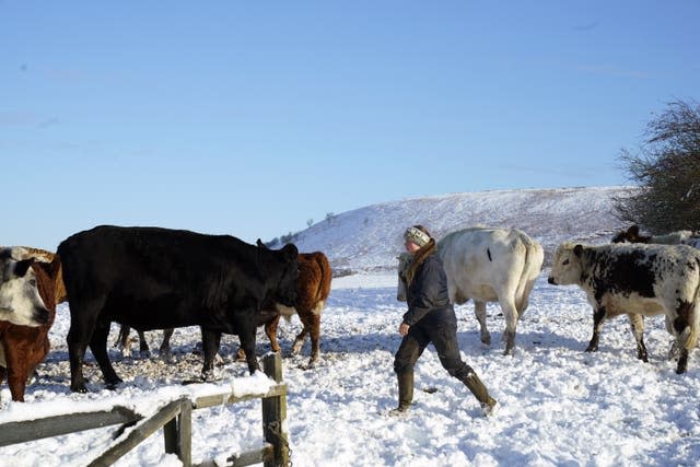
Warning that parts of country face ‘ice rink Monday’ as snow refreezes

Warnings have been issued that parts of the country could be facing an “ice rink Monday”, as snow refreezes overnight.
The Met Office has issued a yellow weather warning for ice across much of the north of England from 5pm on Sunday to 12pm on Monday.
The weather service said a modest thaw of recent snowfall will lead to wet roads and pavements, adding that the refreezing of thawed snow as temperatures fall on Sunday evening will cause some icy patches on untreated surfaces resulting in difficult travel conditions.
The Yellow weather warning for ice has been updated to reduce the area included across central England and to remove it from Wales#WeatherAware https://t.co/o371wShxlt pic.twitter.com/JAUdojj0hq
— Met Office (@metoffice) December 3, 2023
It also issued separate yellow weather warnings of snow in higher parts of Wales and the Peak District, as well as for snow and ice in eastern Scotland until 12pm on Monday.
In its warning for Wales and the Peak District, the Met Office said there could be 2-5cm of snow “on some roads above around 150m, and perhaps 10-15cm on roads above around 350m”.
RAC Breakdown spokesperson Simon Williams said northern parts of the country could be facing an “ice rink Monday as snow refreezes overnight”.
He added: “We’re expecting some very treacherous icy conditions in northern parts, so those who have to drive should exercise great caution. If it’s possible to delay or even abandon journeys that may well be the best option.
“Those who decide to drive should leave extra space behind the vehicle in front, reduce their speeds to give plenty of time to stop.
“Before setting out, it’s important to allow more time to de-ice and de-mist vehicles thoroughly.”
The Met Office said Saturday night saw the coldest temperatures since last winter, with minus 12.5C recorded in Altnaharra in the Highland region of northern Scotland.

Met Office chief meteorologist Jason Kelly said: “The first Atlantic air mass for a while is making some inroads across southern and central parts of the country bringing less cold conditions to many southern areas, whilst the cold air mass continues to hold on in the north.
“Where these two air masses meet is the focus for continuing ice risk. For parts of northeast Scotland, wintry showers will bring some icy conditions overnight, as well as some accumulating snow inland.”
Electricity North West said on Sunday evening that 1,500 properties in Cumbria remained without electricity after power cuts followed heavy snow in the county.
The electricity network operator said it had restored power to 7,500 homes, adding that “access continues to be a major issue and even specialist 4×4 vehicles cannot reach all sites” with “equipment for repairs being carried on foot in some locations”.
It added that Cumbria’s power network had been severely impacted by the snow with more than 35 separate damages to the network reported, including “severe damage to miles of overhead lines”.
Cumbria Police said the focus of a multi-agency response to the major incident that was declared following Saturday’s heavy snowfall had moved to “supporting communities who remain without power”.
Met Office meteorologist Tom Morgan said unofficial reports indicated there was “comfortably in excess of 20cm, probably in excess of 30cm, of snow across the Windermere and Coniston area of the South Lakes and also down towards Ambleside and the far south of Cumbria”.
🌤️ Sunny spells across Northern Ireland and Scotland this afternoon, with scattered showers
🌧️ Cloudier across England and Wales with outbreaks of rain and hill snow
🌡️ Feeling cold for most, but milder across southern England and Wales pic.twitter.com/XFfUWtC1a0
— Met Office (@metoffice) December 3, 2023
He told the PA news agency: “It was quite an unusual situation that led to it because it became slow moving and gave the same areas of south Cumbria hour after hour of heavy snow and that’s what led to the significant disruption there.”
The Met Office meteorologist said the weather on Sunday had “turned a bit milder in the south”, but added it was “still cold further north across the UK and there’s going to be some further wintry showers and ice as we go through tonight”.
“It is turning milder later this week so there is an end in sight to the wintry weather,” he added.
The UK Health Security Agency and the Met Office have issued amber cold health alerts in five regions, the East Midlands, West Midlands, North West, North East and Yorkshire and the Humber, until December 5, meaning “cold weather impacts are likely to be felt across the whole health service for an extended period of time”.

 Yahoo News
