
 Yahoo News
 Water levels across N.W.T. still mostly well below average — except for the Peel
The N.W.T. saw lots of snowpack in the north this winter, but little in the south, according to the territory's spring water outlook released Thursday.
The territory is in a multi-year drought, with dry conditions contributing to wildfire danger (last year's season was the worst on record), and record-low water levels sparking concern from hunters and others who use the territory's rivers and lakes.
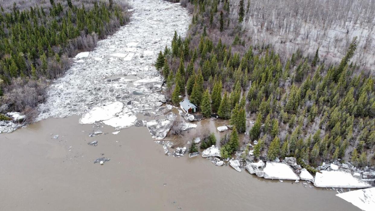
Water levels remain low in most of the territory — except for the Peel River basin, where both water levels and the snowpack are extremely high.
Ryan Connon, a hydrologist with the N.W.T.'s department of Environment and Climate Change, said that also means an elevated risk of high water at breakup this year for communities along the Peel, like Fort McPherson.
"There's a potential for high water and flooding again," Connon said. "But actual water levels at breakup will be really dependent on spring weather conditions when we get warm temperatures."
The risk of flooding goes up if temperatures climb, Connon added.
"If the snow melts really rapidly, all that snowmelt water moves to the river. It lifts the the river ice off the riverbank and the chunks of ice are stronger that are moving downstream — and then they have a better chance of jamming," he said.
"If there's persistent, warm weather that sort of deteriorates the ice, and if the ice can melt out slowly, then that'll decrease the chance of of strong ice jams."
Last May, Fort McPherson experienced devastating flooding, washing out major roads and sweeping away several buildings near the community's Eight Mile area.
More than a dozen cabins and homes in Fort McPherson were damaged from flooding.
Alice Vittrekwa lost her cabin in the flooding, which has seen been rebuilt.
"We don't know what kind of spring and what kind of flood we're going to have this year. There's a lot of snow," Vittrekwa said earlier this week.
"It's a bit rough and hopefully we don't lose this one this year ... Losing another house, I don't think I could handle that."
Connon said even though water levels on the Peel are high, it's hard to predict what will happen.
"There have been years when water levels have been above average and snowpack has been above average, and there hasn't been any flooding," he said. "It'll really depend on what happens over the coming weeks, but there is an elevated risk because of current conditions."

Ryan Connon is a hydrologist with the N.W.T.'s department of Environment and Climate Change. (CBC)
Low water, dry conditions remain in the south
Though the North Slave, Tłįchǫ and Sahtu regions all had average to above-average snowfall, water levels on the Mackenzie River at Tsiigehtchic and throughout the Mackenzie Delta are the lowest on record for this time of year.
The water level on Great Slave Lake is also at an all-time low for this time of year.
"The variability in water level on Great Slave Lake over the past five years has not been previously experienced during the 89-year monitoring record," ECC's report said.
Water levels on the Hay River are also the lowest on record, and beyond that, the Hay River region has significantly less snowpack than usual.
There's still a possibility that bad break-up conditions could cause flooding, the report notes.
In Fort Simpson, water levels on the Mackenzie River remain at record lows.
"We're not going to see a rise or recovery in some of those rivers or lakes unless we get significant rainfall this spring and summer," Connon said.
As with Hay River, that doesn't mean spring flooding is out of the question. Despite the low water levels, ice jams are difficulty to predict.
"Ice-jam flooding can happen in any year regardless of pre-existing water levels and snowpack. The potential severity of flooding, if an ice jam occurs, is higher when water levels are already high and snowpacks are large," the report said.
Lloyd Chicot, Chief of the Ka'a'gee Tu First Nation in Kakisa, said Lady Evelyn Falls just outside the community is dry.
"Right now, everything's pretty well low. Like, there's no water flowing, nothing there," Chicot said.
Residents are concerned about what that means for the summer, he said.
"People are more concerned with the animals coming back. No water, that kind of thing," he said.

