
 Yahoo News
 Weather maps reveal when 250-mile European plume will hit UK
Weather maps have revealed when a 250-mile European plume will hit the UK. Sunshine has given way to rain and thunderstorms in some parts of Britain this week.
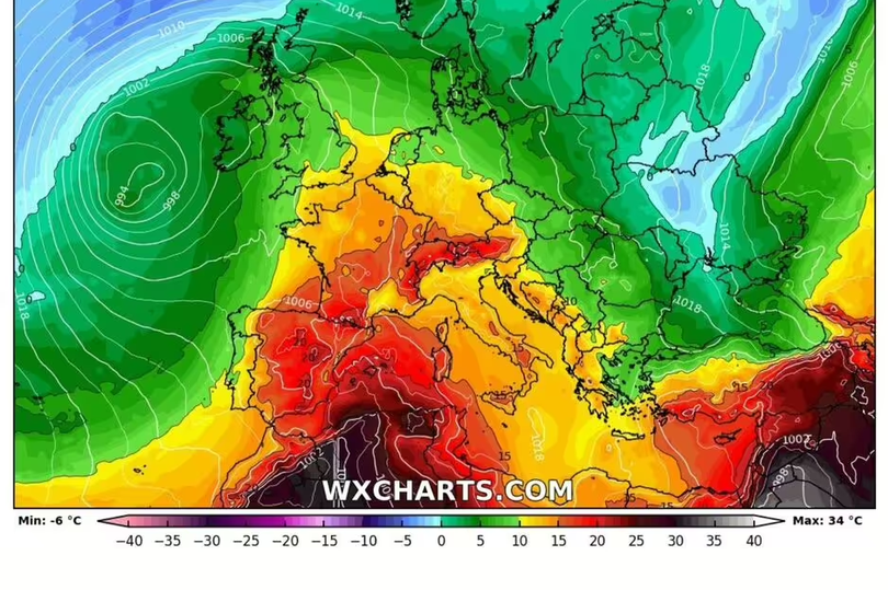
But according to one meteorologist, conditions could change in the coming weeks. Weather maps from WX Charts indicate the potential for a European surge to affect temperatures by the end of May.
They show a surge pushing up through northern Europe from about May 25. But the real heat is expected to engulf France from May 28, with maps for the country turning red and orange.
READ MORE: Sophie Turner reveals what she hated most about being married to Joe Jonas
Sign up to the BirminghamLive newsletter here to get the latest updates on the biggest and breaking stories.
The south of France could sizzle in highs of up to 28C, with the southern coast of England set to catch a glimmer of that heat. Kent could see highs of 21C which are expected to take hold inland, towards Dartford, central London and past the M25.
Bedfordshire, Hertfordshire, Cambridgeshire, Suffolk and Norfolk will see one extra degree of heat. Highs of 21C to 22C are set to move as far north as Leeds, Express reports.
This will rise slightly to 23C north of London from about 3pm on May 28. Jim Dale said: "There is nothing hot in the short term; but in 10 or so days time we may be seeing levels that we saw last few days.
"[There are] some marginal pushes out of Northern Africa, but the main thrust is likely through Central Europe." Experts are downplaying any risk of the mercury rising to sweltering highs of 40C, as was seen last July.
But Mr Dale said a hot surge of weather could still be hitting the UK this summer.

