
 Yahoo News
 UK weather: Amber heat alert issued as temperatures set to hit 31C in some areas
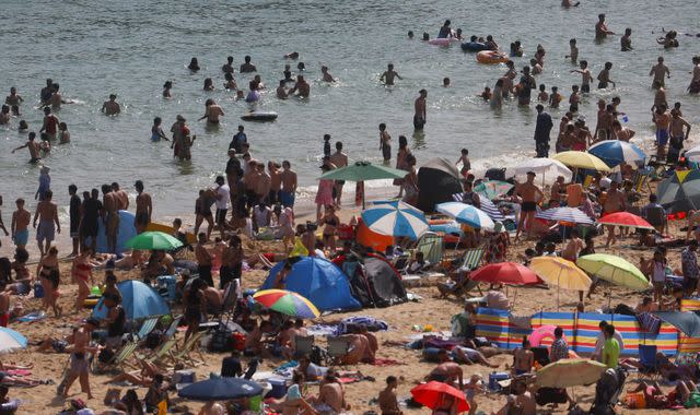
An amber heat-health alert has been issued as forecasters warned temperatures could rise above 30C in parts of the country.
The UK Health Security Agency (UKHSA) upgraded yesterday's yellow alert as the Met Office predicted temperatures could soar to 31C (88F) on Saturday.
Check your local weather forecast here
Forecaster Aiden McGivern said 31C could be possible "somewhere between London, up towards Cambridgeshire, into the Midlands and out towards North West England", in what would "certainly be the hottest day of the year so far".
The amber alert will cover the West Midlands, East Midlands, East of England, South East and South West, with parts of the nation set to be hotter than tourist destinations Ibiza, Tenerife and the Spanish town of Marbella.
The amber alert indicates that the weather could affect the wider population, not just those who are vulnerable - impacting the NHS.
In a statement, the UKHSA said: "The decision to move to an amber alert has been made due to latest Met Office forecasts, which indicate there is a high likelihood that forecasted temperatures will be reached rapidly over the weekend in these regions, while we are also likely to see high overnight temperatures."
A yellow alert has now also been issued in the North East, North West and Yorkshire and Humber, while London will remain at the same level.
The alerts are in place from 9am on Friday until 9am on Monday, 12 June.
However, some coastal areas in the East of England and North East are set to be much cooler, with 17C expected in Newcastle and 19C in Middlesborough.
A "chilly north sea breeze" will see temperatures plunge to 13C on parts of the Aberdeenshire coast in eastern Scotland - but there will be some "notable warm spots", with 28C predicted in the southwest of the country.
Thunderstorms on the way
A big jump in temperatures and increased humidity will trigger "lively downpours", especially for parts of southern England, into the Midlands and Wales.
A yellow alert has also been issued by the Met Office for thunderstorms covering Wales, southern and western England, from 2pm until 9pm on Saturday.
Light winds will cause any showers and thunderstorms to be slow-moving - meaning they will be "hit and miss" but also have the potential to unleash a "serious impact".
Affected areas could be deluged by more than 30-40mm of rain in a few hours, together with "hail, gusty winds and frequent lightning," Mr McGivern said.
Met Office meteorologist, Craig Snell, added: "I'd say 95% of people will probably be dry, 5% will be very wet.
"So you balance that out and the vast majority of the UK is still dry."
Prolonged dry spell could cause travel disruption
The heatwave arrives as new figures show there has been almost no rain in England for the past three weeks.
Less than 1mm has fallen in the South East and North East since 31 May - with the rest of England not seeing a single drop.
Read more:
What is heat-health alert and who is the most vulnerable?
How to sleep better during a heatwave
River levels dropped at all sites monitored by the Environment Agency, while rainfall in May was 43% of the long-term average for north-west England and 86% in the east.
However, most rivers across the south are described as having normal levels.
The Met Office said it was "not rare" to have a prolonged dry spell at this time of year - but warned it could bring a chance of surface water flooding, leading to travel disruption over the weekend.
Mr Snell added: "At this point in the month, rainfall amounts should be about 20% of the average and at the moment, most of us have hardly had a drop."
Click to subscribe to the Sky News Daily wherever you get your podcasts

