
 Yahoo News
 Astonishing before-and-after aerial photos show scale of Hurricane Florence damage

Shocking before-and-after aerial images have shown the scale of the damage wreaked by Hurricane Florence on the coastline of North and South Carolina.
The US's National Oceanic and Atmospheric Administration is assessing the damage shown in pictures captured by planes kitted out with special cameras.
The photographs, which are being taken daily and were last updated on Tuesday, show roads flooded, streets buried in sand, and beaches eroded to half their previous size.
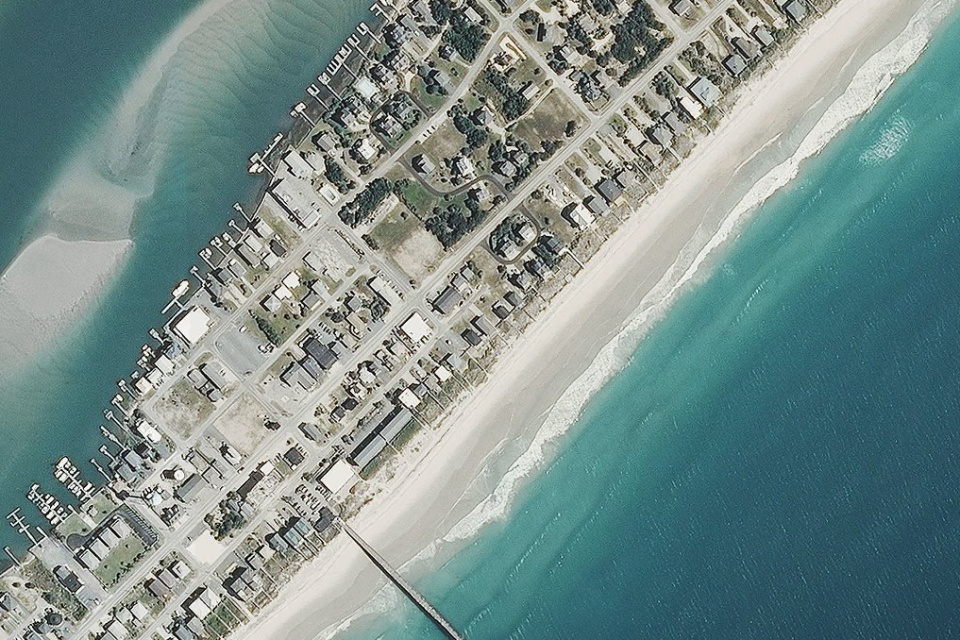
In one image, sections of Anderson Boulevard at Topsail Beach are submerged under dark pools of water while Ocean Boulevard, which runs along the seafront, is covered in places by sand.
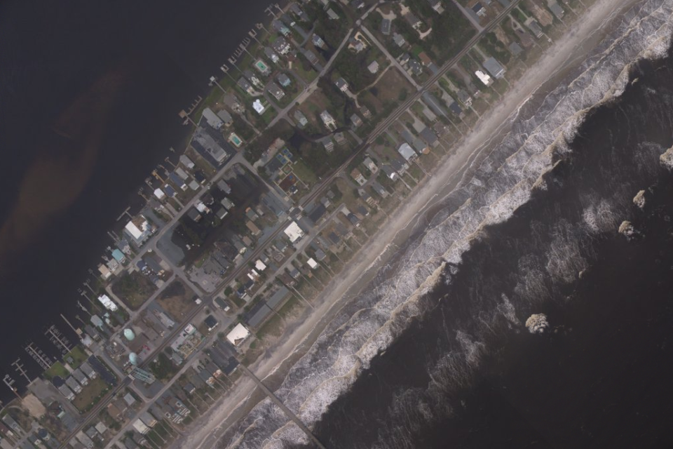
Earlier pictures taken of the same spot by NOAA show long, wide beaches and calmer waters.
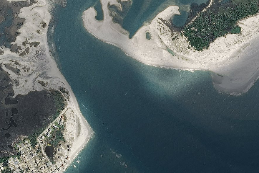
North of that spot, the mouth of an inlet close to Chadwick Acres is shown considerably widened in the post-storm pictures.

The earlier image from 2014 shows a spit of sand that is entirely eroded in the later photographs.
Further up the beach, a headland was shown to have been blunted as sandbanks were claimed by the sea.
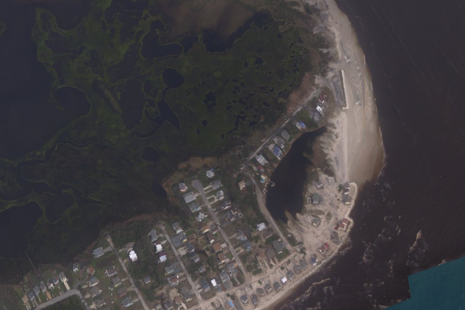
An aerial image from 2014 shows a much larger beach, with houses set back further from the seafront.

US president Donald Trump is expected on Wednesday to visit North and South Carolina, where thousands of homes and roadways remain underwater and swollen rivers threaten more flooding less than a week after Hurricane Florence made landfall.
Florence has killed at least 35 people, including 26 in North Carolina and eight in South Carolina, where authorities said two mental health patients drowned on Tuesday after a sheriff's van they were in crashed.
Thousands of rescues have taken place in the Carolinas. Florence has dumped up to 36 inches (91 cm) of rain in parts of North Carolina since last Thursday.
At least 16 rivers remain at a major flood stage, with three others set to crest in the coming days in North Carolina, the state said.

