
 Yahoo News
 ‘Blood rain’ to fall as red Saharan dust cloud to mix with thunderstorms
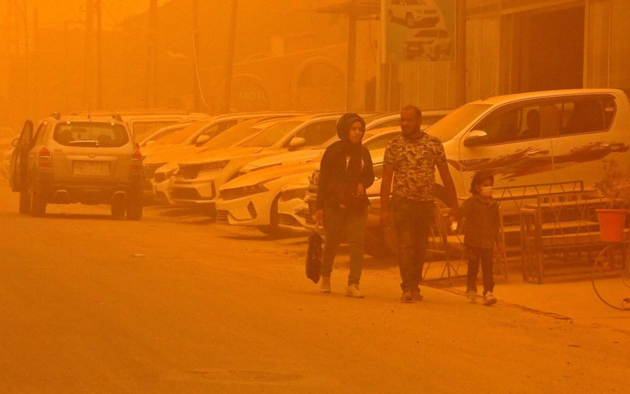
"Blood rain" thunderstorms are set to strike this week, after the Met Office issued weather warnings.
Red or orange rain could fall in some parts of the country, with downpours, lightning, strong winds and hail expected.
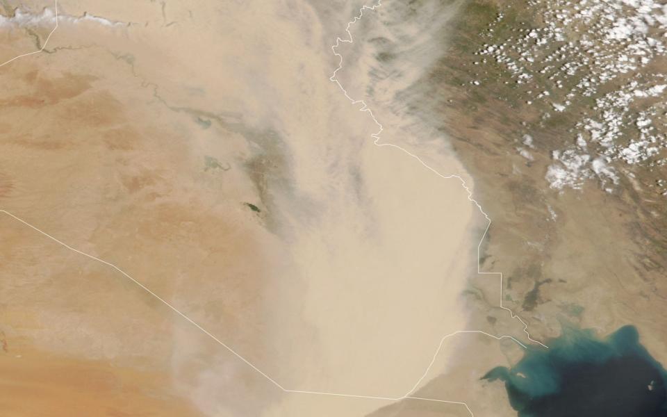
According to the Met Office, "blood rain" occurs when relatively high concentrations of red-coloured dust particles mix with rain, giving it a red appearance as it falls.
A yellow-level thunderstorm warning has also been issued from Wednesday evening to the early hours of Thursday in the south-east, including London. The forecaster said people should expect disruption to travel.
It comes after Britons basked in the country's hottest day of the year on Tuesday, with temperatures in the south-east peaking at 81.5F (27.5C).
Warning of thunderstorms
Richard Miles, of the Met Office, said on Wednesday: "There are some dust concentrations in the atmosphere above the UK at present which might well be washed out in the rain tonight, but it's likely to be relatively small amounts on the whole.
"There's a warning out for thunderstorms for the south-eastern third of England tonight, and a squally cold front will bring wind and sometimes heavy rain to Northern Ireland and north-west Scotland this evening.
"Away from these features, it will be mostly fine and dry today and tomorrow, temperatures up to 23C to 24C in London and the south-east, high teens or low 20Cs elsewhere."
The thunderstorms may cause spray and sudden flooding, leading to difficult driving conditions and some road closures.
There may also be delays or cancellations to train and bus services, flooding to homes and businesses, power cuts and damage due to lightning strikes.
Heavy rain will fall during Wednesday and Thursday in parts of Scotland and Northern Ireland. Showers will also hit areas in Wales and central and south-west England.
Warmer temperatures
Such high temperatures were warmer than averages for mid-May, the forecaster said, but not unheard of.
The first day of the year to record temperatures of 77F (25C) in the UK has moved forward by a fortnight in the past 60 years. Between 1961 and 1990, the first day with temperatures higher than 77F (25C) was, on average, May 19. Between 1991 and 2020, it was May 6.
The number of warm days, where the UK-average temperature is more than 68F (20C), has doubled over the same period - with an average of 35 a year recorded between 1961 and 1990 and 76 between 1991 and 2020.
A spokesman for the Met Office said: "The UK average mean temperature for May has increased from 9.8C to 10.6C in 30 years. As our climate warms, we expect to see a corresponding increase in the number of hot days.”

