
 Yahoo News
 Dramatic waves of cold air to trigger chilly rain, snow in Northeast
A shocking weather pattern change is occurring in the Northeast as much colder air charges into the region in waves, AccuWeather meteorologists say. As colder air arrives, chilly rain and the first accumulating snow of the season may unfold in some areas around Halloween and the days following the holiday.
"There will be a monumental shift in how the air feels in the Northeast, following unseasonable warmth for late October," AccuWeather Senior Meteorologist Dean DeVore said. "However, the change will not be immediate along the Interstate 95 corridor."
Along the I-95 corridor, Saturday afternoon temperatures rose to levels that may not be matched again until next spring. Forecasters said that it would likely pan out to be warmest day of the entire pattern with record-challenging high temperatures. Widespread highs in the mid-70s F to the mid-80s F expanded across the region by midday.
 |
After that, colder air from the Midwest spread toward the Appalachians. By Sunday, this chilly air will spill over the mountains, reaching coastal areas early this week.
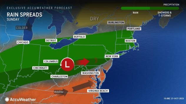
A storm developing along a cold front and traveling northeastward upon it is leading to steady rain breaking out across the Northeast. Rainy conditions are expected to last through Sunday, and even into Monday for many locations.
 |
"That storm threatens to bring the eighth weekend in a row with rain on Sunday in New York City and many other locations in the Northeast," DeVore said.
The rain will trend progressively more chilly from Sunday to Monday along portions of the central Appalachians, the mid-Atlantic and New England, DeVore added.
As colder air catches up to the back side of that storm, especially from northern New York to northern New England, rain can become mixed with and change to snow before ending Monday afternoon and night. In the wake of this storm, colder air will establish more roots in the region from Monday night to Tuesday.
 |
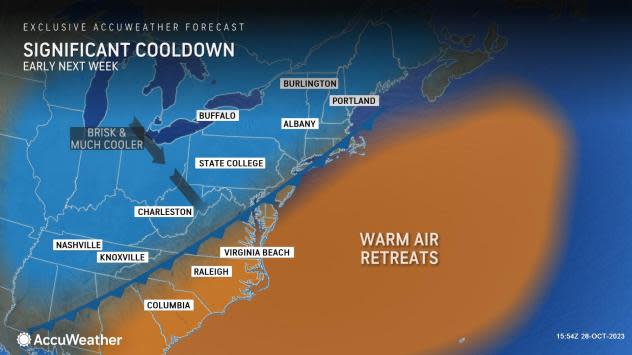
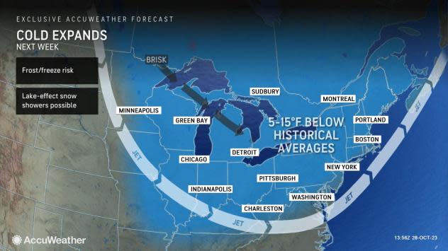
"The coldest air of the season sets in for Tuesday and beyond, with high temperatures 25-35 degrees lower than the peak of the warmth from Saturday," DeVore said. By Tuesday and Wednesday, much of the I-95 zone will experience temperatures closer to historical averages for late November or early December with highs in the 40s to the low 50s.
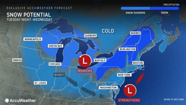
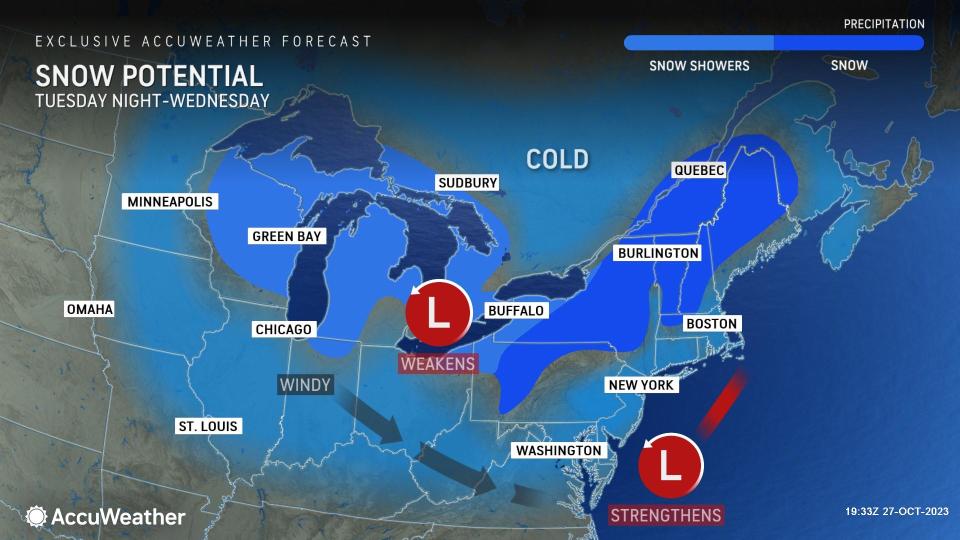
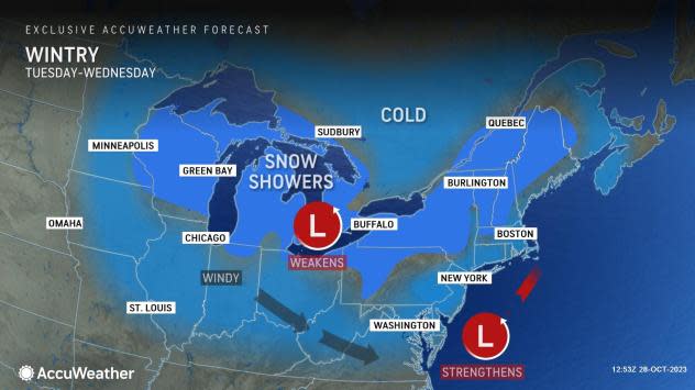
The snow over the northern tier Monday night may not be the last snow that portions of the Northeast will face for a while. Yet another storm swinging in from the Midwest and a coastal storm may develop, bringing snow to a broader swath of the region, as well as portions of southern Ontario and Quebec from late Tuesday to Wednesday.
Even though it will become chilly along the I-95 corridor, the suburbs and across interior valleys, it will not be cold enough for snow to fall, or at least not to accumulate. However, well inland, and especially over the higher terrain from western and northern Pennsylvania to central and northern New England, there is the potential for snow to fall and accumulate from Tuesday night to Wednesday.
 |
The first rounds of lake-effect snow of the season will develop as the colder air passes over the warm waters of the Great Lakes next week. These are likely to bring the first narrow bands of accumulating snow across northern Michigan, parts of Wisconsin, northeastern Ohio, northwestern Pennsylvania and western and northern New York state.
AccuWeather forecasters urge motorists to be prepared for slippery travel and low visibility. Similarly, airline passengers in the region may experience periodic delays.
So, despite the warmth during many of the final days of October, winter conditions are coming for the Northeast well ahead of the official start of the winter season that will occur with the solstice at 8:27 p.m. EST on Thursday, Dec. 21.
Want next-level safety, ad-free? Unlock advanced, hyperlocal severe weather alerts when you subscribe to Premium+ on the AccuWeather app. AccuWeather Alerts™ are prompted by our expert meteorologists who monitor and analyze dangerous weather risks 24/7 to keep you and your family safer.
