
 Yahoo News
 First heat wave of year on horizon for Northeast


The pattern for the northeastern United States will be a 'tale of two weeks' as low humidity and cool to seasonable air much of this week are replaced with surging heat this weekend and the first heat wave of the season for millions next week, AccuWeather meteorologists say. Opportunities for rain will be limited, a switch from much of the spring.
The upcoming weather will provide some great conditions for summertime activity beginning late this week and continuing through much of next week. For some individuals without air conditioning, though, the upcoming building heat may become a problem.
A dip in the jet stream and high pressure that originated in Canada will continue to keep temperatures and humidity levels under control for much of this week. The same high-pressure zone will tend to keep blossoming tropical moisture in the Gulf of Mexico and the Florida Peninsula at bay.
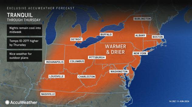
In the Northeast, temperatures will tend to run within several degrees of the historical average through midweek. Highs during the few days before mid-June will range from near 70 F in northern Maine to the mid-80s in eastern Virginia and the Delmarva Peninsula. Because of the dry air, quick cooldowns will continue in the evenings, with very cool conditions during the overnight hours.
 |
"Low humidity and mainly clear skies will result in another chilly night for mid-June on Tuesday," AccuWeather Meteorologist Brandon Buckingham said, "From central and western Pennsylvania through upstate New York and a majority of interior New England, temperatures will fall into the 40s and 50s early this week. Farther west across the northern Great Lakes and Upper Midwest, patchy frost will be possible as some locations will dip into the 30s."
However, the region's natural air conditioning that is providing a break in cooling costs will not last much longer.
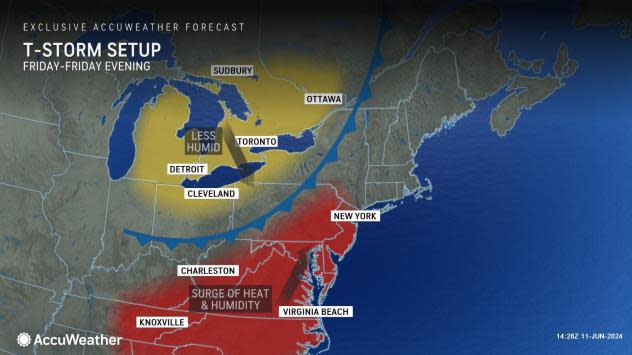
"As a front approaches from the Great Lakes later this week, a southwesterly breeze will help push temperatures upward on Thursday, with a spike of very warm to hot air in store along much of the Atlantic coast on Friday," Buckingham said.
 |
By Thursday, widespread highs in the 80s are in store, and by Friday, temperatures along much of the Interstate 95 corridor from the mid-Atlantic to southern New England will spike into the 90s.
The approaching front may have trouble producing a great deal of rain, but this does not mean there cannot be gusty thunderstorms, including some with damaging wind gusts from Thursday evening across the interior to Friday along part of the I-95 zone.
During Father's Day weekend, temperatures and humidity levels will be in a tug-of-war. Some dry and slightly cooler air will cover the northern parts of the region while heat will hold across the southern zones. The heat will win the battle by early next week.
 |
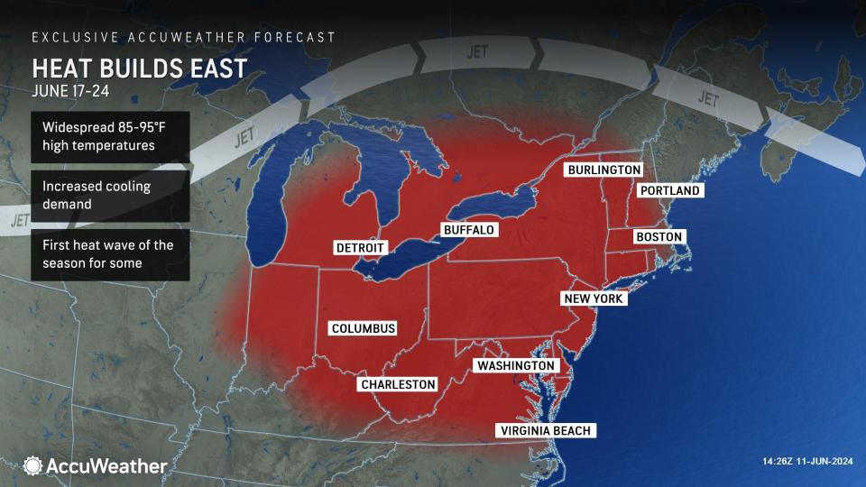
"From Monday through much of next week, home-grown high pressure will build over the region while the jet stream bulges northward," Buckingham explained, "This one-two combination will set the stage for building heat and an uptick in humidity levels. For many, this will be the first heat wave of the year."
 |
A heat wave is a stretch of unusually hot weather, with or without high humidity, lasting more than two days. For much of the Northeast, the 90-degree mark represents the threshold of warm to hot conditions.
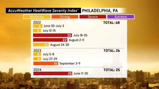
The last heat wave in Philadelphia, where highs were in the 90s for three days or more was Sept. 3-9. Washington, D.C.'s and New York City's last stretch of 90-degree weather around the same time. In the nation's capital, 90-degree highs occurred consecutively from Sept. 3-8. In New York City, it was Sept. 5-8. Boston struggled to bunch 90-degree days together last summer and hit 90 on only a handful of days.
 |
From Monday to Thursday of next week, widespread highs ranging from the mid-80s to the mid-90s are in store, with a few spots potentially climbing into the upper 90s. At this level, when combined with intense mid-June sunshine, AccuWeather RealFeel® Temperatures will surge to dangerous levels, especially in the urban areas of many of the major cities.
Because of light winds over the region, coastal areas, including the major cities of Boston and New York City, may be subject to some cooling sea breezes on certain days, where temperatures are held 10-20 degrees lower than areas several miles inland.
"Aside from the possibility of a shower or gusty thunderstorm from the front late this week, areas that miss out on the rain could have a stretch of where it does not rain at all for seven to 10 days or more," AccuWeather Senior Meteorologist Dave Dombek said, "The dryness will help temperatures surge during the day as much of the sun's energy won't be used up evaporating moisture from the ground."
Rainfall in much of the Northeast since March 1 was 100-150% of the historical average. However, parts of the Northeast were very wet during March, with 150-300% rainfall compared to the historical average.
The dry weather for most days well past mid-June will provide opportunities for outdoor projects to be undertaken, run on schedule or completed.
Want next-level safety, ad-free? Unlock advanced, hyperlocal severe weather alerts when you subscribe to Premium+ on the AccuWeather app. AccuWeather Alerts™ are prompted by our expert meteorologists who monitor and analyze dangerous weather risks 24/7 to keep you and your family safer.
