
 Yahoo News
 Flood barriers erected on the Cornish coast as Britain prepares for Storm Brian


Britain is preparing for a battering from “dangerous” Storm Brian, with winds of up to 80mph forecast for the weekend.
As well as high winds, the storm is expected to bring heavy rain which could cause flooding and disruption on roads, railways and in airports as well as potential power cuts.
As the country prepares for another storm just days after Hurricane Ophelia killed three people in Ireland, authorities have erected temporary flood barriers in parts of Fowey, Cornwall to protect it from potential coastal flooding.
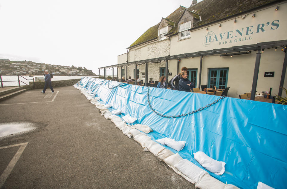
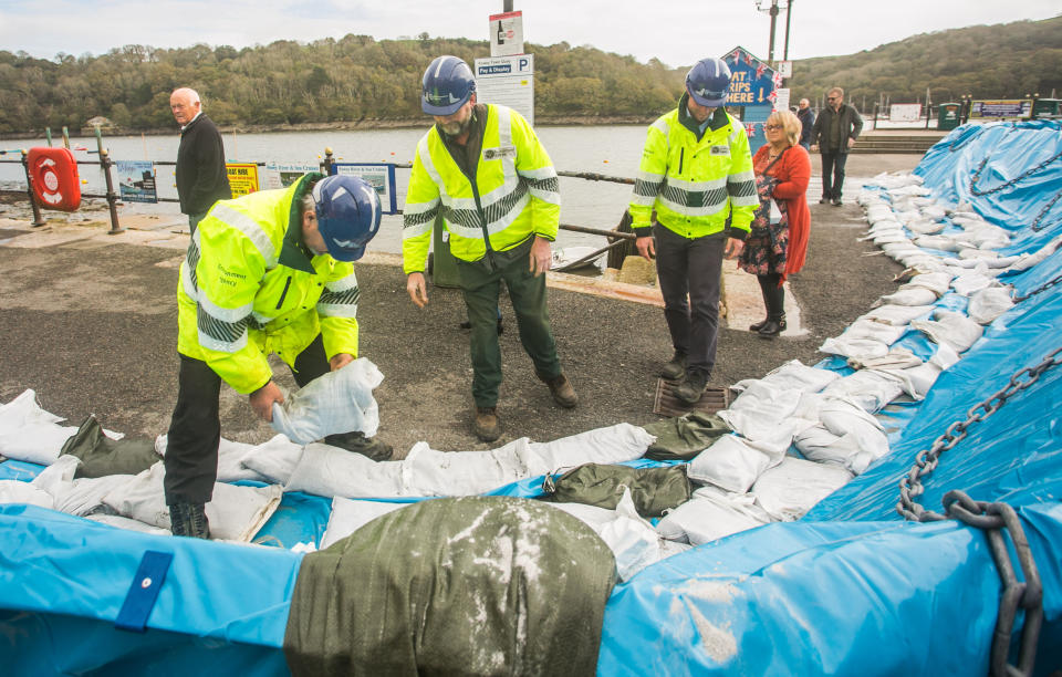
The Environment Agency said this type of flood defence has been used to prevent flooding from rivers for a number of years but this is the first time they’ve been used on the Cornish coast.
The agency’s teams are working round the clock to check flood defences, clear river blockages and closely monitor river levels and will be out in force over the weekend.
Most popular on Yahoo News UK:
UK braced for ‘weather bomb’ as Storm Brian moves in
Vladimir Putin laughs uncontrollably at suggestion Russia should export pork to Muslim country
North Korea warns the US of an ‘unimaginable’ military strike amid rising tensions
Archaeologist spots hundreds of mysterious, ancient stone ‘gates’ on Google Earth
Grieving widower catches male nurse having sex with dead wife in hospital morgue
Kevin Ward, from the Environment Agency said: “We urge residents to take care on the coast this weekend. Strong winds pose a risk of waves overtopping defences and we advise not to stop and admire the waves or take ‘storm selfies’.
“Also, avoid exposed coastal areas and do not walk or drive through flood water, which can dirty and contain hidden debris. Just 30cm of flowing water can move a car and driving through water can also create waves.”
The Met Office has issued an amber weather warning with the high winds expected to batter London and the south east throughout Saturday.
Forecaster Chris Page said: “It’s a very deep area of low pressure and the system coming through on Friday and there are warnings in force.
“We’re looking at gusts in excess of 50mph winds in the warning area but with gusts of up to 80mph on the coast.”

The Met Office warning added: “A spell of strong southwesterly winds is expected.
“Some coastal routes and communities are likely to be affected by large waves, with potential for flooding of properties.
“Some transport disruption is likely across the warning area, with delays to road, rail, air and ferry transport. Short term loss of power and other services is also possible.”
Ophelia’s winds peaked at 100mph in Ireland and the storm’s tail end whipped large swathes of south west England, leaving 360,000 people without power during the storm.

Coastal towns and London are expected to face the worst of Brian, according to forecasts.
A Met Office spokesman added: “Gusts exceeding 50mph are expected widely within the warning area, with gusts of around 70mph along exposed coastal areas.
“These are expected to coincide with high tides, leading to locally dangerous conditions.”
The current weather warning runs between 4am and 11.59pm on Saturday.
Current forecasts show the gusts and rain are expected to fade into Sunday, with the chance of sunny spells across the south east when Brian clears.
(Top picture: SWNS)

