
 Yahoo News
 The flooded roads and seafronts closed as Storm Pierrick strikes North Wales
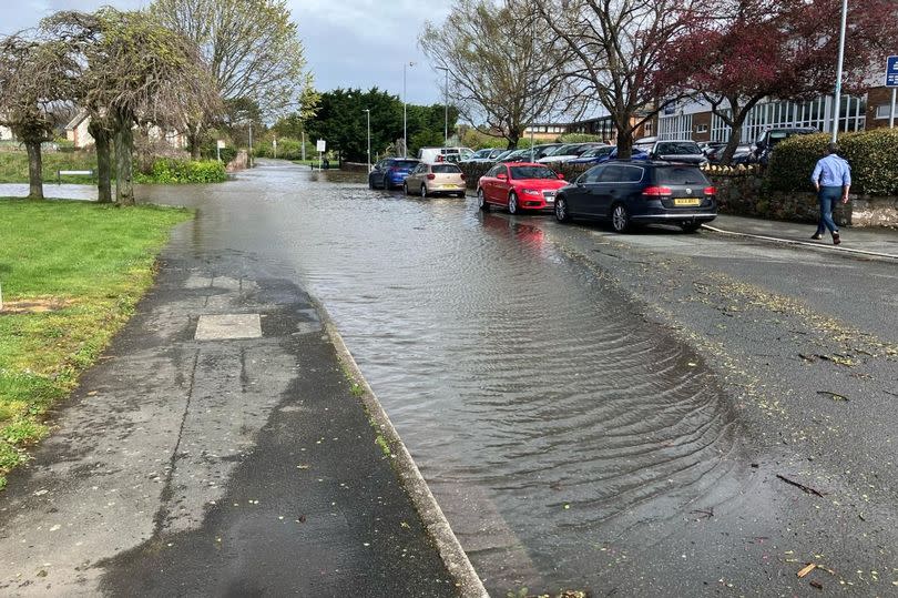
Storm Pierrick is threatening to overwhelm sea defences along the North Wales coast. Some roads have been flooded and are closed, others are passable only with care.
As the storm is coinciding with unusually high tides, its impact is greater than that of Storm Kathleen at the weekend. Six flood warnings have been issued along the North Wales coast and people have been advised in no uncertain terms to stay away from seafronts or risk getting “swept away”.
You can find out more here about the six North Wales towns and villages vulnerable to flooding. In a message issued at lunchtime, Natural Resources Wales (NRW) cautioned that the storm’s flooding impacts may continue into Wednesday (April 10).
READ MORE: Live updates as Storm Pierrick brings flood warnings, closures and road disruption
READ MORE: Spike in Welsh drivers caught breaking 20mph limit as enforcement steps up
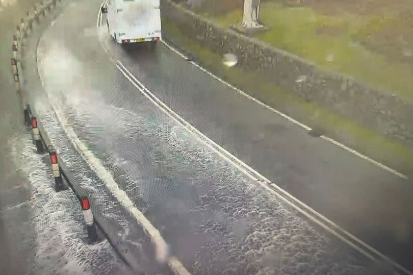
The worst of the weather is expected to be over by 3pm, but as things stand, there’s significant disruption on the region’s roads, nearly all of it related to flooding. Evidence of the scale of the problem was seen between Conwy town and Penmaenbach headland, where a section of the A55 has flooded.
Below is a list of roads and seafronts currently underwater. The North Wales Live Whatsapp community for top stories and breaking news is live now - here’s how to sign up
A548 in Conwy: The road is impassable in both directions due to flooding between Llanfairtalhaiarn and Pentre Isaf.
A55 in Conwy: One lane has been closed due to flooding on the eastbound A55 between Conway Road, Dwygyfylchi, and junction 17 for the A547 (Conwy Morfa). The flooded section is closer to the Conwy end. Traffic is reported to be slow.
A548 in Flintshire: Flooding at the Penyffordd turn-off mens the road is partially blocked in both directions, causing tailbacks.
A5 in Conwy: The A5 partially blocked in both directions due to flooding between Capel Curig and Pont Pen-Y-Benglog.
A55 Britannia Bridge: Matrix signs have been set to 30mph due to strong winds. The speed restruiction runs between junction 9 A487 (Treborth) and junction 8 A5 (Llanfair PG).
B5129 in Flintshire: The B5129 High Street in Shotton is flooded, resulting in heavy traffic. Both directions are affected from Wepre Drive to Brook Road.
B5109 on Anglesey: This road has been closed both ways between Llangoed and Beaumaris due to expected high tide flooding.
Llanfairfechan: The town’s promenade is closed in both directions due to flooding between Shore Road to Glanmor Road. Sign up for the North Wales Live newsletter sent twice daily to your inbox
Colwyn Bay: The road on West Promenade is impassable both ways due to flooding. This affects the stretch between between Rotary Way and Marine Road.
Prestatyn: Beach Road East is closed in both directions due to strong winds. The closure runs from the A548 and Marine Road East to Bastion Road. Bastion Road has also been closed by Denbighshire Council as a precaution amid flooding concerns. This is from Bastion Gardens to Beach Road East.
Morfa Drive, Conwy: This street is closed in both directions closed due to flooding, from the A547 Bangor Road to Ellis Way.
Denbighshire: Lower Denbigh Road, St Asaph, is closed. So too is Plassau Farm, Cwm.
Find out what the weather is up to near you

