
 Yahoo News
Images from new NASA satellite shows the future of weather forecasting

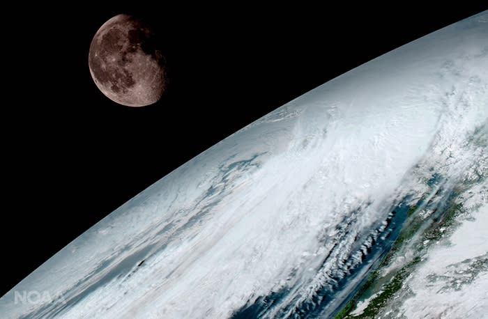
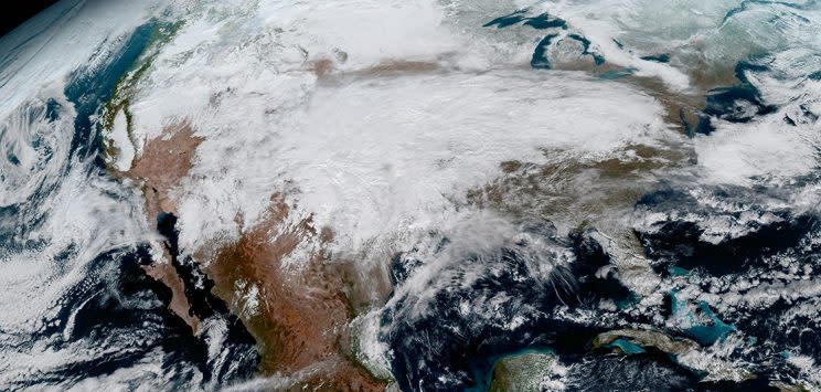
The first images from NASA’s new GOES-16 satellite show off the future of weather satellites – described as ‘high definition from the heavens’.
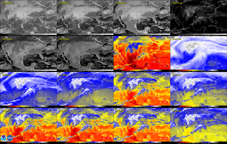
The satellite has three times as many spectral channels as its predecessors – two visvisible, four near-infrared and 10 infrared.
These channels help forecasters distinguish between differences in the atmosphere like clouds, water vapor, smoke, ice and volcanic ash.
MORE: Man who murdered soldier Lee Rigby sues over lost teeth
MORE: Tube Knifeman ‘Had Lee Rigby Image On Phone
‘One of our GOES-16 scientists compared this to seeing a newborn baby’s first pictures — it’s that exciting for us,’ said Stephen Volz, director of NOAA’s Satellite and Information Service.
‘‘These images come from the most sophisticated technology ever flown in space to predict severe weather on Earth. ‘
‘These images come from the most sophisticated technology ever flown in space to predict severe weather on Earth. The fantastically rich images provide us with our first glimpse of the impact GOES-16 will have on developing life-saving forecasts.’
The pictures from the Advanced Baseline Imager boast four times the image resolution of existing GOES spacecraft.
The higher resolution will allow forecasters to pinpoint the location of severe weather with greater accuracy.
GOES-16 can provide a full image of Earth every 15 minutes and one of the continental U.S. every five minutes, and scans the Earth at five times the speed of NOAA’s current GOES imagers.

