
 Yahoo News
 Met Office forecasts it will reach 20°C this week after bitterly cold weekend
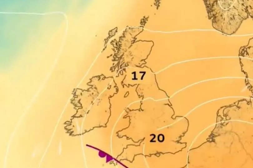
Some places in the UK have started the week with minus temperatures, but forecasters say a change is on the way with 20°C by Thursday. The Met Office says that although the weather is likely to remain rather mixed during the week ahead, with low pressure never too far away from the UK, temperatures are likely to rise
The forecasting agency added that from Wednesday temperatures could reach around 20°C in a few places. The forecast for Wales says that it will turn drier as we move into May but "some rain remains possible".
It comes as temperatures in April have been below average for the time of year, with northerly winds making it feel colder. For the latest Welsh news delivered to your inbox sign up to our newsletter
READ MORE: Huge 4x4 'dangles' at top of garden after rolling away from house
READ MORE: Police issue 'harmless crime' message after cannabis factories discovered
Senior meteorologist at the Met Office Amy Bokota said: "Temperatures have been below average for the last couple of weeks, so certainly by the time we get to Wednesday, and probably into next weekend, temperatures will be warmer. It might not be the glorious sort of heatwave that we're hoping for...but there probably will be some more pleasant and warmer weather for some people as we head towards the end of the week."
BBC Breakfast presenter Carol Kirkwood said that it will be turning warmer although "there will be rain", but added that we could see temperatures of 20°C or possibly higher in some parts of the country. The Met Office forecast for Wales says:
Monday
Often cloudy with occasional bright or sunny intervals in the east during the morning. Scattered showers first thing with more general rain developing through the day, heavy at times in the south and west. Windy, particularly on western coasts. Maximum temperature 15 °C.
Further rain at times this evening and overnight. Some heavier bursts are likely, mainly in the south and west and over higher ground. Drier spells developing in the northeast. Breezy. Minimum temperature 7 °C.
Tuesday:
Often cloudy with showery rain, persistent and heavy at times. Perhaps turning sunnier by the evening in the west. Windy in the morning though winds easing through the afternoon. Maximum temperature 15 °C.
Outlook for Wednesday to Friday:
Turning drier as we move into May but some rain remains possible. Feeling warmer than recently with spells of sunshine. Temperatures often somewhat above average but also breezy at times.
Detailed forecasts do not go as far as the bank holiday weekend yet but the long range UK forecast from the Met Office says: "During the first weekend, northern parts of the UK are likely to be predominantly dry, while areas of rain or showers, perhaps heavy and thundery, clear erratically from the south to usher in a spell of drier weather here too."
It adds: "There is likely to be a fair amount of low cloud in the east at times, with spells of coastal fog, but also temperatures generally above average for the time of year. Through the following week, all areas are likely to see a mixture of periods of rain and drier interludes. Overall, northern, especially northwestern, parts of the UK will probably be driest and sunniest, while the more changeable conditions remain more likely in the south. Temperatures should remain close to or a little above normal for early May."

