
 Yahoo News
 Met Office issues nine hour thunderstorm alert for North Wales
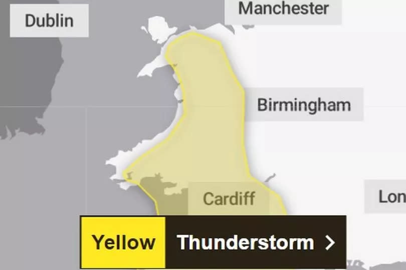
The Met Office has issued a nine hour thunderstorm warning for North Wales. The yellow alert starts at 12pm today and lasts until 9pm tonight covering Gwynedd, Conwy, Denbighshire and Wrexham, with up to 50mm of rain forecast in parts.
People have been warned to expect potential difficult driving conditions, travel disruption power cuts and flash flooding, when the storms hit. It comes as a weather warning for rain has also been issued for North Wales, which comes into effect at 12.15am tomorrow (Wednesday), which lasts until 6am on Thursday.
A Met Office forecast said: "Heavy showers and thunderstorms are expected to develop during the afternoon across parts of southwest England, Wales and the West Midlands before slowly dying out during the evening.
READ MORE: The 'routine' police stop that saw driver abandon van in middle of A55 and cops make discovery
READ MORE: Boy stabbed 'for his trainers' as he walked to sit GCSE exam at school
"Many places will miss the worst, but where they do develop, some slow-moving and intense downpours are possible, giving accumulations of 20-30 mm in around 1 hour, and a lower likelihood of 40-50 mm in 2-3 hours in a few locations. Frequent lightning strikes and hail are also possible."
And it looks as if it is going to get wetter going forward this week, following some nice sunshine at the weekend, which brought people flocking to North Wales and the coast.
According to the Met Office, by Wednesday, an area of low pressure will approach the UK from the east, bringing heavy and, in places, prolonged rainfall. The precise track of the low pressure will determine how much rain falls over land areas and how far west across the UK the heavy rain will reach.
Deputy Chief Meteorologist Dan Rudman said: “Low pressure is going to influence our weather from the middle of this week, bringing some heavy rain to parts of the UK.
"Eastern areas are most likely to see the highest rainfall accumulations, though this will depend on the precise positioning of the low pressure. It is important to keep an eye on the forecast as the detail becomes clearer, and it is possible Severe Weather Warnings will also be issued.”
Join the North Wales Live Whatsapp community now
Find out what the weather has in store near you

