
 Yahoo News
 Patt Morrison: Palos Verdes Peninsula landslides can tell us a lot about L.A. history
Oh-so-many millennia ago, the Palos Verdes Peninsula arose like Aphrodite, beautiful and dripping wet, from the sea.
All right, so it didn’t happen exactly that way. The inexorable wonder-workings of geology — with a fanciful nod to Poseidon, the god of earthquakes and oceans — created that stunning headland that juts its chin out into the Pacific from Los Angeles County.
And geology has had a hand in its recent slip-sliding dangers too. (Poseidon: Don’t blame me, mortals!)
As the winter rains finally make their way to wherever it is they go for the summer, the peninsula can tally its casualty list from the last eight or nine months.
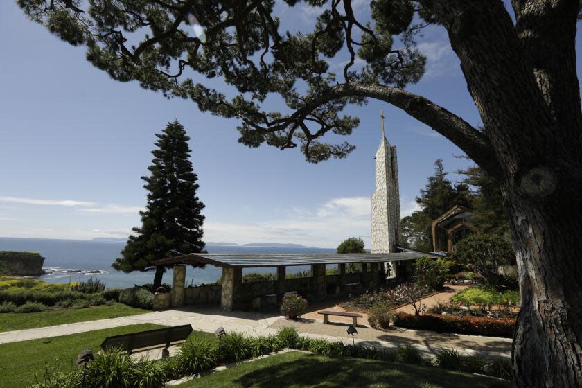
Principally and most recently, the luminous Wayfarers Chapel, a national historic landmark, Lloyd Wright’s marvel of wood and glass in Rancho Palos Verdes, has always seemed to hover above the sea. Now it’s been sidling tragically toward it: It is closed, and probably unlikely to reopen in the same place ever again.
A couple of months ago, houses in Rancho Palos Verdes were red-tagged. The landslide system at Portuguese Bend has been hitting the accelerator. As the Rancho Palos Verdes mayor, John Cruikshank, has mournfully described it, the land “used to move inches a year; now it is moving feet a year.” Last year, 10 houses in Rolling Hills Estates descended catastrophically into a canyon.
No place in the spectacular 4,000-plus square miles of Los Angeles County — desert, mountains, seashore, hills and basin — has been unaffected by what I’ll call “the late deluge,” but in the heights of the PV Peninsula, it was dramatic and costly.
The place that looks like an eternal fortress turns out to have feet of clay — and I mean that literally, as you will see.
The human history of the peninsula has been abbreviated, compared with its geology. Native Americans built their villages across this promontory, and Malaga Cove has been a settlement for at least seven millennia. On Oct. 8, 1542, 50 years less four days after Columbus made landfall in the New World, a Portuguese explorer whose name was rendered in Spanish as Juan Rodriguez Cabrillo sighted the PV Peninsula. Perhaps he deserves the title “the father of smog,” for he called the place “the bay of smokes,” probably from the signal fires the Native Americans built atop the headland.
A couple of centuries or so later, the peninsula became part of a Spanish land grant, and the demesne of Manuel Dominguez as his Rancho San Pedro. Later, in Mexican California, another grandee family, the Sepulvedas, became masters of the land, now renamed Rancho Palos Verdes.
A whaling station briefly operated here, and by the 20th century, the cattle that once grazed the promontory had long vanished, but the people kept coming.
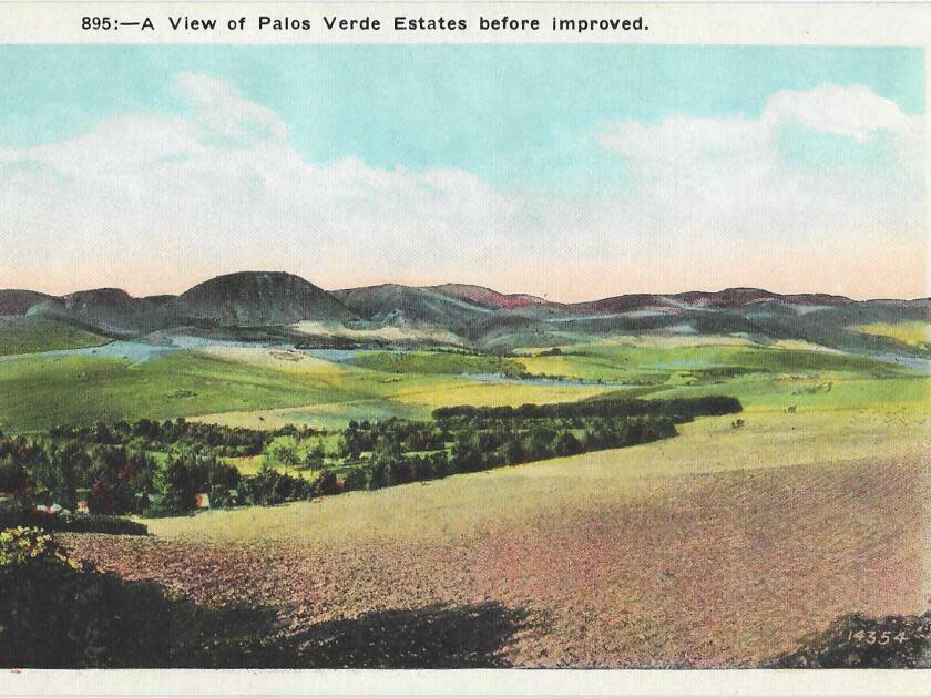
Around World War I, an influential financier named Frank Vanderlip visited the place and was so struck by its beauty that he began a plan to acquire and develop the peninsula, a kind of Newport of the Pacific, a California version of the Rhode Island community where Gilded Age magnates built seafront “cottages” of marble and gilt. Vanderlip built his own magnificent estate, Villa Narcissa, in the 1920s. Some years ago, I was a guest for lunch there, the plus-one of an English friend who had been invited by Vanderlip’s grande dame daughter-in-law Elin.
In the 1930s, the locals staged foxhunts and hunt balls and other fashionable gatherings, yet it wasn’t until after the next World War that the peninsula truly filled up, with more modest houses in spectacular settings. The houses are still modest, certainly by comparison to the metabolically overwrought mansions of Beverly Hills and West L.A., but now the prices, like the views, are spectacular. The supporting cast over the years has run to Marineland (now closed), aggressively territorial surfer gangs, feral peacocks, and the inevitable golf courses, one of them Donald Trump’s.
That’s a Twitter-short summation of the human history.
For the geo-genealogy that’s begetting the fractious Palos Verdes Peninsula of today, I consulted Kevin Coffey, a lecturer in earth, planetary, and space sciences at UCLA.
Coffey lives on the peninsula and rejoices in having its real-life science right out his door: “The Palos Verdes Peninsula is unique in its geology in many ways. And in other ways it’s the geology we have throughout much of Los Angeles, but it’s unique in how it’s been uplifted, in how we can see it all.”
Where Los Angeles is now, there was just ocean. The L.A. County Natural History Museum’s L.A. Underwater exhibit takes us back 90 million years to the life of underwater L.A. So the ocean, and not space aliens, explains why ancient whale parts have turned up in Lincoln Heights and Mt. Washington, once the contours of the seabed.
Even after the peninsula shook off those ages of immersion, about a million years ago, give or take a few centuries, it was for a very long time still an island, like its nearby relative, Santa Catalina. A sleeve of water separated it from the continent. Only 75,000 or 100,000 years ago did that water channel silt in and fill up, and lo, the promontory was wedded to the mainland.
Read more: Wayfarers Chapel looks to relocate due to threatening landslide
One thing about the PVP that delights Coffey is that it is composed of all three kinds of rock — sedimentary, metamorphic and igneous.
If you were to slice it like a cake, this is what you’d find:
At the top there is, like frosting on a cake, shale mud, Altamira Shale, the sedimentary legacy of those seabed millennia. These layers have mouth-watering names that sound like expensive paint colors or elaborate pastries: Valmonte Diatomite, San Onofre Breccia, and the PV specialty, Malaga Mudstone. Combined, it’s “some number of hundreds of feet deep,” says Coffey, which sounds immense to us, but in geologic terms is about as thick as nail polish, and all basically mud that piled up on the ancient sea floor and got compacted and turned into rock.
The base layer of the PV cake is Catalina schist. We are all living on the Catalina schist, which is a great name for a band. It’s the sturdy metamorphic rock that underlies the Los Angeles Basin, “the bedrock of this whole area,” Coffey says. It’s way down there, under our gardens and freeways, and the one place on the mainland that you can see it bare as a newborn babe is in Palos Verdes, at a nature preserve and canyon known as the George F. (Who was George F. to be so immortalized? No one knows for sure — the Daily Breeze suggested that it was either a mis-transcription of the name of early land tycoon George S. Bixby, or named for George F. Vickery, a way-back San Pedro rancher.)
But sneaking throughout the sedimentary layers like a nest of snakes are the slippery bands that are responsible for a good bit of what’s falling away: volcanic ash.
![Green hills and a sweeping coastline on a vintage postcard. Text: "The Coast, Palos Verde [sic] Hills, California"](https://s.yimg.com/ny/api/res/1.2/5DnDKsF5yBAJ4O5MIBY78w--/YXBwaWQ9aGlnaGxhbmRlcjt3PTk2MDtoPTYyNw--/https://media.zenfs.com/en/la_times_articles_853/b0e2bf7c56d3768e10649a4bc836dba3)
Now if you were awake in high school science class, you’re thinking, igneous rock: volcanic lava. Solid stuff, so solid that an Icelandic architect has been suggesting using lava as building material. Volcanoes some distance away from here left behind some sturdy volcanic rock, but also this spoor of volcanic ash that drifted underwater before the PV Peninsula became itself.
Volcanic ash is quite different from lava, so light it can be blown around. Underfoot and underground, it is fickle. When it’s wet, it turns into what Coffey calls a “slimy clay” that can turn as slick as a water slide. And on Palos Verdes, says Coffey, this is what it does: When water percolates through the frosting of shale, the part that Coffey calls the “sedimentary veneer” from those underwater eons, and then hits these deposits of volcanic ash, the veneer can start slipping like Buster Keaton on a banana peel, and take with it anything that’s sitting atop it.
Read more: Morrison: Confederate sentiment in Southern California ran deeper than you might know
Oh, and then there were the earthquakes.
Much of Southern California finds itself near that bump-and-grind intersection of the North American and Pacific plates, whose borderland we know as the San Andreas fault.
That’s a strike-slip fault, the seismic action you get is when these plates slide past each other. But when a fault itself bends, you get serious plate-to-plate contact, the kind of quakes that shoved the San Gabriel and San Bernardino mountains into being (I’m thinking of the uplift as a geologic push-up bra).
The PV Peninsula is a good ways away from the San Andreas, but L.A. is still fringed with a network of smaller, related faults — some of them as jagged and dramatic as the silhouette of a lightning strike. It’s those that helped to shape the peninsula, squeezing the land into sinuous bends and folds and tilts.
By comparison, says Coffey, “if you go to Torrance, Carson, under your feet are the same rocks of the Palos Verdes Peninsula — they’re just still down there because nothing happened to push them up.”
Landslides have been happening on the peninsula since it became land, so there’s nothing novel in the perils of the last year. The Portuguese Bend area, Coffey notes, is “so old it has been through multiple ice ages.” These cycles get the earth to sliding when it’s wet, and then stop it or slow it down when the land dries out. What’s new to the recipe is what we humans have added to it: the weight of houses and roads, and the water from landscape irrigation and septic systems PV Peninsula cities put into the ground.
But just now, the late spring weather forecast for temperatures and precipitation thereabouts looks hearteningly like the dramatic peninsula itself: high and dry.
This story originally appeared in Los Angeles Times.

